LS postcode area
The LS postcode area, also known as the Leeds postcode area,[2] is a group of 29 postcode districts in England, within six post towns. These cover northern West Yorkshire (including Leeds, Wetherby, Pudsey, Otley and Ilkley) and a small part of western North Yorkshire (including Tadcaster).
| Leeds postcode area | |
|---|---|
 LS | |
| Postcode area | LS |
| Postcode area name | Leeds |
| Post towns | 6 |
| Postcode districts | 32 |
| Postcode sectors | 150 |
| Postcodes (live) | 21,561 |
| Postcodes (total) | 31,805 |
| Statistics as at May 2020[1] | |
Coverage
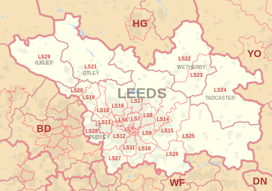
The approximate coverage of the postcode districts:
Map
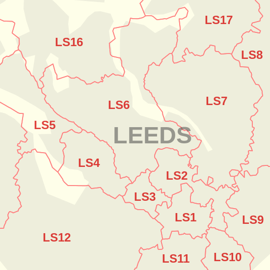
Detailed map of postcode districts in central Leeds
References
- "ONS Postcode Directory Version Notes" (ZIP). National Statistics Postcode Products. Office for National Statistics. May 2020. Table 2. Retrieved 19 June 2020. Coordinates from mean of unit postcode points, "Code-Point Open". OS OpenData. Ordnance Survey. February 2012. Retrieved 21 April 2012.
- Royal Mail, Address Management Guide, (2004)
External links
This article is issued from Wikipedia. The text is licensed under Creative Commons - Attribution - Sharealike. Additional terms may apply for the media files.