Keady
Keady (from Irish: An Céide, meaning "the flat-topped hill"[1]) is a village and civil parish in County Armagh, Northern Ireland. It is south of Armagh and near the border with the Republic of Ireland. It is situated mainly in the historic barony of Armagh with six townlands in the barony of Tiranny.[2] It had a population of 3,036 people in the 2011 Census.[3]
Keady
| |
|---|---|
 Kinelowen Street | |
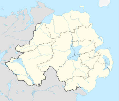 Location within Northern Ireland | |
| Population | 3,036 (2011 Census) |
| Irish grid reference | H844340 |
| District | |
| County | |
| Country | Northern Ireland |
| Sovereign state | United Kingdom |
| Postcode district | BT |
| Dialling code | 028, 048 |
| Police | Northern Ireland |
| Fire | Northern Ireland |
| Ambulance | Northern Ireland |
| UK Parliament | |
A tributary of the River Callan, known as the Clea, flows from its source in Clea Lake (also spelled as Clay Lake) through the middle of the village. The River Clea once powered Keady's millwheels. In the middle of the village, on the banks of the river, stands the Old Mill, which has been converted into workshops and offices.
History
The name Keady is recorded as long ago as 1674 in a letter from Symore Richardson to the Provost of Trinity College, Dublin (the district was part of a grant of County Armagh lands to that college). However, the village did not emerge as an important centre until the mid 18th century when the use of waterpower led to the growth of great linen mills and factories. By 1837, Keady was noted as being the centre of an important flourishing linen trade by Samuel Lewis in his Topographical Dictionary of Ireland. The Keady Monument was erected by the local people to honour William Kirk, (a member of Second Keady Presbyterian Church), who through his mills at Keady and Darkley, provided so much economic prosperity in the area. The village also became a centre of tailoring before the First World War, and the arrival of the railway brought the town great commercial benefit, although the lines for both goods and passenger traffic have since closed. Until recently, Keady retained its links with clothing manufacture, with a major textiles firm employing many local people; this has since closed. Situated on the River Clea (which flows from Clea Lake to the River Callan), Keady is noted chiefly for the 'Keady Trout Lakes'. It is also of interest to the industrial archeologist as the centre of a district with many derelict watermills. Tassagh Glen, just outside the village, has a mill and viaduct of great size. The newly restored mill in the middle of Keady offers the visitor a glimpse into Keady's industrial past.
The Troubles
For more information see The Troubles in Keady, which includes a list of incidents in Keady during the Troubles resulting in two or more deaths.
Transport
- The railway arrived in Keady in 1909, with the opening of the Castleblayney, Keady and Armagh Railway line from Armagh, which was extended to Castleblayney in 1910. Keady railway station opened on 31 May 1909, closed for passenger traffic on 1 February 1932 and finally closed altogether on 1 October 1957.[4] As a cross border line, when the Irish Free State was created in 1922, it lost all passenger traffic in 1923, with freight being withdrawn from the cross border section from Castleblayney to Keady in 1924. The Armagh to Keady freight service was withdrawn on 1 October 1957.
- There is a railway viaduct in Keady as well as one of the more interesting artifacts of Irish railway history, the tunnel for the Ulster and Connaught Light Railway. This was a proposal for a narrow gauge line from Greenore, County Louth to Clifden, County Galway, for which the tunnel under the railway embankment at Keady was built, but never used. Ulsterbus now use part of the tunnel as a bus garage.
Sport
Gaelic games have been popular in Keady since the 19th century. The local Gaelic football club, founded in 1888, is Keady Michael Dwyer's GFC. The hurling club, founded in 1949, is Keady Lámh Dhearg; prior to 1949 the Dwyer's club also fielded hurling teams, as did the defunct Éire Óg club in the 1920s and early '30s.
People
- Cathal Boylan, Sinn Féin MLA
- Michael Colgan, actor
- Jimmy Jones, footballer
- Tommy Makem, singer, musician, and songwriter
- Thomas O'Hanlon, Social Democratic and Labour Party Councillor
- Dessie O'Hare, Irish republican paramilitary
- Conor Corvan, Gaelic Footballer/Hurler
Churches in Keady
- The Temple Presbyterian, Rev Ian Abraham
- Second Keady Presbyterian, Rev Alan Marsh (www.secondkeady.co.uk)
- St Matthews Church of Ireland
- St Patricks, Roman Catholic
Schools

- Clea Primary School
- Keady Primary School
- St. Francis of Assisi Primary School
- St. Mary's Boy's School (Keady)
- St Patrick's High School (Keady)
Demography
2011 Census
In the 2011 Census Keady had a population of 3,036 people (1,239 households).[3]
2001 Census
Keady is classified as an intermediate settlement by the NI Statistics and Research Agency (NISRA)[5] (i.e. with population between 2,250 and 4,500 people). On Census day (29 April 2001) there were 2,960 people living in Keady. Of these:
- 25.6% were aged under 16 years and 15.5% were aged 60 and over
- 48.8% of the population were male and 51.2% were female
- 94.2% were from a Catholic background and 5.6% were from a Protestant background
- 6.2% of people aged 16–74 were unemployed.
For more details see: NI Neighbourhood Information Service[6]
References
- "Bunachar Logainmneacha na hÉireann".
- "Keady". IreAtlas Townlands Database. Retrieved 7 May 2015.
- "Keady". Census 2011 Results. NI Statistics and Research Agency. Archived from the original on 22 April 2015. Retrieved 22 April 2015.
- "Keady station" (PDF). Railscot - Irish Railways. Retrieved 16 October 2007.
- "NISRA - Northern Ireland Statistics and Research Agency (c) 2015".
- Agency, Northern Ireland Statistics and Research. "statistics".
External links
| Wikimedia Commons has media related to Keady. |

| Authority control |
|
|---|