Camlough
Camlough (/ˈkæm.lɒx/ KAM-lokh; from Irish: Camloch, meaning "crooked lake")[2] is a small village five kilometres west of Newry in County Armagh, Northern Ireland. The village is named after a lake, known as Cam Lough, in the parish, which is about 90 acres in extent. South of the village is Camlough Mountain (Slieve Girkin, Sliabh gCuircín) which is part of the Ring of Gullion.[3] The Ring of Gullion (Irish: Fáinne Cnoc Shliabh gCuillinn, meaning "hill ring of Slieve Gullion") is a geological formation and area and is officially designated as an Area of Outstanding Natural Beauty, (AONB).
| Camlough | |
|---|---|
 The 'crooked lake' from which Camlough derives its name | |
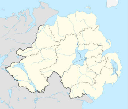 Location within Northern Ireland | |
| Population | 1,081 (2011) |
| District | |
| County | |
| Country | Northern Ireland |
| Sovereign state | United Kingdom |
| Post town | NEWRY |
| Postcode district | BT35 |
| Dialling code | 028, +44 28 |
| UK Parliament | |
| NI Assembly | |
History
There is much evidence of pre-Christian settlers in and around the village: the erection of Dolmens on Camlough Mountain, The Hag's Chair in Lislea and the Ballykeel Dolmen which all point towards Stone Age dwellers.
Camlough (Irish: Camloch) was an ecclesiastical district in the Barony of Upper Orior and was anciently part of the O'Hanlon's country. At the time of the Plantation of Ulster, 1000 acres of 12 townlands were granted to Henry McShane O'Neill and the village was developed during this period.
Camlough village is in the townland of Cross, referring not to a stone monument but to the village crossroads in the north of the townland. In 1620 Camlough Mountain was known as Sliabh na Croise, meaning 'Mountain of the Cross'.
Camlough Lake
Camlough Lake was formed as a glacial ribbon lake, and takes its name from its irregular shape; although its modern form does not appear particularly crooked, its shape was much less regular in the past before its level was raised by the embankment built in the late 19th century. The glacial left-over sits in a valley carved between Slieve Gullion and Camlough Mountain and is today the largest lake in the Ring of Gullion.
Close to the shore of the lake is an approximately one kilometre long tunnel, wide enough to drive an articulated truck into, which was excavated in the 1960s as part of a planned development intended to create a man-made cavern within Camlough Mountain which was to have been used to store and release water to generate electricity. It was planned that the pumped hydro storage scheme, when operational, would generate more than 200 megawatts of electricity had it been completed; however, plans were shelved with the onset of The Troubles.
Camlough Mountain (Sliabh gCuircín)
The rock that makes up Camlough Mountain is called granodiorite. Granodiorite, just like the rocks that make up Slieve Gullion, forms from the cooling, deep underground, of molten magma. However, unlike the rocks that make up Slieve Gullion and the Ring of Gullion, which were formed around 60 million years ago, the granodiorites of Camlough Mountain are around 400 million years old. Whereas the younger rocks of Gullion are associated with igneous activity related to the formation of the present day Atlantic Ocean, the rocks of Camlough Mountain are associated with igneous activity related to the closure of a precursor to the present day Atlantic, the now long disappeared Lapetus Ocean.
Camlough National School
Camlough National School was built in 1836 and was located on the Quarter Road. It was divided into a boys' school and a girls' school. The classroom was heated by a pot-bellied stove in the centre of the room and pupils would have been sent to collect sticks for the fire.
Mass Rock
A Mass Rock (Carraig an Aifrinn), dating from the Penal era, is located in Camlough. It is situated in Grant's Rocks and is over 300 years old. In 2003, a special Mass was held at the Mass Rock in memory of the people who suffered during Penal times.
St Malachy's Church, Carrickcruppen, is the oldest church building in the Parish of Lower Killeavy. It was built in 1816 and replaced an earlier church.
Kelly's Mill
Camlough River is a small meandering stream that makes its way from Camlough to the Newry Canal. It was once a vibrant fast flowing river, teeming with trout and the power source of approximately nine mills. The first of these mills was Kelly's Flax and Scutching Mill in Camlough village. It was situated to the rear of Carragher's house. Established around the mid-18th century, the mill comprised nine buildings, two of which were split level. It was powered by water from two ponds on either side of the Keggal Road.
Irish War of Independence - 1920s
During the Irish War of Independence, the Camlough Company of the Irish Republican Army were active in the area and were commanded by Frank Aiken (1898 –1983). A founding member of the Fianna Fáil political party, Aiken was also Tánaiste from 1965-1969. Aiken was first elected to Dáil Éireann in 1923 and at each subsequent election until 1973. He holds the distinction of being the second longest-serving member of Dáil Éireann. As Foreign Minister he developed and maintained an independent stance for Ireland at the United Nations and other international forums such as the Council of Europe, defending the rights of small nations. Aiken also supported the right of countries such as Algeria to self-determination and he was a critic of apartheid in South Africa. Aiken was also a champion of nuclear non-proliferation and he was granted the honour of being the first minister to sign the Nuclear Non-Proliferation Treaty in 1968 at Moscow.
In December 1920, approximately 200 IRA volunteers, led by Aiken, attacked Camlough Royal Irish Constabulary barracks. They exchanged fire with the RIC, threw grenades and set fire to the building. British troops sent from Newry were ambushed by the IRA who opened fire and threw grenades from a bridge overhead. Three volunteers were fatally wounded. The next day, British forces set fire to several homes and businesses in Camlough in reprisal, many of them owned by Aiken's relatives.[4]
The Troubles
Camlough is situated in South Armagh, which was the most militarised region in Western Europe during the Troubles. The region was a stronghold of support for the Provisional IRA, earning it the nickname 'Bandit Country' (see Provisional IRA South Armagh Brigade).
On 19 May 1981, five British soldiers were killed in an Irish Republican Army (IRA) landmine attack on the Chancellors Road 3 miles from Camlough. The soldiers had been travelling in a Saracen armoured personnel carrier when the bomb exploded. This attack was during the 1981 Irish hunger strike in Maze (HM Prison), and 3 miles from the home of one of the hunger strikers, Raymond McCreesh.
Sports
Open Water / Marathon Swimming Since breaking the Open Water Relay Guinness World Record the lake has been a prominent training ground for Triathletes and Open Water Swimmers. Local Swimmer and CLWF Chairman Padraig Mallon then went on to complete the English and North Channel in the same year (only 3rd person to ever do so). His sister Colleen Mallon went on to break the Irish record for crossing the North Channel in 2014 and Keith Garry completed the English Channel in 2014. The area has also produced 2 successful relay teams crossing the North Channel and world-class ice swimmers.
Camlough Rovers F.C. is the local football team, playing in the Mid-Ulster Football League.
Camloch is famous for its links with the Gaelic Athletic Association (GAA). The village hosts two Gaelic football clubs. St Patrick's Carrickcruppen GFC has won four Senior county championships; Shane O'Neill's GAC, a continuation of the first Camloch club (William O'Brien's, founded in 1888), has won two Senior and three Junior titles.
Craobh Rua Camloch hurling club was established in 1991 in the Camlough and Bessbrook areas of South Armagh. As hurling had not been played in the area in some 40 years, the club received some help from Armagh Hurling Board chairman, Jimmy Carlisle, who helped set up coaching courses for the children and their mentors. Over its first ten years the club has successfully fielded teams at under 12, under 14, under 16 and since 2010 at under 8, minor and senior levels. They play their home games at Dunster Park (An Dún Rua) on High Street, Derrymore.
In 2010 the Seniors reached the Junior Championship Final and subsequently made it to the semi-final of the Ulster championship. The Under 14s won the 2010 Championship and the Feile, and represented County Armagh in the All Ireland Feile in Ennis, where they reached the semi-final. There are currently three Craobh Rua players representing Armagh at senior inter-county level, Fiachra Bradley, Micheal Garvey and Ryan Lewis.
World Record
A Guinness World Record for the longest open water relay swim was broken by a team of intrepid swimmers at Camlough Lake in South Armagh on Saturday 19 September 2009.[5] The group beat the world record for a 'continuous long distance relay swim' after embarking on the world beating attempt over a week before.
Two hundred swimmers from across Ireland took part in the challenge. The previous record was 480 km; Camlough set the record at 680 km.
Places of interest
Events
- Feile Chamlocha is the annual festival held in Camlough in the summer months including Camlough Festival and the Crooked Lake Triathlon
- Crooked Lake Triathlon is an annual triathlon held in Camlough in June.
- Camlough Lake Water Festival CLWF is home to Irelands only outdoor / open water swimming festival over a weekend in August. As well as introductory swimming events the lake also hosts the National 5k & 10k swims for Swim Ireland. Other events include:
- Lord & Lady of the Lake 2.4km
- Night Swim
- Coffee Dock Swim
- Try a Tri
- 1k swim
- Kids & adults duathalon (swim run)
Education
- St. Malachy's Primary School
- St Paul's High School, Bessbrook
2001 Census
Camlough is classified as a Small Village by the NI Statistics and Research Agency (NISRA) (i.e. with population between 500 and 1,000 people). On Census day (April 29, 2001) there were 910 people living in Camlough. Of these:
- 27.6% were aged under 16 years;
- 12.6% were aged 60 and over;
- the average age was 31.8 years (NI average age 35.8 years);
- 46.5% of the population were male and 53.5% were female;
- 98.8% were from a Catholic Community Background;
- 1.2% were from a 'Protestant and Other Christian (including Christian related)' Community Background;
- 9.7% were born outside Northern Ireland; and
- 0.0% were from an ethnic group other than white.
Notable residents
- Frank Aiken, Chief of Staff of the Irish Republican Army during the War of Independence, founding member of Fianna Fáil and Tánaiste from 1965-1969
- Tomás Cardinal Ó Fiaich, Irish Catholic Cardinal, Archbishop of Armagh and the Primate of All Ireland.
- Eugene O'Callaghan, Roman Catholic Bishop of Clogher 1943–1969
- Donn Byrne, Irish-American poet and novelist, 1889 – 1928
- Conor Murphy, Sinn Féin Member of Parliament for Newry and Armagh 2005–2015
- Raymond McCreesh, member of the Provisional IRA who died on hunger-strike in 1981
- Paddy Quinn, member of the Provisional IRA who took part in the 1981 Irish hunger strike.
- Andrew Britton, author
- Conor McGinn, Member of Parliament for St Helens North 2015–present
References
- Placenames Database of Ireland
- Place Names NI
- See Census 2011 - Headcount and Household Estimates for Settlements published by the Northern Ireland Statistics and Research Agency, available at http://www.nisra.gov.uk/census/2011/results/settlements.html
- Lawlor, Pearse. The Outrages: The IRA and the Ulster Special Constabulary in the Border Campaign. Mercier Press, 2011. pp.78-81
- "Longest distance swimming in relay (open water)". Guinness World Records. Retrieved 19 June 2015.
- "Archaeological Sites of Counties Armagh and Down" (PDF). Northern Ireland Archaeology Forum. Retrieved 17 November 2010.
