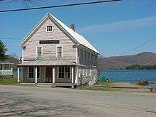
Industry, Maine
Industry is a town in Franklin County, Maine, United States. The population was 929 at the 2010 census. It was named from the industrious habits of its citizens.[4]
Industry, Maine | |
|---|---|
 Industry  Industry | |
| Coordinates: 44°44′59″N 70°4′29″W | |
| Country | United States |
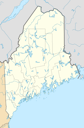
| State | Maine |
| County | Franklin |
| Villages | Allens Mills West Mills |
| Area | |
| • Total | 30.98 sq mi (80.24 km2) |
| • Land | 29.75 sq mi (77.05 km2) |
| • Water | 1.23 sq mi (3.19 km2) |
| Elevation | 820 ft (250 m) |
| Population | |
| • Total | 929 |
| • Estimate (2012[3]) | 923 |
| • Density | 31.2/sq mi (12.0/km2) |
| Time zone | UTC-5 (Eastern (EST)) |
| • Summer (DST) | UTC-4 (EDT) |
| ZIP code | 04938 |
| Area code(s) | 207 |
| FIPS code | 23-34820 |
| GNIS feature ID | 0582528 |
Geography
According to the United States Census Bureau, the town has a total area of 30.98 square miles (80.24 km2), of which, 29.75 square miles (77.05 km2) of it is land and 1.23 square miles (3.19 km2) is water.[1]
Demographics
| Historical population | |||
|---|---|---|---|
| Census | Pop. | %± | |
| 1810 | 562 | — | |
| 1820 | 796 | 41.6% | |
| 1830 | 902 | 13.3% | |
| 1840 | 1,036 | 14.9% | |
| 1850 | 1,041 | 0.5% | |
| 1860 | 827 | −20.6% | |
| 1870 | 725 | −12.3% | |
| 1880 | 715 | −1.4% | |
| 1890 | 545 | −23.8% | |
| 1900 | 553 | 1.5% | |
| 1910 | 465 | −15.9% | |
| 1920 | 431 | −7.3% | |
| 1930 | 342 | −20.6% | |
| 1940 | 307 | −10.2% | |
| 1950 | 315 | 2.6% | |
| 1960 | 262 | −16.8% | |
| 1970 | 347 | 32.4% | |
| 1980 | 563 | 62.2% | |
| 1990 | 685 | 21.7% | |
| 2000 | 790 | 15.3% | |
| 2010 | 929 | 17.6% | |
| Est. 2014 | 919 | [5] | −1.1% |
| U.S. Decennial Census[6] | |||
2010 census
As of the census[2] of 2010, there were 929 people, 376 households, and 264 families living in the town. The population density was 31.2 inhabitants per square mile (12.0/km2). There were 625 housing units at an average density of 21.0 per square mile (8.1/km2). The racial makeup of the town was 97.2% White, 0.1% African American, 0.2% Native American, 0.1% Asian, and 2.4% from two or more races. Hispanic or Latino of any race were 0.4% of the population.
There were 376 households, of which 31.9% had children under the age of 18 living with them, 57.2% were married couples living together, 9.6% had a female householder with no husband present, 3.5% had a male householder with no wife present, and 29.8% were non-families. 23.9% of all households were made up of individuals, and 8.6% had someone living alone who was 65 years of age or older. The average household size was 2.47 and the average family size was 2.93.
The median age in the town was 44.1 years. 24.3% of residents were under the age of 18; 5.4% were between the ages of 18 and 24; 21.8% were from 25 to 44; 33.3% were from 45 to 64; and 15.5% were 65 years of age or older. The gender makeup of the town was 49.5% male and 50.5% female.
2000 census
As of the census[7] of 2000, there were 790 people, 306 households, and 219 families living in the town. The population density was 26.4 people per square mile (10.2/km2). There were 487 housing units at an average density of 16.2 per square mile (6.3/km2). The racial makeup of the town was 98.35% White, 0.63% African American, and 1.01% from two or more races. Hispanic or Latino of any race were 0.51% of the population.
There were 306 households, out of which 28.8% had children under the age of 18 living with them, 62.7% were married couples living together, 4.2% had a female householder with no husband present, and 28.4% were non-families. 20.6% of all households were made up of individuals, and 8.2% had someone living alone who was 65 years of age or older. The average household size was 2.58 and the average family size was 2.97.
In the town, the population was spread out, with 25.9% under the age of 18, 6.3% from 18 to 24, 30.1% from 25 to 44, 24.6% from 45 to 64, and 13.0% who were 65 years of age or older. The median age was 39 years. For every 100 females, there were 101.0 males. For every 100 females age 18 and over, there were 101.7 males.
The median income for a household in the town was $32,292, and the median income for a family was $36,875. Males had a median income of $29,375 versus $18,875 for females. The per capita income for the town was $14,403. About 13.1% of families and 18.1% of the population were below the poverty line, including 20.6% of those under age 18 and 18.0% of those age 65 or over.
Notable residents
- Will Bonsall, author, seed saver and veganic farmer
References
- "US Gazetteer files 2010". United States Census Bureau. Archived from the original on 2012-12-20. Retrieved 2012-12-16.
- "U.S. Census website". United States Census Bureau. Retrieved 2012-12-16.
- "Population Estimates". United States Census Bureau. Archived from the original on 2013-06-11. Retrieved 2013-07-06.
- Gannett, Henry (1905). The Origin of Certain Place Names in the United States. Govt. Print. Off. pp. 165.
- "Annual Estimates of the Resident Population for Incorporated Places: April 1, 2010 to July 1, 2014". Archived from the original on May 23, 2015. Retrieved June 4, 2015.
- "Census of Population and Housing". Census.gov. Retrieved June 4, 2015.
- "U.S. Census website". United States Census Bureau. Retrieved 2008-01-31.
Further reading
- A History of the Town of Industry: Franklin County, Maine. By William Collins Hatch. Published 1893.
Municipalities and communities of Franklin County, Maine, United States | ||
|---|---|---|
| Towns |  Franklin County map | |
| Plantations | ||
| Unorganized territories | ||
| CDPs | ||
| Other villages | ||
| Footnotes | ‡This populated place also has portions in an adjacent county | |