Grand Rapids, Ohio
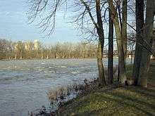
Grand Rapids is a village in Grand Rapids Township, Wood County, Ohio, United States, along the Maumee River. The population was 965 at the 2010 census. Grand Rapids is served by a branch of the Weston Public Library.
Grand Rapids, Ohio | |
|---|---|
 Businesses in downtown Grand Rapids. | |
 Location of Grand Rapids, Ohio | |
 Location of Grand Rapids in Wood County | |
| Coordinates: 41°24′39″N 83°52′1″W | |
| Country | United States |
| State | Ohio |
| County | Wood |
| Township | Grand Rapids |
| Government | |
| • Mayor | John Berry |
| Area | |
| • Total | 0.97 sq mi (2.51 km2) |
| • Land | 0.88 sq mi (2.28 km2) |
| • Water | 0.09 sq mi (0.23 km2) |
| Elevation | 659 ft (201 m) |
| Population | |
| • Total | 965 |
| • Estimate (2019)[4] | 1,004 |
| • Density | 1,139.61/sq mi (439.84/km2) |
| Time zone | UTC-5 (Eastern (EST)) |
| • Summer (DST) | UTC-4 (EDT) |
| ZIP code | 43522 |
| Area code(s) | 419 |
| FIPS code | 39-31206[5] |
| GNIS feature ID | 1064745[2] |
| Website | www |
Grand Rapids is the hometown of Robyn Hancock, the 1996 Miss Ohio who represented Ohio in the Miss America contest. She previously held the title of Miss Crestline. The town was also the home of glass sculptor Dominick Labino, whose working studio remains in operation.
On the second Sunday of October each year, the town hosts the Apple Butter Festival which has attracted over 70,000 people.
History
Grand Rapids was originally called Gilead, and under the latter name was platted in 1833.[6] A post office called Gilead was established in 1837, and the name was changed to Grand Rapids in 1868.[7] The village was incorporated in 1885.[8]
Geography
Grand Rapids is located at 41°24′39″N 83°52′01″W.[9]
According to the United States Census Bureau, the village has a total area of 0.97 square miles (2.51 km2), of which 0.88 square miles (2.28 km2) is land and 0.09 square miles (0.23 km2) is water.[10]
Demographics
| Historical population | |||
|---|---|---|---|
| Census | Pop. | %± | |
| 1880 | 332 | — | |
| 1890 | 572 | 72.3% | |
| 1900 | 549 | −4.0% | |
| 1910 | 574 | 4.6% | |
| 1920 | 517 | −9.9% | |
| 1930 | 589 | 13.9% | |
| 1940 | 614 | 4.2% | |
| 1950 | 657 | 7.0% | |
| 1960 | 670 | 2.0% | |
| 1970 | 976 | 45.7% | |
| 1980 | 962 | −1.4% | |
| 1990 | 955 | −0.7% | |
| 2000 | 1,002 | 4.9% | |
| 2010 | 965 | −3.7% | |
| Est. 2019 | 1,004 | [4] | 4.0% |
| U.S. Decennial Census[11] | |||
2010 census
As of the census[3] of 2010, there were 965 people living in the village. The population density was 1,096.6 inhabitants per square mile (423.4/km2). There were 429 housing units at an average density of 487.5 per square mile (188.2/km2). The racial makeup of the village was 96.5% White, 0.5% African American, 0.2% Native American, 0.1% Asian, 0.8% from other races, and 1.9% from two or more races. Hispanic or Latino of any race were 3.9% of the population.
There were 385 households, of which 33.5% had children under the age of 18 living with them, 47.0% were married couples living together, 12.2% had a female householder with no husband present, 4.7% had a male householder with no wife present, and 36.1% were non-families. 29.1% of all households were made up of individuals, and 12.2% had someone living alone who was 65 years of age or older. The average household size was 2.42 and the average family size was 3.00.
The median age in the village was 38.9 years. 25.3% of residents were under the age of 18; 6.9% were between the ages of 18 and 24; 26.2% were from 25 to 44; 25.8% were from 45 to 64; and 15.6% were 65 years of age or older. The gender makeup of the village was 47.9% male and 52.1% female.
2000 census
As of the census[5] of 2000, the population density was 1,990.7 people per square mile (773.7/km2). There were 423 housing units at an average density of 840.4 per square mile (326.6/km2). The racial makeup of the village was 97.21% White, 0.20% African American, 0.20% Native American, 0.40% Asian, 1.60% from other races, and 0.40% from two or more races. Hispanic or Latino of any race were 2.89% of the population.

There were 402 households, out of which 32.8% had children under the age of 18 living with them, 53.2% were married couples living together, 9.0% had a female householder with no husband present, and 33.6% were non-families. 28.4% of all households were made up of individuals, and 11.2% had someone living alone who was 65 years of age or older. The average household size was 2.42 and the average family size was 2.98.
In the village, the population was spread out, with 24.9% under the age of 18, 7.8% from 18 to 24, 31.8% from 25 to 44, 21.7% from 45 to 64, and 13.9% who were 65 years of age or older. The median age was 35 years. For every 100 females there were 90.5 males. For every 100 females age 18 and over, there were 88.7 males.
The median income for a household in the village was $42,014, and the median income for a family was $50,982. Males had a median income of $35,357 versus $25,000 for females. The per capita income for the village was $19,796. About 2.6% of families and 5.7% of the population were below the poverty line, including 5.6% of those under age 18 and 10.4% of those age 65 or over.
Trivia
- At least two U.S. Presidents and one of the nation's preeminent explorers have spent time near the village. In 1794, future President William Henry Harrison marched his army through what would later become in 1833, the north side of the future village. With Gen. Anthony Wayne's forces on their way to the Battle of Fallen Timbers was William Clark, who several months later would meet Meriwether Lewis, and form the friendship that would be the basis of their expedition to the Pacific Ocean.
- President Rutherford B. Hayes owned a hunting lodge on the north side of the Maumee River.
References
- "2019 U.S. Gazetteer Files". United States Census Bureau. Retrieved July 28, 2020.
- "US Board on Geographic Names". United States Geological Survey. 2007-10-25. Retrieved 2008-01-31.
- "U.S. Census website". United States Census Bureau. Retrieved 2013-01-06.
- "Population and Housing Unit Estimates". United States Census Bureau. May 24, 2020. Retrieved May 27, 2020.
- "U.S. Census website". United States Census Bureau. Retrieved 2008-01-31.
- Leeson, Michael A. (1897). Commemorative Historical and Biographical Record of Wood County, Ohio: Its Past and Present, Early Settlement and Development. J.H. Beers & Company. p. 272.
- "Wood County". Jim Forte Postal History. Retrieved 11 January 2016.
- "Cities, Townships, & Villages". Wood County Government. Archived from the original on June 6, 2015. Retrieved 11 January 2016.
- "US Gazetteer files: 2010, 2000, and 1990". United States Census Bureau. 2011-02-12. Retrieved 2011-04-23.
- "US Gazetteer files 2010". United States Census Bureau. Archived from the original on 2012-01-24. Retrieved 2013-01-06.
- "Census of Population and Housing". Census.gov. Retrieved June 4, 2015.
11. "Grand Rapids, Ohio and Area, Commemorating the Past and Present". Grand Rapids Historical Society. (1978).
External links
- Village website
- Chamber of Commerce
- Maumee Valley Heritage Corridor, local history
Municipalities and communities of Wood County, Ohio, United States | ||
|---|---|---|
| Cities | 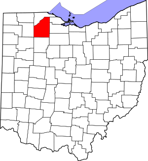 Map of Ohio highlighting Wood County | |
| Villages | ||
| Townships | ||
| CDPs | ||
| Other unincorporated communities | ||
| Footnotes | ‡This populated place also has portions in an adjacent county or counties | |