Webster Township, Wood County, Ohio
Webster Township is one of the nineteen townships of Wood County, Ohio, United States. The 2010 census found 1,283 people in the township.[3]
Webster Township, Ohio | |
|---|---|
 The Webster Township township building on Sugar Ridge Road at Ohio State Route 199 | |
 Location of Webster Township in Wood County | |
| Coordinates: 41°25′37″N 83°32′7″W | |
| Country | United States |
| State | Ohio |
| County | Wood |
| Area | |
| • Total | 28.8 sq mi (74.5 km2) |
| • Land | 28.8 sq mi (74.5 km2) |
| • Water | 0.0 sq mi (0.0 km2) |
| Elevation | 659 ft (201 m) |
| Population (2010) | |
| • Total | 1,283 |
| • Density | 45/sq mi (17/km2) |
| Time zone | UTC-5 (Eastern (EST)) |
| • Summer (DST) | UTC-4 (EDT) |
| FIPS code | 39-82544[2] |
| GNIS feature ID | 1087200[1] |
Geography
Located in the eastern central part of the county, it borders the following townships:
- Perrysburg Township - north
- Troy Township - northeast
- Freedom Township - southeast
- Center Township - southwest
- Middleton Township - west
No municipalities are located in Webster Township.
Name and history
Webster Township was established in 1846.[4] It is the only Webster Township statewide.[5]
Government
The township is governed by a three-member board of trustees, who are elected in November of odd-numbered years to a four-year term beginning on the following January 1. Two are elected in the year after the presidential election and one is elected in the year before it. There is also an elected township fiscal officer,[6] who serves a four-year term beginning on April 1 of the year after the election, which is held in November of the year before the presidential election. Vacancies in the fiscal officership or on the board of trustees are filled by the remaining trustees.
References
- "US Board on Geographic Names". United States Geological Survey. 2007-10-25. Retrieved 2008-01-31.
- "U.S. Census website". United States Census Bureau. Retrieved 2008-01-31.
- "Geographic Identifiers: 2010 Demographic Profile Data (G001): Webster township, Wood County, Ohio". U.S. Census Bureau, American Factfinder. Archived from the original on February 12, 2020. Retrieved January 22, 2013.
- "Cities, Townships, & Villages". Wood County Government. Archived from the original on June 6, 2015. Retrieved 11 January 2016.
- "Detailed map of Ohio" (PDF). United States Census Bureau. 2000. Retrieved 2007-02-16.
- §503.24, §505.01, and §507.01 of the Ohio Revised Code. Accessed 4/30/2009.
External links
Municipalities and communities of Wood County, Ohio, United States | ||
|---|---|---|
| Cities | 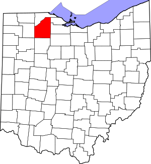 Map of Ohio highlighting Wood County | |
| Villages | ||
| Townships | ||
| CDPs | ||
| Other unincorporated communities | ||
| Footnotes | ‡This populated place also has portions in an adjacent county or counties | |