Fogama'a Crater
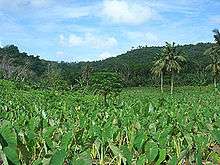
Fogama'a Crater (Samoan: Fogāma'a) is a valley basin on Tutuila Island, American Samoa, immediately north of Larsen Bay. It is within the village of Futiga, just below Logotala Hill.[1] It is a prominent crater on the island.[2] The Fogama'a Crater National Natural Landmark contains 485 acres and was designated in 1972. It is scenic and geologically significant as the most recent illustration of volcanism in American Samoa.[3] It is one of very few places where illustrations of the most recent episode of American Samoa volcanism can be seen.[4]
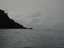
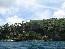
The crater is situated immediately inland from Larsen Bay, which contains two smaller coves: Fagalua and Fogama'a.[1] Fogama'a Cove is an idyllic and isolated beach on the inner margin of Larsen's Bay. There are extensive seabird breeding grounds in Larsen's Bay.[5]
Fogama'a Crater National Natural Landmark is located next to Fagatele Bay and also includes Steps Point,[6] which is the farthest southern point of U.S. territory.[5]
History
The nearby village of Vaitogi was previously located in the Fogama'a Crater, where the villagers had rich soil for farming and plenty of game for hunting. However, families began leaving the area at the end of the 19th century due to ease in connecting with other villages. The present-day location of the village was much closer to other villages when traveling on foot. Vaitogians often visit Fogama'a to enjoy the beach and bay.[7]
References
- Goldin, Meryl Rose (2002). Field Guide to the Samoan Archipelago: Fish, Wildlife, and Protected Areas. Bess Press. Page 282. ISBN 9781573061117.
- Keating, Barbara H. and Barrie R. Bolton (2012). Geology and Offshore Mineral Resources of the Central Pacific Basin. Springer Science & Business Media. Page 146. ISBN 9781461228967.
- "National Natural Landmarks - National Natural Landmarks (U.S. National Park Service)". www.nps.gov.
- https://dokumen.tips/documents/national-natural-landmarks-us-national-park-service.html (Page 6)
- "American Samoa Territorial comprehensive outdoor recreation plan". www.govinfo.gov.
- http://www.npshistory.com/publications/npsa/feasibility-study.pdf (Page 65)
- Fai’ivae, Alex Godinet (2018). Ole Manuō o Tala Tu’u Ma Fisaga o Tala Ave. Amerika Samoa Humanities Council. Page 117. ISBN 9781546229070.
| Topics | |||||
|---|---|---|---|---|---|
| Geography | |||||
| Politics |
| ||||
| Economy |
| ||||
| Culture |
| ||||
| Districts |
| ||||
| Islands | |||||
| Villages |
| ||||