Earlville, Illinois
Earlville is a city in LaSalle County, Illinois, United States. The population was 1,701 at the 2010 census, and was estimated to be 1,600 by July 2018.[3] It is part of the Ottawa, IL Micropolitan Statistical Area.
Earlville | |
|---|---|
City | |
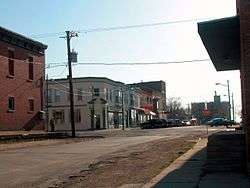 Earlville in 2003 | |
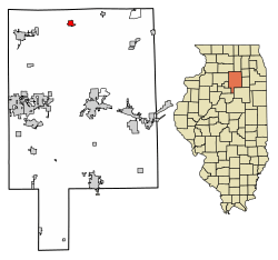 Location of Earlville in LaSalle County, Illinois. | |
.svg.png) Location of Illinois in the United States | |
| Coordinates: 41°35′19″N 88°55′20″W | |
| Country | United States |
| State | Illinois |
| County | LaSalle |
| Township | Earl |
| Settled | 1834 |
| Incorporated | 1863 |
| Government | |
| • Type | Mayor–council |
| • Mayor | Michael S. Hall |
| Area | |
| • Total | 1.20 sq mi (3.11 km2) |
| • Land | 1.20 sq mi (3.11 km2) |
| • Water | 0.00 sq mi (0.00 km2) |
| Elevation | 698 ft (213 m) |
| Population (2010) | |
| • Total | 1,701 |
| • Estimate (2019)[2] | 1,587 |
| • Density | 1,321.40/sq mi (510.00/km2) |
| Time zone | UTC-6 (CST) |
| • Summer (DST) | UTC-5 (CDT) |
| ZIP Code(s) | 60518 |
| Area code(s) | 815 |
| FIPS code | 17-21540 |
| GNIS ID | 2394593 |
| Wikimedia Commons | Earlville, Illinois |
| Website | earlvilleil |
History
The Earlville Post Office has been in operation since 1844.[4] The city was named after Earlville, New York, the former hometown of an early settler.[5]
Geography
Earlville is located at 41°35′19″N 88°55′20″W.[6]
According to the 2010 census, Earlville has a total area of 1.2 square miles (3.11 km2), all land.[7]
Demographics
| Historical population | |||
|---|---|---|---|
| Census | Pop. | %± | |
| 1880 | 963 | — | |
| 1890 | 1,058 | 9.9% | |
| 1900 | 1,122 | 6.0% | |
| 1910 | 1,059 | −5.6% | |
| 1920 | 1,012 | −4.4% | |
| 1930 | 1,028 | 1.6% | |
| 1940 | 1,103 | 7.3% | |
| 1950 | 1,217 | 10.3% | |
| 1960 | 1,420 | 16.7% | |
| 1970 | 1,410 | −0.7% | |
| 1980 | 1,382 | −2.0% | |
| 1990 | 1,435 | 3.8% | |
| 2000 | 1,778 | 23.9% | |
| 2010 | 1,701 | −4.3% | |
| Est. 2019 | 1,587 | [2] | −6.7% |
| U.S. Decennial Census[8] | |||
As of the 2010 census,[9] there were 1,701 people and 663 households residing in the city. The population density was 1,417.5 people per square mile (547/km2). There were 763 housing units at an average density of 635.8 per square mile (254.3/km2). The racial makeup of the city was 97.2% White, 0.6% African American, 0.6% Native American, 0.4% Asian, 0.1% Native Hawaiian and Other Pacific Islander, and 2.8% from other races. Hispanic or Latino of any race were 8.1% of the population.
There were 663 households out of which 28.5% had children under the age of 18 living with them, 51.3% were married couples living together, 13.7% were single parent households, and 33.2% were non-families. 26.1% of all households were made up of individuals and 12.1% had someone living alone who was 65 years of age or older. The average household size was 2.57 and the average family size was 3.10.
In the city, the population was spread out with 25.4% under the age of 18 and 13.3% who were 65 years of age or older. The median age was 36.9 years. Females made up 50.1% of the population.
The median income for a household in the city was $51,964, and the median income for a family was $65,145. Males had a median income of $38,705 versus $24,891 for females. The per capita income for the city was $21,063. About 9.2% of families and 13.3% of the population were below the poverty line of which 18.8% were under the age of 18 and 9.7% were aged 65 or over.
Earlville has a modern library, a K-12 school system, a bank, a medical clinic, a weekly newspaper, a drive-in movie theater, and a number of local businesses. The area surrounding Earlville is strongly agricultural. Earlville lacks major shopping centers and industries.
Many of the inhabitants of Earlville work at blue-collar jobs. Earlville's population has remained stable for the past several years. Several planned residential developments of moderate size were derailed by the nationwide housing crash that began in 2008.
Education
Earlville Community Unit School District #9 (CUSD #9) occupies a campus of school buildings on Union Street, a main thoroughfare and former route of US 34. The school has underwent many changes over the last several years including renovations and the hiring of new teachers and principal. The campus includes Earlville Grade School, Earlville Junior High, and Earlville High School. The administrative offices are within buildings on the site, which the Elementary, Junior High, and High School share. On the site is also a cafeteria, 2 gymnasiums, and library. The school Mascot is a Raider, stylized as a Pirate, with the colors of Red and White. The School is a part of the Little Ten Conference (LTC), which includes the schools of: Serena, Newark, Paw Paw, Indian Creek (Shabbona/Waterman), LaMoille, Leland, Somonauk, Kirkland Hiawatha, Earlville, and Hinckley-Big Rock. In recent years, the Earlville-Leland Cooperative has been the school's representation in IHSA play.
Notable people
- Steve Behel, MLB player for the Milwaukee Brewers and New York Mets
- Herbert O. Crisler, head football coach and athletic director at University of Michigan, and namesake of Crisler Arena at the university
- Frank Haven Hall, inventor of the Hall Braille Writer
- Bessie S. McColgin, Oklahoma state representative
- John J. Myers, Roman Catholic Archbishop of Newark, N.J
- Gary K. Wolf, author of the novel Who Censored Roger Rabbit, which became the Movie Who Framed Roger Rabbit
References
- "2019 U.S. Gazetteer Files". United States Census Bureau. Retrieved July 14, 2020.
- "Population and Housing Unit Estimates". United States Census Bureau. May 24, 2020. Retrieved May 27, 2020.
- "Population and Housing Unit Estimates". Retrieved January 9, 2020.
- "LaSalle County". Jim Forte Postal History. Archived from the original on 2 April 2015. Retrieved 16 March 2015.
- Chicago and North Western Railway Company (1908). A History of the Origin of the Place Names Connected with the Chicago & North Western and Chicago, St. Paul, Minneapolis & Omaha Railways. p. 66.
- "US Gazetteer files: 2010, 2000, and 1990". United States Census Bureau. 2011-02-12. Retrieved 2011-04-23.
- "G001 - Geographic Identifiers - 2010 Census Summary File 1". United States Census Bureau. Archived from the original on 2020-02-13. Retrieved 2015-12-27.
- "Census of Population and Housing". Census.gov. Retrieved June 4, 2015.
- "U.S. Census website". United States Census Bureau. US Census Bureau. Retrieved 15 January 2014.
Municipalities and communities of LaSalle County, Illinois, United States | ||
|---|---|---|
| Cities | Map of Illinois highlighting LaSalle County | |
| Villages | ||
| Townships |
| |
| CDPs | ||
| Other unincorporated communities | ||
| Ghost towns | ||
| Footnotes | ‡This populated place also has portions in an adjacent county or counties | |
| Authority control |
|
|---|