Dalzell, Illinois
Dalzell is a village in Bureau and LaSalle counties in the U.S. state of Illinois. The population was 717 at the 2010 census.[3] It is part of the Ottawa Micropolitan Statistical Area. Founded on November 24, 1903 and certified on February 11, 1904
Dalzell, Illinois | |
|---|---|
Village | |
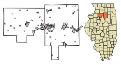 Location of Dalzell in Bureau County, Illinois. | |
.svg.png) Location of Illinois in the United States | |
| Coordinates: 41°21′22″N 89°10′25″W | |
| Country | United States |
| State | Illinois |
| Counties | Bureau |
| Townships | Hall, Peru |
| Area | |
| • Total | 0.98 sq mi (2.53 km2) |
| • Land | 0.97 sq mi (2.51 km2) |
| • Water | 0.01 sq mi (0.02 km2) |
| Population (2010) | |
| • Total | 717 |
| • Estimate (2019)[2] | 659 |
| • Density | 680.08/sq mi (262.66/km2) |
| Time zone | UTC-6 (CST) |
| • Summer (DST) | UTC-5 (CDT) |
| ZIP Code(s) | 61320 |
| Area code(s) | 815 & 779 |
| FIPS code | 17-18459 |
| Wikimedia Commons | Dalzell, Illinois |
History
The coal mine shaft in Dalzell was sunk in 1899 by the Spring Valley Coal Company. The town was originally known as the No. 5 Mine Camp. The company owned the property in and around the town. Later the No. 6 Mine Camp was added. The camps were incorporated on February 11, 1904. The village was named for mining magnate Samuel M. Dalzell, the mine manager from Spring Valley. The mine close in February 1923.[4] [5]
A post office called Dalzell has been in operation since 1902.[6]
Geography
Dalzell is located at 41°21′22″N 89°10′25″W (41.356206, -89.173685).[7] Most of the village lies in Bureau County, although a small portion extends into west central LaSalle County. In the 2000 census, all of Dalzell's 717 residents lived in Bureau County.
According to the 2010 census, Dalzell has a total area of 1 square mile (2.59 km2), of which 0.99 square miles (2.56 km2) (or 99%) is land and 0.01 square miles (0.03 km2) (or 1%) is water.[8]
Demographics
| Historical population | |||
|---|---|---|---|
| Census | Pop. | %± | |
| 1910 | 949 | — | |
| 1920 | 903 | −4.8% | |
| 1930 | 577 | −36.1% | |
| 1940 | 496 | −14.0% | |
| 1950 | 543 | 9.5% | |
| 1960 | 496 | −8.7% | |
| 1970 | 579 | 16.7% | |
| 1980 | 824 | 42.3% | |
| 1990 | 587 | −28.8% | |
| 2000 | 717 | 22.1% | |
| 2010 | 717 | 0.0% | |
| Est. 2019 | 659 | [2] | −8.1% |
| U.S. Decennial Census[9] | |||
As of the census[10] of 2000, there were 717 people, 278 households, and 209 families living in the village. The population density was 564.5 people per square mile (218.0/km2). There were 289 housing units at an average density of 227.6 per square mile (87.9/km2). The racial makeup of the village was 99.44% White, 0.14% African American, and 0.42% from two or more races. Hispanic or Latino of any race were 1.26% of the population.
There were 278 households out of which 32.7% had children under the age of 18 living with them, 65.1% were married couples living together, 6.1% had a female householder with no husband present, and 24.8% were non-families. 22.3% of all households were made up of individuals and 10.4% had someone living alone who was 65 years of age or older. The average household size was 2.58 and the average family size was 3.01.
In the village, the population was spread out with 26.1% under the age of 18, 5.9% from 18 to 24, 28.7% from 25 to 44, 25.8% from 45 to 64, and 13.5% who were 65 years of age or older. The median age was 38 years. For every 100 females, there were 94.3 males. For every 100 females age 18 and over, there were 94.9 males.
The median income for a household in the village was $49,808, and the median income for a family was $56,375. Males had a median income of $39,531 versus $22,050 for females. The per capita income for the village was $20,215. About 1.0% of families and 3.5% of the population were below the poverty line, including 3.5% of those under age 18 and 0.9% of those age 65 or over.
Notable Individuals
References
- "2019 U.S. Gazetteer Files". United States Census Bureau. Retrieved July 14, 2020.
- "Population and Housing Unit Estimates". United States Census Bureau. May 24, 2020. Retrieved May 27, 2020.
- "Geographic Identifiers: 2010 Demographic Profile Data (G001): Dalzell village, Illinois". U.S. Census Bureau, American Factfinder. Archived from the original on February 12, 2020. Retrieved November 14, 2013.
- Piacenti, Jim (2011). The Promise of a Better Life: The Coal Mines of Eastern Bureau County, Illinois. Ladd, Illinois: Locust Street Publishing. pp. 137–144.
- Company, Chicago and North Western Railway (1908). A History of the Origin of the Place Names Connected with the Chicago & North Western and Chicago, St. Paul, Minneapolis & Omaha Railways. p. 62.
- "Bureau County". Jim Forte Postal History. Retrieved 1 March 2015.
- "US Gazetteer files: 2010, 2000, and 1990". United States Census Bureau. 2011-02-12. Retrieved 2011-04-23.
- "G001 - Geographic Identifiers - 2010 Census Summary File 1". United States Census Bureau. Archived from the original on 2020-02-13. Retrieved 2015-08-02.
- "Census of Population and Housing". Census.gov. Retrieved June 4, 2015.
- "U.S. Census website". United States Census Bureau. Retrieved 2008-01-31.
Municipalities and communities of Bureau County, Illinois, United States | ||
|---|---|---|
| Cities | Map of Illinois highlighting Bureau County | |
| Villages | ||
| Townships | ||
| Unincorporated communities | ||
| Ghost town | ||
| Footnotes | ‡This populated place also has portions in an adjacent county or counties | |
Municipalities and communities of LaSalle County, Illinois, United States | ||
|---|---|---|
| Cities | Map of Illinois highlighting LaSalle County | |
| Villages | ||
| Townships |
| |
| CDPs | ||
| Other unincorporated communities | ||
| Ghost towns | ||
| Footnotes | ‡This populated place also has portions in an adjacent county or counties | |