Naplate, Illinois
Naplate is a village in LaSalle County, Illinois, United States. The population was 496 at the 2010 census.[3] It is part of the Ottawa Micropolitan Statistical Area.
Naplate, Illinois | |
|---|---|
Village | |
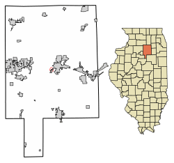 Location in LaSalle County, Illinois | |
.svg.png) Location of Illinois in the United States | |
| Coordinates: 41°19′53″N 88°52′44″W | |
| Country | United States |
| State | Illinois |
| County | LaSalle |
| Township | Ottawa |
| Area | |
| • Total | 0.16 sq mi (0.41 km2) |
| • Land | 0.16 sq mi (0.41 km2) |
| • Water | 0.00 sq mi (0.00 km2) |
| Elevation | 459 ft (140 m) |
| Population (2010) | |
| • Total | 496 |
| • Estimate (2019)[2] | 470 |
| • Density | 2,937.50/sq mi (1,137.41/km2) |
| Time zone | UTC-6 (CST) |
| • Summer (DST) | UTC-5 (CDT) |
| ZIP Code(s) | 61350 |
| Area code(s) | 815 |
| FIPS code | 17-51648 |
| Wikimedia Commons | Naplate, Illinois |
Geography
Naplate is located in central LaSalle County at 41°19′53″N 88°52′44″W (41.331269, -88.878932).[4]
According to the 2010 census, Naplate has a total area of 0.11 square miles (0.28 km2), all land.[5] The name Naplate was created at the time of incorporation by combining the name of the primary employer, National Plate Glass Company into Naplate.
Naplate lies on the north bank of the Illinois River just downstream from Ottawa.[6][7] Buffalo Rock State Park and Starved Rock State Park lie along the river just west and southwest of Naplate.[7]
Demographics
| Historical population | |||
|---|---|---|---|
| Census | Pop. | %± | |
| 1950 | 783 | — | |
| 1960 | 738 | −5.7% | |
| 1970 | 686 | −7.0% | |
| 1980 | 581 | −15.3% | |
| 1990 | 609 | 4.8% | |
| 2000 | 523 | −14.1% | |
| 2010 | 496 | −5.2% | |
| Est. 2019 | 470 | [2] | −5.2% |
| U.S. Decennial Census[8] | |||
As of the census[9] of 2000, there were 523 people, 233 households, and 137 families residing in the village. The population density was 4,671.6 people per square mile (1,835.7/km2). There were 252 housing units at an average density of 2,251.0 per square mile (884.5/km2). The racial makeup of the village was 97.71% White, 0.38% Asian, 0.19% from other races, and 1.72% from two or more races. Hispanic or Latino of any race were 1.91% of the population.
There were 233 households out of which 24.0% had children under the age of 18 living with them, 46.8% were married couples living together, 9.4% had a female householder with no husband present, and 41.2% were non-families. 37.3% of all households were made up of individuals and 16.7% had someone living alone who was 65 years of age or older. The average household size was 2.23 and the average family size was 2.99.
In the village, the population was spread out with 21.2% under the age of 18, 8.4% from 18 to 24, 27.7% from 25 to 44, 21.2% from 45 to 64, and 21.4% who were 65 years of age or older. The median age was 40 years. For every 100 females, there were 84.2 males. For every 100 females age 18 and over, there were 86.4 males.
The median income for a household in the village was $31,083, and the median income for a family was $41,250. Males had a median income of $33,929 versus $18,214 for females. The per capita income for the village was $16,459. About 7.6% of families and 9.7% of the population were below the poverty line, including 17.1% of those under age 18 and 5.0% of those age 65 or over.
References
- "2019 U.S. Gazetteer Files". United States Census Bureau. Retrieved July 14, 2020.
- "Population and Housing Unit Estimates". United States Census Bureau. May 24, 2020. Retrieved May 27, 2020.
- "Profile of General Population and Housing Characteristics: 2010 Census Summary File 1 (DP-1), Naplate village, Illinois". American FactFinder. U.S. Census Bureau. Archived from the original on February 13, 2020. Retrieved December 27, 2019.
- "US Gazetteer files: 2010, 2000, and 1990". United States Census Bureau. 2011-02-12. Retrieved 2011-04-23.
- "G001 - Geographic Identifiers - 2010 Census Summary File 1". United States Census Bureau. Archived from the original on 2020-02-13. Retrieved 2015-12-19.
- Ottawa, Illinois 7.5 Minute Topographic Quadrangle, USGS, 1994
- Starved Rock, Illinois 7.5 Minute Topographic Quadrangle, USGS, 1970
- "Census of Population and Housing". Census.gov. Retrieved June 4, 2015.
- "U.S. Census website". United States Census Bureau. Retrieved 2008-01-31.
Municipalities and communities of LaSalle County, Illinois, United States | ||
|---|---|---|
| Cities | Map of Illinois highlighting LaSalle County | |
| Villages | ||
| Townships |
| |
| CDPs | ||
| Other unincorporated communities | ||
| Ghost towns | ||
| Footnotes | ‡This populated place also has portions in an adjacent county or counties | |