Dyer, Arkansas
Dyer is a city[3] in Crawford County, Arkansas, United States. It is part of the Fort Smith, Arkansas-Oklahoma Metropolitan Statistical Area. The population was 876 at the 2010 census.[4]
Dyer, Arkansas | |
|---|---|
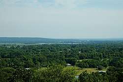 Outskirts of Dyer with Arkansas River in the background, July 2005 | |
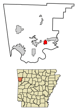 Location of Dyer in Crawford County, Arkansas. | |
| Coordinates: 35°29′40″N 94°8′19″W | |
| Country | United States |
| State | Arkansas |
| County | Crawford |
| Area | |
| • Total | 2.94 sq mi (7.62 km2) |
| • Land | 2.94 sq mi (7.62 km2) |
| • Water | 0.00 sq mi (0.00 km2) |
| Elevation | 430 ft (131 m) |
| Population (2010) | |
| • Total | 876 |
| • Estimate (2019)[2] | 902 |
| • Density | 306.70/sq mi (118.43/km2) |
| Time zone | UTC-6 (Central (CST)) |
| • Summer (DST) | UTC-5 (CDT) |
| ZIP code | 72935 |
| Area code(s) | 479 |
| FIPS code | 05-20200 |
| GNIS feature ID | 0076832 |
| Website | www |
History
Dyer was platted in 1884 by G. E. Dyer soon after the Little Rock and Fort Smith Railroad was extended to that point.[5] The community has the name of the local Dyer family; S. M. Dyer bought the town site in 1870.[5] A post office has been in operation at Dyer since 1885.[6]
Geography
Dyer is located in southeastern Crawford County at 35°29′40″N 94°8′19″W (35.494532, -94.138541),[7] in the Arkansas River valley. U.S. Route 64 passes through the community, leading west 5 miles (8 km) to Alma and 13 miles (21 km) to Van Buren, the county seat, and east 5 miles (8 km) to Mulberry. Interstate 40 passes through the northern part of Dyer but does not have a direct exit for the city; the nearest access is from Exit 20 in the western part of Mulberry.
According to the United States Census Bureau, Dyer has a total area of 2.6 square miles (6.8 km2), all land.[4]
Demographics
| Historical population | |||
|---|---|---|---|
| Census | Pop. | %± | |
| 1900 | 343 | — | |
| 1910 | 433 | 26.2% | |
| 1920 | 609 | 40.6% | |
| 1930 | 425 | −30.2% | |
| 1940 | 513 | 20.7% | |
| 1950 | 398 | −22.4% | |
| 1960 | 450 | 13.1% | |
| 1970 | 486 | 8.0% | |
| 1980 | 608 | 25.1% | |
| 1990 | 502 | −17.4% | |
| 2000 | 585 | 16.5% | |
| 2010 | 876 | 49.7% | |
| Est. 2019 | 902 | [2] | 3.0% |
| U.S. Decennial Census[8] | |||
As of the census[9] of 2000, there were 585 people, 230 households, and 163 families residing in the town. The population density was 86.9/km2 (225.3/mi2). There were 248 housing units at an average density of 36.8/km2 (95.5/mi2). The racial makeup of the town was 96.24% White, 0.17% Black or African American, 1.20% Native American, 0.85% Asian, and 1.54% from two or more races. 0.17% of the population were Hispanic or Latino of any race.
There were 230 households, out of which 30.4% had children under the age of 18 living with them, 61.3% were married couples living together, 5.2% had a female householder with no husband present, and 28.7% were non-families. 23.9% of all households were made up of individuals, and 13.5% had someone living alone who was 65 years of age or older. The average household size was 2.54 and the average family size was 3.06.
In the town the population was spread out, with 25.5% under the age of 18, 6.0% from 18 to 24, 29.1% from 25 to 44, 23.6% from 45 to 64, and 15.9% who were 65 years of age or older. The median age was 39 years. For every 100 females, there were 93.1 males. For every 100 females age 18 and over, there were 98.2 males.
The median income for a household in the town was $23,438, and the median income for a family was $28,500. Males had a median income of $28,523 versus $21,500 for females. The per capita income for the town was $13,206. About 22.6% of families and 34.1% of the population were below the poverty line, including 52.7% of those under age 18 and 32.1% of those age 65 or over.
Notable people
Controversial minister Tony Alamo once claimed Dyer to be the home of his organization, although it is commonly referred to as "Alma" in most media reports. (Dyer is located about 5 miles (8 km) east of Alma.) Alamo's compound, which included a church, school, and round-the-clock guards, served as a meeting place for his organization, Alamo Ministries.[10]
In 2008 Alamo was arrested in Flagstaff, Arizona, after a raid of his new compound in Fouke, located in southwest Arkansas. He was charged with violating the Mann Act for allegedly transporting minors across state lines for illegal purposes, i.e. sexual acts.
References
- "2019 U.S. Gazetteer Files". United States Census Bureau. Retrieved June 30, 2020.
- "Population and Housing Unit Estimates". United States Census Bureau. May 24, 2020. Retrieved May 27, 2020.
- Local.Arkansas.gov - Dyer, retrieved September 3, 2012
- "Geographic Identifiers: 2010 Demographic Profile Data (G001): Dyer city, Arkansas". U.S. Census Bureau, American Factfinder. Archived from the original on February 12, 2020. Retrieved June 18, 2014.
- History of Benton, Washington, Carroll, Madison, Crawford, Franklin, and Sebastian Counties, Arkansas. Higginson Book Company. 1889. p. 555.
- "Post Offices". Jim Forte Postal History. Retrieved 6 February 2018.
- "US Gazetteer files: 2010, 2000, and 1990". United States Census Bureau. 2011-02-12. Retrieved 2011-04-23.
- "Census of Population and Housing". Census.gov. Retrieved June 4, 2015.
- "U.S. Census website". United States Census Bureau. Retrieved 2008-01-31.
- http://www.alamoministries.com/content/english/newsreleases/pressreleasemillers.html
Municipalities and communities of Crawford County, Arkansas, United States | ||
|---|---|---|
| Cities | 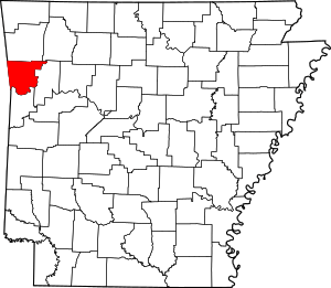 Map of Arkansas highlighting Crawford County | |
| Towns | ||
| Unincorporated communities | ||
| Ghost towns | ||