Coverdale Parish, New Brunswick
Coverdale is a civil parish[lower-alpha 1] in Albert County, New Brunswick, Canada. For governance purposes the parish is divided between the town of Riverview, New Brunswick and the local service district of the parish of Coverdale.
Coverdale | |
|---|---|
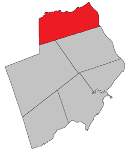 Location within Albert County. | |
| Coordinates: 46.03°N 64.86°W | |
| Country | |
| Province | |
| County | Albert County |
| Established | 1786 |
| Area | |
| • Land | 236.04 km2 (91.14 sq mi) |
| Population (2016)[1] | |
| • Total | 4,466 |
| • Density | 18.9/km2 (49/sq mi) |
| • Pop 2011-2016 | |
| • Dwellings | 1,806 |
| Time zone | UTC-4 (AST) |
| • Summer (DST) | UTC-3 (ADT) |
History
Coverdale Parish was set off from Hillsborough Parish in 1828 and named for the Coverdale River.
Delineation
Coverdale Parish is defined in the Territorial Division Act[2] as being bounded:
- North and east by the Petitcodiac River; south by the south line of lot no. 2, granted to Robert Crossman, at Stoney Creek, on the western side of the Petitcodiac River and its westerly prolongation to the County line; west by the County line.
Communities
Parish population total does not include incorporated municipalities (in bold).
|
|
|
Bodies of water & Islands
This is a list of rivers, lakes, streams, creeks, marshes and Islands that are at least partially in this parish
- Coverdale River
- Petitcodiac River
Demographics
Access Routes
Highways and numbered routes that run through the parish, including external routes that start or finish at the parish limits:[5]
See also
Notes
- Civil parishes served a variety of government functions until 1966, when the new Municipalities Act stripped them of their responsibilities; parishes continue to provide convenient boundaries for federal and provincial electoral districts. Statistics Canada uses civil parishes as census subdivisions for all parts of the province that are not within municipalities and similar entities.
References
- "Census Profile, 2016 Census: Coverdale, Parish [Census subdivision], New Brunswick". Statistics Canada. Retrieved September 4, 2019.
- "Territorial Division Act (R.S.N.B. 1973, c. T-3)". Government of New Brunswick website. Retrieved 18 August 2016.
- Statistics Canada: 2001, 2006 census
- 2011 Statistics Canada Census Profile: Coverdale Parish, New Brunswick
- Atlantic Canada Back Road Atlas ISBN 978-1-55368-618-7
Places adjacent to Coverdale Parish, New Brunswick | |
|---|---|
| Subdivisions |
|
|---|---|
| Cities | |
| Counties | |
| |
This article is issued from Wikipedia. The text is licensed under Creative Commons - Attribution - Sharealike. Additional terms may apply for the media files.