Lamoille Township, Bureau County, Illinois
La Moille Township is one of twenty-five townships in Bureau County, Illinois, USA. As of the 2010 census, its population was 1,122 and it contained 491 housing units.[1]
Lamoille Township | |
|---|---|
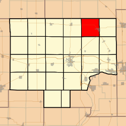 Location in Bureau County | |
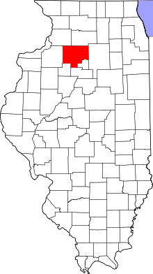 Bureau County's location in Illinois | |
| Coordinates: 41°32′15″N 89°20′06″W | |
| Country | United States |
| State | Illinois |
| County | Bureau |
| Established | November 6, 1849 |
| Area | |
| • Total | 37.69 sq mi (97.6 km2) |
| • Land | 37.67 sq mi (97.6 km2) |
| • Water | 0.01 sq mi (0.03 km2) 0.03% |
| Elevation | 804 ft (245 m) |
| Population (2010) | |
| • Total | 1,122 |
| • Density | 29.8/sq mi (11.5/km2) |
| Time zone | UTC-6 (CST) |
| • Summer (DST) | UTC-5 (CDT) |
| ZIP codes | 61330, 61349, 61356, 61374 |
| GNIS feature ID | 0429227 |
La Moille Township was named after the Lamoille River valley in Vermont.[2]
Geography
According to the 2010 census, the township has a total area of 37.69 square miles (97.6 km2), of which 37.67 square miles (97.6 km2) (or 99.95%) is land and 0.01 square miles (0.026 km2) (or 0.03%) is water.[1]
Cities
- La Moille (west three-quarters)
Unincorporated towns
Cemeteries
The township contains four cemeteries:
- Greenfield
- North Prairie
- Union
- Van Orin Repose
Major highways


School districts
- La Moille Community Unit School District 303
Political districts
- Illinois's 16th congressional district
- State House District 76
- State Senate District 38
References
- "Lamoille Township, Bureau County, Illinois". Geographic Names Information System. United States Geological Survey. Retrieved 4 January 2010.
- US Census Bureau 2007 TIGER/Line Shapefiles
- United States National Atlas
- "Population, Housing Units, Area, and Density: 2010 - County". US Census Bureau. Archived from the original on 12 February 2020. Retrieved 28 May 2013.
- Gannett, Henry (1905). The Origin of Certain Place Names in the United States. Government Printing Office. p. 180.
External links
Places adjacent to Lamoille Township, Bureau County, Illinois | |
|---|---|
Municipalities and communities of Bureau County, Illinois, United States | ||
|---|---|---|
| Cities | Map of Illinois highlighting Bureau County | |
| Villages | ||
| Townships | ||
| Unincorporated communities | ||
| Ghost town | ||
| Footnotes | ‡This populated place also has portions in an adjacent county or counties | |
This article is issued from Wikipedia. The text is licensed under Creative Commons - Attribution - Sharealike. Additional terms may apply for the media files.