Corbin City, New Jersey
Corbin City is a city in Atlantic County, New Jersey, United States. As of the 2010 United States Census, the city's population was 492,[8][9][10] reflecting an increase of 24 (+5.1%) from the 468 counted in the 2000 Census, which had in turn increased by 56 (+13.6%) from the 412 counted in the 1990 Census.[18]
Corbin City, New Jersey | |
|---|---|
| City of Corbin City | |
 Head-of-the-River Methodist Episcopal Church | |
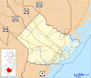
 Map of Corbin City in Atlantic County | |
 Census Bureau map of Corbin City, New Jersey | |
 Corbin City Location in Atlantic County 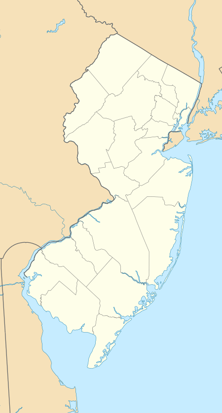 Corbin City Location in New Jersey  Corbin City Location in the United States | |
| Coordinates: 39.30162°N 74.76024°W[1][2] | |
| Country | |
| State | |
| County | Atlantic |
| Incorporated | March 11, 1922 |
| Named for | Austin Corbin |
| Government | |
| • Type | City |
| • Body | City Council |
| • Mayor | Robert Schulte (R, term ends December 31, 2020)[4][5] |
| • Municipal clerk | Joanne Siedlecki[6] |
| Area | |
| • Total | 8.97 sq mi (23.24 km2) |
| • Land | 7.70 sq mi (19.94 km2) |
| • Water | 1.28 sq mi (3.30 km2) 14.23% |
| Area rank | 221st of 565 in state 12th of 23 in county[1] |
| Elevation | 0 ft (0 m) |
| Population | |
| • Total | 492 |
| • Estimate (2019)[11] | 491 |
| • Rank | 557th of 566 in state 23rd of 23 in county[12] |
| • Density | 64.2/sq mi (24.8/km2) |
| • Density rank | 552nd of 566 in state 22nd of 23 in county[12] |
| Time zone | UTC−05:00 (Eastern (EST)) |
| • Summer (DST) | UTC−04:00 (Eastern (EDT)) |
| ZIP Code | 08270[13] |
| Area code(s) | 609[14] |
| FIPS code | 3400115160[1][15][16] |
| GNIS feature ID | 0885192[1][17] |
| Website | www |
Corbin City was incorporated as a city by an act of the New Jersey Legislature on March 11, 1922, from portions of Weymouth Township.[19][20] The borough was named for robber baron Austin Corbin.[21]
History
The city has been one of several New Jersey municipalities that have considered consolidation. Corbin City announced it 2008 that it was investigating a prospective merger with neighboring Upper Township, across the county line in Cape May County, citing proximity and that Corbin City's children already attend Upper Township schools.[22] There are no municipalities within New Jersey that have incorporated lands within multiple counties, and by 2010 Cape May County's Board of Chosen Freeholders objected to the plan, citing an analysis that the added costs of serving Corbin City would exceed revenues.[23]
Geography
According to the United States Census Bureau, the city had a total area of 8.97 square miles (23.24 km2), including 7.70 square miles (19.94 km2) of land and 1.28 square miles (3.3 km2) of water (14.23%).[1][2]
Unincorporated communities, localities and place names located partially or completely within the city include Buck Hill and Rock Point.[24]
The city borders the municipalities of Egg Harbor Township and Estell Manor in Atlantic County; and Upper Township in Cape May County.[25][26][27]
The city is one of 56 South Jersey municipalities that are included within the New Jersey Pinelands National Reserve, a protected natural area of unique ecology covering 1,100,000 acres (450,000 ha), that has been classified as a United States Biosphere Reserve and established by Congress in 1978 as the nation's first National Reserve.[28] All of the city is included either in the state-designated Pinelands area (which includes portions of Atlantic County, along with areas in Burlington, Camden, Cape May, Cumberland, Gloucester and Ocean counties) or in the Pinelands National Reserve.[29]
Demographics
| Historical population | |||
|---|---|---|---|
| Census | Pop. | %± | |
| 1930 | 256 | — | |
| 1940 | 220 | −14.1% | |
| 1950 | 238 | 8.2% | |
| 1960 | 271 | 13.9% | |
| 1970 | 258 | −4.8% | |
| 1980 | 254 | −1.6% | |
| 1990 | 412 | 62.2% | |
| 2000 | 468 | 13.6% | |
| 2010 | 492 | 5.1% | |
| Est. 2019 | 491 | [11][30] | −0.2% |
| Population sources: 1930-2000[31] 1930[32] 1930-1990[33] 2000[34][35] 2010[8][9][10] | |||
Corbin City is the least-populous municipality with the city type of government in New Jersey. While there are municipalities with smaller populations, they are either boroughs, towns, townships or villages.[36][37]
2010 Census
The 2010 United States Census counted 492 people, 185 households, and 130.055 families in the city. The population density was 64.2 per square mile (24.8/km2). There were 212 housing units at an average density of 27.7 per square mile (10.7/km2). The racial makeup was 97.56% (480) White, 0.41% (2) Black or African American, 0.00% (0) Native American, 1.22% (6) Asian, 0.00% (0) Pacific Islander, 0.61% (3) from other races, and 0.20% (1) from two or more races. Hispanic or Latino of any race were 3.46% (17) of the population.[8]
Of the 185 households, 30.3% had children under the age of 18; 53.0% were married couples living together; 10.3% had a female householder with no husband present and 29.7% were non-families. Of all households, 24.9% were made up of individuals and 9.7% had someone living alone who was 65 years of age or older. The average household size was 2.66 and the average family size was 3.18.[8]
23.2% of the population were under the age of 18, 9.1% from 18 to 24, 25.8% from 25 to 44, 29.7% from 45 to 64, and 12.2% who were 65 years of age or older. The median age was 39.1 years. For every 100 females, the population had 96.0 males. For every 100 females ages 18 and older there were 92.9 males.[8]
2000 Census
As of the 2000 United States Census[15] there were 468 people, 172 households, and 120 families residing in the city. The population density was 59.3 people per square mile (22.9/km2). There were 204 housing units at an average density of 25.9 per square mile (10.0/km2). The racial makeup of the city was 94.02% White, 2.78% African American, 0.85% Native American, 1.28% Asian, 0.64% from other races, and 0.43% from two or more races. Hispanic or Latino of any race were 2.99% of the population.[34][35]
There were 172 households, out of which 37.2% had children under the age of 18 living with them, 56.4% were married couples living together, 8.7% had a female householder with no husband present, and 29.7% were non-families. 22.7% of all households were made up of individuals, and 8.7% had someone living alone who was 65 years of age or older. The average household size was 2.72 and the average family size was 3.21.[34][35]
In the city the population was spread out, with 29.9% under the age of 18, 4.9% from 18 to 24, 29.3% from 25 to 44, 25.4% from 45 to 64, and 10.5% who were 65 years of age or older. The median age was 36 years. For every 100 females, there were 98.3 males. For every 100 females age 18 and over, there were 105.0 males.[34][35]
The median income for a household in the city was $47,083, and the median income for a family was $56,000. Males had a median income of $35,938 versus $27,250 for females. The per capita income for the city was $21,321. None of the families and 4.9% of the population were living below the poverty line, including no under eighteens and 17.0% of those over 64.[34][35]
Government
Local government
Corbin City operates within the City form of New Jersey municipal government.[38] The city is one of 15 municipalities (of the 565) statewide that use this traditional form of government.[39] The city's governing body is comprised of the Mayor and the three-member City Council. The Mayor is elected at-large to a two-year term of office and the City Council has three members elected at-large to three-year terms in office on a staggered basis, with one seat coming up for election each year as part of the November general election in a three-year cycle.[3][40]
As of 2020, the Mayor of Corbin City is Republican Robert J. Schulte, whose term of office ends December 31, 2020. Members of the City Council are Council President Matthew V. Kane (D, 2020), Laverne Kirn (R, 2021) and Kristofer M. Surran (R, 2022).[4][41][42][43][44][45]
In 2018, the city had an average property tax bill of $3,680, the lowest in the county, compared to an average bill of $6,367 in Atlantic County and $8,767 statewide.[46][47]
Federal, state and county representation
Corbin City is located in the 2nd Congressional District[48] and is part of New Jersey's 1st state legislative district.[9][49][50] Prior to the 2011 reapportionment following the 2010 Census, Corbin City had been in the 2nd state legislative district.[51]
For the 116th United States Congress, New Jersey's Second Congressional District is represented by Jeff Van Drew (R, Dennis Township).[52] New Jersey is represented in the United States Senate by Democrats Cory Booker (Newark, term ends 2021)[53] and Bob Menendez (Paramus, term ends 2025).[54][55]
For the 2020–2021 session (Senate, General Assembly), the 1st Legislative District of the New Jersey Legislature is represented in the State Senate by Mike Testa (R, Vineland) and in the General Assembly by Antwan McClellan (R, Ocean City) and Erik K. Simonsen (R, Lower Township).[56][57]
Atlantic County is governed by a directly elected county executive and a nine-member Board of Chosen Freeholders, responsible for legislation. The executive serves a four-year term and the freeholders are elected to staggered three-year terms, of which four are elected from the county on an at-large basis and five of the freeholders represent equally populated districts.[58][59] As of 2018, Atlantic County's Executive is Republican Dennis Levinson, whose term of office ends December 31, 2019.[60] Members of the Board of Chosen Freeholders are Chairman Frank D. Formica, Freeholder At-Large (R, 2018, Margate City)[61] Vice Chairwoman Maureen Kern, Freeholder District 2, including Atlantic City (part), Egg Harbor Township (part), Linwood, Longport, Margate City, Northfield, Somers Point and Ventnor City (R, 2018, Somers Point),[62] Ashley R. Bennett, Freeholder District 3, including Egg Harbor Township (part) and Hamilton Township (part) (D, 2020, Egg Harbor Township),[63] James A. Bertino, Freeholder District 5, including Buena, Buena Vista Township, Corbin City, Egg Harbor City, Estell Manor, Folsom, Hamilton Township (part), Hammonton, Mullica Township and Weymouth Township (R, 2018, Hammonton),[64] Ernest D. Coursey, Freeholder District 1, including Atlantic City (part), Egg Harbor Township (part) and Pleasantville (D, 2019, Atlantic City),[65] Richard R. Dase, Freeholder District 4, including Absecon, Brigantine, Galloway Township and Port Republic (R, 2019, Galloway Township),[66] Caren L. Fitzpatrick, Freeholder At-Large (D, 2020, Linwood),[67] Amy L. Gatto, Freeholder At-Large (R, 2019, Mays Landing in Hamilton Township)[68] and John W. Risley, Freeholder At-Large (R, 2020, Egg Harbor Township)[69][58][70] Atlantic County's constitutional officers are County Clerk Edward P. McGettigan (D, 2021; Linwood),[71] [72] Sheriff Eric Scheffler (D, 2021, Northfield)[73][74] and Surrogate James Curcio (R, 2020, Hammonton).[75][76][77]
Politics
As of March 23, 2011, there were a total of 303 registered voters in Corbin City, of which 54 (17.8% vs. 30.5% countywide) were registered as Democrats, 135 (44.6% vs. 25.2%) were registered as Republicans and 114 (37.6% vs. 44.3%) were registered as Unaffiliated. There were no voters registered to other parties.[78] Among the city's 2010 Census population, 61.6% (vs. 58.8% in Atlantic County) were registered to vote, including 80.2% of those ages 18 and over (vs. 76.6% countywide).[78][79]
In the 2012 presidential election, Republican Mitt Romney received 138 votes (58.0% vs. 41.1% countywide), ahead of Democrat Barack Obama with 91 votes (38.2% vs. 57.9%) and other candidates with 7 votes (2.9% vs. 0.9%), among the 238 ballots cast by the city's 315 registered voters, for a turnout of 75.6% (vs. 65.8% in Atlantic County).[80][81] In the 2008 presidential election, Republican John McCain received 150 votes (62.5% vs. 41.6% countywide), ahead of Democrat Barack Obama with 85 votes (35.4% vs. 56.5%) and other candidates with 5 votes (2.1% vs. 1.1%), among the 240 ballots cast by the city's 317 registered voters, for a turnout of 75.7% (vs. 68.1% in Atlantic County).[82] In the 2004 presidential election, Republican George W. Bush received 143 votes (63.8% vs. 46.2% countywide), ahead of Democrat John Kerry with 77 votes (34.4% vs. 52.0%) and other candidates with 1 vote (0.4% vs. 0.8%), among the 224 ballots cast by the city's 278 registered voters, for a turnout of 80.6% (vs. 69.8% in the whole county).[83]
In the 2013 gubernatorial election, Republican Chris Christie received 134 votes (68.4% vs. 60.0% countywide), ahead of Democrat Barbara Buono with 50 votes (25.5% vs. 34.9%) and other candidates with 5 votes (2.6% vs. 1.3%), among the 196 ballots cast by the city's 324 registered voters, yielding a 60.5% turnout (vs. 41.5% in the county).[84][85] In the 2009 gubernatorial election, Republican Chris Christie received 95 votes (58.3% vs. 47.7% countywide), ahead of Democrat Jon Corzine with 60 votes (36.8% vs. 44.5%), Independent Chris Daggett with 6 votes (3.7% vs. 4.8%) and other candidates with no votes (0.0% vs. 1.2%), among the 163 ballots cast by the city's 308 registered voters, yielding a 52.9% turnout (vs. 44.9% in the county).[86]
Education
Corbin City is a non-operating school district.[87] Students attend public school for pre-kindergarten through eighth grade in the Upper Township School District, as part of a sending/receiving relationship.[88][89] As of the 2018–19 school year, the district, comprised of three schools, had an enrollment of 1,448 students and 131.0 classroom teachers (on an FTE basis), for a student–teacher ratio of 11.1:1.[90] Schools in the district (with 2018–19 enrollment data from the National Center for Education Statistics[91]) are Upper Township Primary School[92] with 492 students in grades PreK-2, Upper Township Elementary School[93] with 481 students in grades 3-5 and Upper Township Middle School[94] with 469 students in grades 6-8.[95][96]
High school students in public school for ninth through twelfth grades attend Ocean City High School in Ocean City as part of a sending/receiving relationship with the Ocean City School District, together with students from Longport, Ocean City, Sea Isle City and Upper Township.[89][97] As of the 2018–19 school year, the high school had an enrollment of 1,245 students and 98.5 classroom teachers (on an FTE basis), for a student–teacher ratio of 12.6:1.[98]
City public school students are also eligible to attend the Atlantic County Institute of Technology in the Mays Landing section of Hamilton Township[99] or the Charter-Tech High School for the Performing Arts, located in Somers Point.[100]
Transportation
_in_Corbin_City%2C_Atlantic_County%2C_New_Jersey.jpg)
Roads and highways
As of May 2010, the city had a total of 10.44 miles (16.80 km) of roadways, of which 3.52 miles (5.66 km) were maintained by the municipality, 4.55 miles (7.32 km) by Atlantic County and 2.37 miles (3.81 km) by the New Jersey Department of Transportation.[101]
Route 50 is the main road that passes through the city. The Garden State Parkway is accessible in neighboring Upper Township.
Public transportation
NJ Transit provide bus service in the city on the 315 route that runs between Cape May and Philadelphia.[102][103]
Media
Two FM radio stations serving the greater Atlantic City area transmit from a site in Corbin City. They are WENJ (97.3), an ESPN Radio affiliate licensed to Millville with studios in Northfield,[104] and WRTQ (91.3), an Ocean City-licensed relay of WRTI in Philadelphia, which programs classical music and jazz.[105]
References
- 2019 Census Gazetteer Files: New Jersey Places, United States Census Bureau. Accessed July 1, 2020.
- US Gazetteer files: 2010, 2000, and 1990, United States Census Bureau. Accessed September 4, 2014.
- 2012 New Jersey Legislative District Data Book, Rutgers University Edward J. Bloustein School of Planning and Public Policy, March 2013, p. 13.
- Elected Officials, City of Corbin City. Accessed March 26, 2020.
- 2020 New Jersey Mayors Directory, New Jersey Department of Community Affairs. Accessed February 1, 2020.
- Services, City of Corbin City. Accessed March 26, 2020.
- U.S. Geological Survey Geographic Names Information System: City of Corbin City, Geographic Names Information System. Accessed March 5, 2013.
- DP-1 - Profile of General Population and Housing Characteristics: 2010 Demographic Profile Data for Corbin City city, Atlantic County, New Jersey Archived February 12, 2020, at Archive.today, United States Census Bureau. Accessed May 15, 2012.
- Municipalities Sorted by 2011-2020 Legislative District, New Jersey Department of State. Accessed February 1, 2020.
- Profile of General Demographic Characteristics: 2010 for Corbin City city, New Jersey Department of Labor and Workforce Development. Accessed May 15, 2012.
- Annual Estimates of the Resident Population for Minor Civil Divisions in New Jersey: April 1, 2010 to July 1, 2019, United States Census Bureau. Accessed May 21, 2020.
- GCT-PH1 Population, Housing Units, Area, and Density: 2010 - State -- County Subdivision from the 2010 Census Summary File 1 for New Jersey Archived February 12, 2020, at Archive.today, United States Census Bureau. Accessed December 11, 2012.
- Look Up a ZIP Code for Corbin City, NJ, United States Postal Service. Accessed May 15, 2012.
- Area Code Lookup - NPA NXX for Corbin City, NJ, Area-Codes.com. Accessed February 14, 2015.
- U.S. Census website, United States Census Bureau. Accessed September 4, 2014.
- Geographic codes for New Jersey, Missouri Census Data Center. Accessed September 24, 2019.
- US Board on Geographic Names, United States Geological Survey. Accessed September 4, 2014.
- Table 7. Population for the Counties and Municipalities in New Jersey: 1990, 2000 and 2010, New Jersey Department of Labor and Workforce Development, February 2011. Accessed July 9, 2013.
- Snyder, John P. The Story of New Jersey's Civil Boundaries: 1606-1968, Bureau of Geology and Topography; Trenton, New Jersey; 1969. p. 68. Accessed May 15, 2012.
- Staff. Acts of the One Hundred and Forty-Sixth Legislature of the State of New Jersey, pp. 106-107. New Jersey Secretary of State, 1922. Accessed October 17, 2015. "Chapter 56 - An Act to incorporate corbin City and fix the boundaries thereof"
- Rogers, Judy; and Houdart, Mike of the Historical Preservation Society of Upper Township. "Corbin City's namesake was an infamous robber baron, called 'part hog, part shark'" Archived 2016-03-04 at the Wayback Machine, Upper Township Gazette, July 3, 2015. Accessed August 29, 2015. "In 1922, the town known as North Tuckahoe was incorporated as Corbin City after Austin Corbin. Many people today do not know how or why the name was chosen, or the notorious background of the city's namesake."
- Little choice for small New Jersey towns but to merge. PhillyBurbs.com. Accessed May 26, 2008.
- Staff. "Corbin City, smallest N.J. town, tries to keep its way of life", The Star-Ledger, June 10, 2010. Accessed January 23, 2015. "However, the plan's main recommendation, merging with Upper Township, was opposed by Cape May County freeholders, since providing services to Corbin City costs more than its tax base."
- Locality Search, State of New Jersey. Accessed May 21, 2015.
- Areas touching Corbin City, MapIt. Accessed March 26, 2020.
- Atlantic County District Map, Atlantic County, New Jersey. Accessed March 26, 2020.
- New Jersey Municipal Boundaries, New Jersey Department of Transportation. Accessed November 15, 2019.
- The Pinelands National Reserve, New Jersey Pinelands Commission. Accessed November 18, 2013.
- Pinelands Municipalities, New Jersey Pinelands Commission, April 2003. Accessed November 18, 2013.
- Census Estimates for New Jersey April 1, 2010 to July 1, 2019, United States Census Bureau. Accessed May 21, 2020.
- Barnett, Bob. Population Data for Atlantic County Municipalities, 1840 - 2000, WestJersey.org. December 6, 2010. Accessed March 21, 2013.
- Fifteenth Census of the United States : 1930 - Population Volume I, United States Census Bureau, p. 714. Accessed May 15, 2012.
- New Jersey Resident Population by Municipality: 1930 - 1990 Archived May 10, 2015, at the Wayback Machine, Workforce New Jersey Public Information Network. Accessed June 28, 2015.
- Census 2000 Profiles of Demographic / Social / Economic / Housing Characteristics for Corbin City city, New Jersey Archived 2017-01-03 at the Wayback Machine, United States Census Bureau. Accessed July 9, 2013.
- DP-1: Profile of General Demographic Characteristics: 2000 - Census 2000 Summary File 1 (SF 1) 100-Percent Data for Corbin City city, Atlantic County, New Jersey Archived February 10, 2020, at Archive.today, United States Census Bureau. Accessed July 9, 2013.
- "The Press Answer Guy", The Press of Atlantic City, February 20, 2005. Accessed August 10, 2007. "Another town, Corbin City, is the smallest city. In 2000's census, only 468 people lived there."
- Procida, Lee. "Corbin City, the smallest town in New Jersey, fights to preserve 'paradise'", The Press of Atlantic City, June 10, 2020. Accessed March 26, 2020. "Corbin City — Just before Route 50 weaves its way south into Cape May County, it bisects the state’s smallest city, a hamlet on the Tuckahoe River that has changed little in its nearly 90-year history — and whose people hope it never will.... There have been growing worries in recent years that it will be forced to change, though, because keeping the tiny government functioning has required putting a significant tax burden on homeowners in a town with a population of 520."
- Forms of Municipal Government in Atlantic County, Atlantic County, New Jersey. Accessed November 17, 2013.
- Inventory of Municipal Forms of Government in New Jersey, Rutgers University Center for Government Studies, July 1, 2011. Accessed November 18, 2019.
- Staff. "Corbin City Profile", The Press of Atlantic City, November 12, 1993. Accessed May 15, 2012. "Government Form: Mayor/Council"
- 2019 Municipal Data Sheet, City of Corbin City. Accessed September 15, 2019.
- Municipal Governments, Atlantic County, New Jersey. Accessed May 14, 2017.
- General Election Results - November 5, 2019, Atlantic County, New Jersey, updated November 19, 2019. Accessed January 1, 2020.
- Atlantic County November 6, 2018 General Election Unofficial Results, Atlantic County, New Jersey Clerk, updated November 7, 2017. Accessed January 1, 2019.
- Atlantic County November 7, 2017 General Election Unofficial Results, Atlantic County, New Jersey Clerk, updated November 7, 2017. Accessed January 1, 2018.
- 2018 Property Tax Information, New Jersey Department of Community Affairs, updated January 16, 2019. Accessed November 7, 2019.
- Marcus, Samantha. "These are the towns with the lowest property taxes in each of N.J.’s 21 counties", NJ Advance Media for NJ.com, April 30, 2019. Accessed November 7, 2019. "New Jersey’s average property tax bill may have hit $8,767 last year — a new record — but taxpayers in some parts of the state pay just a fraction of that.... The average property tax bill in Corbin City was $3,680 in 2018, the lowest in Atlantic County."
- Plan Components Report, New Jersey Redistricting Commission, December 23, 2011. Accessed February 1, 2020.
- 2019 New Jersey Citizen's Guide to Government, New Jersey League of Women Voters. Accessed October 30, 2019.
- Districts by Number for 2011-2020, New Jersey Legislature. Accessed January 6, 2013.
- 2011 New Jersey Citizen's Guide to Government Archived 2013-06-04 at the Wayback Machine, p. 56, New Jersey League of Women Voters. Accessed May 22, 2015.
- Directory of Representatives: New Jersey, United States House of Representatives. Accessed January 3, 2019.
- About Cory Booker, United States Senate. Accessed January 26, 2015. "He now owns a home and lives in Newark's Central Ward community."
- Biography of Bob Menendez, United States Senate, January 26, 2015. "He currently lives in Paramus and has two children, Alicia and Robert."
- Senators of the 116th Congress from New Jersey. United States Senate. Accessed April 17, 2019. "Booker, Cory A. - (D - NJ) Class II; Menendez, Robert - (D - NJ) Class I"
- Legislative Roster 2020–2021 Session, New Jersey Legislature. Accessed April 16, 2020.
- District 1 Legislators, New Jersey Legislature. Accessed April 16, 2020.
- Atlantic County Board of Chosen Freeholders, Atlantic County, New Jersey. Accessed June 5, 2018.
- District Map, Atlantic County, New Jersey. Accessed June 5, 2018.
- County Executive, Atlantic County, New Jersey. Accessed June 5, 2018.
- Frank D. Formica, Atlantic County, New Jersey. Accessed June 5, 2018.
- Maureen Kern, Atlantic County, New Jersey. Accessed June 5, 2018.
- Ashley R. Bennett, Atlantic County, New Jersey. Accessed June 5, 2018.
- James A. Bertino, Atlantic County, New Jersey. Accessed June 5, 2018.
- Ernest D. Coursey, Atlantic County, New Jersey. Accessed June 5, 2018.
- Richard R. Dase, Atlantic County, New Jersey. Accessed June 5, 2018.
- Caren L. Fitzpatrick, Atlantic County, New Jersey. Accessed June 5, 2018.
- Amy L. Gatto, Atlantic County, New Jersey. Accessed June 5, 2018.
- John W. Risley, Atlantic County, New Jersey. Accessed June 5, 2018.
- Atlantic County Manual 2018, Atlantic County, New Jersey. Accessed June 5, 2018.
- Meet the Atlantic County Clerk, Atlantic County Clerk. Accessed June 5, 2018.
- Members List: Clerks, Constitutional Officers Association of New Jersey. Accessed June 5, 2018.
- Sheriff Eric Scheffler, Atlantic County Sheriff's Office. Accessed June 5, 2018.
- Members List: Sheriffs, Constitutional Officers Association of New Jersey. Accessed June 5, 2018.
- Surrogate's Office, Atlantic County, New Jersey. Accessed June 5, 2018.
- Members List: Surrogates, Constitutional Officers Association of New Jersey. Accessed June 5, 2018.
- Constitutional Officers, Atlantic County, New Jersey. Accessed June 5, 2018.
- Voter Registration Summary - Atlantic, New Jersey Department of State Division of Elections, March 23, 2011. Accessed December 24, 2014.
- GCT-P7: Selected Age Groups: 2010 - State -- County Subdivision; 2010 Census Summary File 1 for New Jersey Archived February 12, 2020, at Archive.today, United States Census Bureau. Accessed December 24, 2014.
- Presidential November 6, 2012 General Election Results - Atlantic County Archived December 25, 2014, at the Wayback Machine, New Jersey Department of State Division of Elections, March 15, 2013. Accessed December 24, 2014.
- Number of Registered Voters and Ballots Cast November 6, 2012 General Election Results - Atlantic County Archived December 25, 2014, at the Wayback Machine, New Jersey Department of State Division of Elections, March 15, 2013. Accessed December 24, 2014.
- 2008 Presidential General Election Results: Atlantic County, New Jersey Department of State Division of Elections, December 23, 2008. Accessed December 24, 2014.
- 2004 Presidential Election: Atlantic County, New Jersey Department of State Division of Elections, December 13, 2004. Accessed December 24, 2014.
- 2013 Governor: Atlantic County, New Jersey Department of State Division of Elections, January 29, 2014. Accessed December 24, 2014.
- Number of Registered Voters and Ballots Cast November 5, 2013 General Election Results : Atlantic County, New Jersey Department of State Division of Elections, January 29, 2014. Accessed December 24, 2014.
- 2009 Governor: Atlantic County Archived 2016-01-12 at the Wayback Machine, New Jersey Department of State Division of Elections, December 31, 2009. Accessed December 24, 2014.
- 13 Non-Operating School Districts Eliminated, New Jersey Department of Education press release dated July 1, 2009. Accessed November 17, 2013. "The remaining 13 non-operating districts that will be addressed at a later date are Longport (Atlantic), Corbin City (Atlantic), Rockleigh (Bergen), Teterboro (Bergen), Pine Valley (Camden), Chesilhurst (Camden), Hi Nella (Camden), Cape May Point (Cape May), West Wildwood (Cape May), Newfield (Gloucester), Allenhurst (Monmouth), Interlaken (Monmouth), and Lake Como (Monmouth)."
- School Board, City of Corbin City. Accessed November 17, 2013 "Corbin City is a Type 1 non-operating school district. Elementary students attend Upper Township Schools and High school students attend Ocean City High School."
- Procida, Lee. "Corbin City, the smallest town in New Jersey, fights to preserve 'paradise'", The Press of Atlantic City, June 10, 2010. Accessed May 15, 2012. "Corbin City has all that. More than 70 percent of its 5,063 acres is preserved open space, and a winding river lines it southern border. Its children go to Upper Township elementary and middle schools and then to Ocean City for high school."
- District information for Upper Township School District, National Center for Education Statistics. Accessed April 1, 2020.
- School Data for the Upper Township School District, National Center for Education Statistics. Accessed April 1, 2020.
- Upper Township Primary School, Upper Township School District. Accessed May 25, 2020.
- Upper Township Elementary School, Upper Township School District. Accessed May 25, 2020.
- Upper Township Middle School, Upper Township School District. Accessed May 25, 2020.
- School Information, Upper Township School District. Accessed May 25, 2020.
- New Jersey School Directory for the Upper Township School District, New Jersey Department of Education. Accessed December 29, 2016.
- Ocean City High School 2016 Report Card Narrative, New Jersey Department of Education. Accessed August 6, 2017. "Ocean City High School is a comprehensive high school serving the communities of Ocean City, Upper Township, Sea Isle City, Corbin City and Longport, with an enrollment of over 1,250 students."
- School data for Ocean City High School, National Center for Education Statistics. Accessed April 1, 2020.
- Frequently Asked Questions , Atlantic County Institute of Technology. Accessed May 17, 2017. "What does it cost to attend ACIT? As a public school, there is no cost to Atlantic County residents of high school age. New Jersey Title 18A:54-20.1 entitles students the right to choose ACIT for their high school education."
- Profile, Charter-Tech High School for the Performing Arts. Accessed May 18, 2017.
- Atlantic County Mileage by Municipality and Jurisdiction, New Jersey Department of Transportation, May 2010. Accessed November 17, 2013.
- Atlantic County Bus / Rail Connections, NJ Transit, backed up by the Internet Archive as of July 26, 2010. Accessed November 17, 2013.
- South Jersey Transit Guide Archived 2018-09-29 at the Wayback Machine, Cross County Connection, as of April 1, 2010. Accessed November 17, 2013.
- Radio stations in Dover, DE, World Radio Map. Accessed July 6, 2015.
- , Radio-Locator. Accessed June 18, 2020.
External links
| Wikimedia Commons has media related to Corbin City, New Jersey. |
- Official website
- The School District of Upper Township
- Ocean City School District
- Ocean City School District's 2015–16 School Report Card from the New Jersey Department of Education
- School Data for the Ocean City School District, National Center for Education Statistics
Municipalities and communities of Atlantic County, New Jersey, United States | ||
|---|---|---|
| Cities | 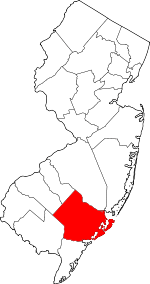 Map of New Jersey highlighting Atlantic County | |
| Boroughs | ||
| Town | ||
| Townships | ||
| CDPs | ||
| Other unincorporated communities | ||