Bryant, Arkansas
Bryant is a city in Saline County, Arkansas, United States and a suburb of Little Rock. According to the 2010 Census, the population of the city was 16,688.[3] It is part of the Central Arkansas region.
Bryant, Arkansas | |
|---|---|
| Motto(s): Geographical center of ARKANSAS" | |
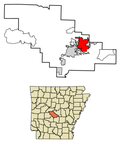 Location of Bryant in Saline County, Arkansas. | |
| Coordinates: 34°36′49″N 92°29′29″W | |
| Country | United States |
| State | Arkansas |
| County | Saline |
| Area | |
| • Total | 20.58 sq mi (53.31 km2) |
| • Land | 20.49 sq mi (53.08 km2) |
| • Water | 0.09 sq mi (0.23 km2) |
| Elevation | 413 ft (126 m) |
| Population (2010) | |
| • Total | 16,688 |
| • Estimate (2019)[2] | 20,968 |
| • Density | 1,023.13/sq mi (395.03/km2) |
| Time zone | UTC-6 (Central (CST)) |
| • Summer (DST) | UTC-5 (CDT) |
| ZIP codes | 72022, 72089 |
| Area code(s) | 501 |
| FIPS code | 05-09460 |
| GNIS feature ID | 0057459 |
| Website | cityofbryant |
History
European settlers established themselves along Hurricane Creek in the early 19th century. A skirmish in the area occurred during the American Civil War.[4] Rail service in the 1870s brought development.[5] The town was hard hit by economic struggles in the early 20th century and through the Great Depression. World War II era saw development as demand for the area's bauxite grew.[4]
Geography
Bryant is located at 34°36′49″N 92°29′29″W (34.613518, -92.491464).[6]
According to the United States Census Bureau, the city has a total area of 9.1 square miles (24 km2), of which 9.1 square miles (24 km2) is land and 0.04 square miles (0.10 km2) (0.33%) is water.
Demographics
| Historical population | |||
|---|---|---|---|
| Census | Pop. | %± | |
| 1900 | 113 | — | |
| 1910 | 91 | −19.5% | |
| 1920 | 132 | 45.1% | |
| 1930 | 162 | 22.7% | |
| 1940 | 173 | 6.8% | |
| 1950 | 387 | 123.7% | |
| 1960 | 737 | 90.4% | |
| 1970 | 1,199 | 62.7% | |
| 1980 | 2,682 | 123.7% | |
| 1990 | 5,269 | 96.5% | |
| 2000 | 9,764 | 85.3% | |
| 2010 | 16,688 | 70.9% | |
| Est. 2019 | 20,968 | [2] | 25.6% |
| U.S. Decennial Census[7] | |||
As of the census[8] of 2000, there were 9,764 people, 3,601 households, and 2,823 families residing in the city. The population density was 1,076.4 people per square mile (415.6/km2). There were 3,762 housing units at an average density of 414.7 per square mile (160.1/km2). The racial makeup of the city was 95.2% White, 1.5% Black or African American, 0.34% Native American, 1.05% Asian, 0.37% from other races, and 0.84% from two or more races. 1.05% of the population were Hispanic or Latino of any race.
There were 3,601 households, out of which 42.6% had children under the age of 18 living with them, 63.9% were married couples living together, 11.1% had a female householder with no husband present, and 21.6% were non-families. 19.1% of all households were made up of individuals, and 7.0% had someone living alone who was 65 years of age or older. The average household size was 2.65 and the average family size was 3.03.
In the city, the population was spread out, with 27.9% under the age of 18, 7.1% from 18 to 24, 32.7% from 25 to 44, 21.8% from 45 to 64, and 10.4% who were 65 years of age or older. The median age was 35 years. For every 100 females, there were 89.8 males. For every 100 females age 18 and over, there were 86.5 males.
The median income for a household in the city was $48,870, and the median income for a family was $56,038. Males had a median income of $39,380 versus $26,261 for females. The per capita income for the city was $20,730. About 3.5% of families and 4.8% of the population were below the poverty line, including 6.1% of those under age 18 and 8.0% of those age 65 or over.
Water supply
Bryant purchases treated surface water from Lake Maumelle and Lake Winona from Central Arkansas Water.
Government and infrastructure
The Arkansas Department of Human Services Arkansas Juvenile Assessment & Treatment Center (AJATC) is located in Bryant.[9][10]
The U.S. Postal Service operates the Bryant Post Office.[11]
Education
Public education for elementary and secondary school students may attend Bryant School District with students graduating from Bryant High School.
In the early 1970s, political aide Carol Rasco set up the public school system's psychological counseling services while she worked in the district.[12]
Notable people
- Karen Aston - women's basketball head coach, University of Texas
- Travis Wood - Major League Baseball pitcher
- Sean Michel - Musician
References
- "2019 U.S. Gazetteer Files". United States Census Bureau. Retrieved June 30, 2020.
- "Population and Housing Unit Estimates". United States Census Bureau. May 24, 2020. Retrieved May 27, 2020.
- "Annual Estimates of the Population for All Incorporated Places in Arkansas". 2005 Population Estimates. U.S. Census Bureau, Population Division. June 21, 2006. Archived from the original (CSV) on 2006-10-15. Retrieved November 16, 2006.
- "Encyclopedia of Arkansas". Encyclopedia of Arkansas.
- Company, Goodspeed Publishing (16 April 1889). "Biographical and Historical Memoirs: Pulaski, Jefferson, Lonoke, Faulkner, Grant, Saline, Perry, Garland, and Hot Spring Counties, Arkansas". Southern Historical Press – via Google Books.
- "US Gazetteer files: 2010, 2000, and 1990". United States Census Bureau. 2011-02-12. Retrieved 2011-04-23.
- "Census of Population and Housing". Census.gov. Retrieved June 4, 2015.
- "U.S. Census website". United States Census Bureau. Retrieved 2008-01-31.
- "Community-based program directory." Arkansas Department of Human Services. Retrieved on August 30, 2010. "Arkansas Juvenile Assessment and Treatment Center 1501 Woody Drive Alexander, AR 72002"
- "Bryant city, Arkansas." U.S. Census Bureau. Retrieved on August 30, 2010.
- "Post Office™ Location - BRYANT Archived March 5, 2011, at the Wayback Machine." U.S. Postal Service. Retrieved on March 1, 2011.
- Radcliffe, Donnie (1993-08-24). "CLINTON'S WINDOW ON THE HOME FRONT". Washington Post. ISSN 0190-8286. Retrieved 2018-07-28.
External links
| Wikimedia Commons has media related to Bryant, Arkansas. |
Municipalities and communities of Saline County, Arkansas, United States | ||
|---|---|---|
| Cities | 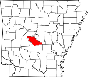 Map of Arkansas highlighting Saline County | |
| Towns | ||
| CDPs | ||
| Unincorporated communities | ||
| Footnotes | ‡This populated place also has portions in an adjacent county or counties | |