Haskell, Arkansas
Haskell is a city in Saline County, Arkansas, United States. The population was 3,990 at the 2010 census. It is part of the Little Rock–North Little Rock–Conway Metropolitan Statistical Area.
Haskell, Arkansas | |
|---|---|
 Location of Haskell in Saline County, Arkansas. | |
| Coordinates: 34°30′44″N 92°38′20″W | |
| Country | United States |
| State | Arkansas |
| County | Saline |
| Area | |
| • Total | 4.94 sq mi (12.79 km2) |
| • Land | 4.92 sq mi (12.74 km2) |
| • Water | 0.02 sq mi (0.06 km2) |
| Elevation | 299 ft (91 m) |
| Population (2010) | |
| • Total | 3,990 |
| • Estimate (2019)[2] | 4,605 |
| • Density | 936.36/sq mi (361.51/km2) |
| Time zone | UTC-6 (Central (CST)) |
| • Summer (DST) | UTC-5 (CDT) |
| ZIP code | 72015 |
| Area code(s) | 501 |
| FIPS code | 05-30640 |
| GNIS feature ID | 0057897 |
| Website | cityofhaskell |
Geography
Haskell is located at 34°30′44″N 92°38′20″W (34.512171, -92.638978).[3]
According to the United States Census Bureau, the city has a total area of 4.6 square miles (12 km2), of which 4.6 square miles (12 km2) is land and 0.04 square miles (0.10 km2) (0.43%) is water.
Demographics
| Historical population | |||
|---|---|---|---|
| Census | Pop. | %± | |
| 1930 | 180 | — | |
| 1940 | 171 | −5.0% | |
| 1950 | 209 | 22.2% | |
| 1960 | 215 | 2.9% | |
| 1970 | 239 | 11.2% | |
| 1980 | 1,125 | 370.7% | |
| 1990 | 1,342 | 19.3% | |
| 2000 | 2,645 | 97.1% | |
| 2010 | 3,990 | 50.9% | |
| Est. 2019 | 4,605 | [2] | 15.4% |
| U.S. Decennial Census[4] | |||
As of the census[5] of 2000, there were 2,645 people, 724 households, and 563 families residing in the city. The population density was 572.4 people per square mile (221.0/km2). There were 762 housing units at an average density of 164.9/sq mi (63.7/km2). The racial makeup of the city was 89.07% White, 8.77% Black or African American, 0.72% Native American, 0.23% Asian, 0.19% from other races, and 1.02% from two or more races. 1.36% of the population were Hispanic or Latino of any race.
There were 724 households, out of which 42.8% had children under the age of 18 living with them, 60.2% were married couples living together, 12.8% had a female householder with no husband present, and 22.2% were non-families. 18.4% of all households were made up of individuals, and 6.8% had someone living alone who was 65 years of age or older. The average household size was 2.66 and the average family size was 3.03.
In the city, the population was spread out, with 21.8% under the age of 18, 8.5% from 18 to 24, 36.4% from 25 to 44, 20.9% from 45 to 64, and 12.4% who were 65 years of age or older. The median age was 36 years. For every 100 females, there were 126.5 males. For every 100 females age 18 and over, there were 131.7 males.
The median income for a household in the city was $33,583, and the median income for a family was $38,438. Males had a median income of $28,547 versus $21,346 for females. The per capita income for the city was $13,692. About 12.7% of families and 22.1% of the population were below the poverty line, including 18.0% of those under age 18 and 16.3% of those age 65 or over.
References
- "2019 U.S. Gazetteer Files". United States Census Bureau. Retrieved June 30, 2020.
- "Population and Housing Unit Estimates". United States Census Bureau. May 24, 2020. Retrieved May 27, 2020.
- "US Gazetteer files: 2010, 2000, and 1990". United States Census Bureau. 2011-02-12. Retrieved 2011-04-23.
- "Census of Population and Housing". Census.gov. Retrieved June 4, 2015.
- "U.S. Census website". United States Census Bureau. Retrieved 2008-01-31.
External links
Municipalities and communities of Saline County, Arkansas, United States | ||
|---|---|---|
| Cities | 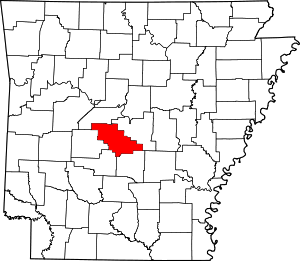 Map of Arkansas highlighting Saline County | |
| Towns | ||
| CDPs | ||
| Unincorporated communities | ||
| Footnotes | ‡This populated place also has portions in an adjacent county or counties | |