Beauchêne, Loir-et-Cher
Beauchêne is a commune in the Loir-et-Cher department in central France.
Beauchêne | |
|---|---|
 Coat of arms | |
Location of Beauchêne 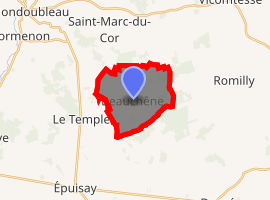
| |
 Beauchêne  Beauchêne | |
| Coordinates: 47°56′28″N 0°58′12″E | |
| Country | France |
| Region | Centre-Val de Loire |
| Department | Loir-et-Cher |
| Arrondissement | Vendôme |
| Canton | Le Perche |
| Intercommunality | Collines du Perche |
| Government | |
| • Mayor (2014–2020) | Roland Bingler |
| Area 1 | 10.08 km2 (3.89 sq mi) |
| Population (2017-01-01)[1] | 173 |
| • Density | 17/km2 (44/sq mi) |
| Time zone | UTC+01:00 (CET) |
| • Summer (DST) | UTC+02:00 (CEST) |
| INSEE/Postal code | 41014 /41170 |
| Elevation | 164–205 m (538–673 ft) (avg. 176 m or 577 ft) |
| 1 French Land Register data, which excludes lakes, ponds, glaciers > 1 km2 (0.386 sq mi or 247 acres) and river estuaries. | |
Population
| Year | Pop. | ±% |
|---|---|---|
| 1793 | 269 | — |
| 1800 | 318 | +18.2% |
| 1806 | 320 | +0.6% |
| 1821 | 424 | +32.5% |
| 1831 | 406 | −4.2% |
| 1836 | 432 | +6.4% |
| 1841 | 459 | +6.2% |
| 1846 | 456 | −0.7% |
| 1851 | 407 | −10.7% |
| 1856 | 411 | +1.0% |
| 1861 | 407 | −1.0% |
| 1866 | 424 | +4.2% |
| 1872 | 352 | −17.0% |
| 1876 | 349 | −0.9% |
| 1881 | 330 | −5.4% |
| 1886 | 349 | +5.8% |
| 1891 | 357 | +2.3% |
| 1896 | 372 | +4.2% |
| 1901 | 388 | +4.3% |
| 1906 | 378 | −2.6% |
| 1911 | 380 | +0.5% |
| 1921 | 376 | −1.1% |
| 1926 | 367 | −2.4% |
| 1931 | 351 | −4.4% |
| 1936 | 337 | −4.0% |
| 1946 | 283 | −16.0% |
| 1954 | 285 | +0.7% |
| 1962 | 263 | −7.7% |
| 1968 | 234 | −11.0% |
| 1975 | 183 | −21.8% |
| 1982 | 144 | −21.3% |
| 1990 | 117 | −18.8% |
| 1999 | 142 | +21.4% |
| 2006 | 158 | +11.3% |
| 2009 | 165 | +4.4% |
References
- "Populations légales 2017". INSEE. Retrieved 6 January 2020.
| Wikimedia Commons has media related to Beauchêne (Loir-et-Cher). |
| Authority control |
|
|---|
This article is issued from Wikipedia. The text is licensed under Creative Commons - Attribution - Sharealike. Additional terms may apply for the media files.