Auxiliary routes of Arkansas Highway 7
Six auxiliary routes of Arkansas Highway 7 currently exist.[1] Four are spur routes, one is a business route, and one is a truck route. They are listed below in south-to-north order.
One former alternate route existed in Dallas County, replaced by Highway 128 in 1937.
El Dorado spur
| |
|---|---|
| Location | El Dorado |
| Length | 2.39 mi[1] (3.85 km) |
| Existed | August 25, 1971[2]–present |
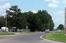
Arkansas Highway 7 Spur is a spur route of 2.39 miles (3.85 km) in El Dorado.[1] The highway runs from US 167 Business north to AR 7.[3]
- Major intersections
The entire route is in El Dorado, Union County.
| mi[3] | km | Destinations | Notes | ||
|---|---|---|---|---|---|
| 0.0 | 0.0 | Southern terminus | |||
| 2.39 | 3.85 | Northern terminus | |||
| 1.000 mi = 1.609 km; 1.000 km = 0.621 mi | |||||
Smackover business route
| |
|---|---|
| Location | Smackover |
| Length | 5.55 mi[1] (8.93 km) |
| Existed | October 28, 1976[4]–present |
Arkansas Highway 7 Business is a business loop of 5.55 miles (8.93 km) in Smackover.[1] The route is known as Pershing Highway east of town, and W 7th Street west of town.[5] AR 7B passes the Smackover Historic Commercial District on the National Register of Historic Places.
- Major intersections
The entire route is in Smackover, Union County.
| mi[5] | km | Destinations | Notes | ||
|---|---|---|---|---|---|
| 0.0 | 0.0 | Western terminus | |||
| 3.7 | 6.0 | AR 160 northern terminus | |||
| 5.6 | 9.0 | Eastern terminus | |||
| 1.000 mi = 1.609 km; 1.000 km = 0.621 mi | |||||
Hot Springs spur
| |
|---|---|
| Location | Hot Springs |
| Length | 1.62 mi[1] (2.61 km) |
| Existed | November 17, 2004[6]–present |
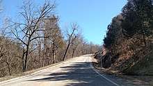
Arkansas Highway 7 Spur is a spur route of 1.62 miles (2.61 km) in Hot Springs. The route is known as Gorge Road and is a former alignment of US 70B.[1] It connects AR 7 to the current US 70B and provides access to Gulpha Gorge Recreational Area.[7]
- Major intersections
The entire route is in Hot Springs, Garland County.
| mi[7] | km | Destinations | Notes | ||
|---|---|---|---|---|---|
| 0.0 | 0.0 | Southern terminus | |||
| 1.6 | 2.6 | Northern terminus | |||
| 1.000 mi = 1.609 km; 1.000 km = 0.621 mi | |||||
Russellville spur
| |
|---|---|
| Location | Russellville |
| Length | 1.40 mi[1] (2.25 km) |
| Existed | October 23, 1974[8]–present |
Arkansas Highway 7 Spur is a spur route of 1.40 miles (2.25 km) in Russellville.[9] The route is known as International Paper Road. AR 7S runs past Norristown Cemetery to an International Paper factory.[9]
- Major intersections
The entire route is in Russellville, Pope County.
| mi[9] | km | Destinations | Notes | ||
|---|---|---|---|---|---|
| 0.0 | 0.0 | Western terminus | |||
| 1.40 | 2.25 | International Paper factory | Eastern terminus | ||
| 1.000 mi = 1.609 km; 1.000 km = 0.621 mi | |||||
Russellville truck route
| |
|---|---|
| Location | Russellville |
| Length | 2.79 mi[1] (4.49 km) |
| Existed | March 7, 1962[10]–present |
Highway 7 Truck (AR 7T, Ark. 7T, and Hwy. 7T) is a truck route of 2.79 miles (4.49 km) in Russellville.[1] The route runs from an intersection with Highway 77 and Highway 326 as a two-lane road. It runs east along Bernice Avenue before turning along Knoxville Avenue north to E Main St..
- Major intersections
The entire route is in Russellville, Pope County.
| mi[9] | km | Destinations | Notes | ||
|---|---|---|---|---|---|
| 0.0 | 0.0 | Southern terminus | |||
| 2.79 | 4.49 | Northern terminus | |||
| 1.000 mi = 1.609 km; 1.000 km = 0.621 mi | |||||
Marble Falls spur
| |
|---|---|
| Location | Marble Falls |
| Length | 0.29 mi[1] (0.47 km) |
| Existed | May 21, 1974[11]–present |
Arkansas Highway 7 Spur is a spur route of 0.29 miles (0.47 km) in Marble Falls.[1] The route runs to the former amusement park Dogpatch USA whose parking lot contains Marble Falls' post office.[12]
- Major intersections
The entire route is in Marble Falls, Newton County.
| mi[12] | km | Destinations | Notes | ||
|---|---|---|---|---|---|
| 0.0 | 0.0 | Western terminus | |||
| 0.29 | 0.47 | Marble Falls post office, Dogpatch USA | Eastern terminus | ||
| 1.000 mi = 1.609 km; 1.000 km = 0.621 mi | |||||
Dallas County alternate route
| |
|---|---|
| Location | Dallas County |
| Length | 6.6 mi (10.6 km) |
| Existed | c. 1931[13]–c. July 1, 1937[14] |
State Road 7A is a former alternate route of 6.6 miles (10.6 km) in Dallas County. The route ran between State Road 7 in Pine Grove and State Road 9 in Holly Springs in South Arkansas. It was supplanted by State Road 128 in 1937.[14]
- Major intersections
The entire route is in Dallas County.
| Location | mi | km | Destinations | Notes | |
|---|---|---|---|---|---|
| Pine Grove | 0.0 | 0.0 | Northern terminus | ||
| Holly Springs | 6.6 | 10.6 | Southern terminus | ||
| 1.000 mi = 1.609 km; 1.000 km = 0.621 mi | |||||
See also


References
- "[Arkansas] State Highways 2009 (Database)." April 2010. AHTD: Planning and Research Division. Database. Archived 2011-07-07 at the Wayback Machine Retrieved March 20, 2011.
- "Minutes" (1970–79), p. 1525.
- Map of El Dorado, Arkansas (PDF) (Map) (September 2004 ed.). Arkansas State Highway and Transportation Department. Retrieved March 20, 2011.
- "Minutes" (1970–79), p. 740.
- Map of Smackover, Arkansas (PDF) (Map) (May 2003 ed.). Arkansas State Highway and Transportation Department. Retrieved March 20, 2011.
- "Minutes" (2000–09), p. 708-709.
- Map of Hot Springs, Arkansas (PDF) (Map) (December 2007 ed.). Arkansas State Highway and Transportation Department. Retrieved March 20, 2011.
- "Minutes" (1970–79), p. 1055.
- Map of Russellville, Arkansas (PDF) (Map) (April 2010 ed.). Arkansas State Highway and Transportation Department. Retrieved March 20, 2011.
- "Minutes" (1953–69), p. 1045-46.
- "Minutes" (1970–79), p. 983.
- General Highway Map - Newton County, Arkansas (PDF) (Map) (1/10/03 ed.). Arkansas State Highway and Transportation Department. Archived from the original (PDF) on September 29, 2011. Retrieved March 30, 2011.
- Arkansas State Highway Commission (June 1, 1931). Official Highway Service Map (TIF) (Revised). Scale not given. Little Rock: Arkansas State Highway Commission. Retrieved December 23, 2017 – via Arkansas GIS Office.
- Arkansas State Highway Commission (July 1, 1937). Map of State of Arkansas Showing System of State Highways (TIF) (Map). Scale not given. Little Rock: Arkansas State Highway Commission. Retrieved December 23, 2017 – via Arkansas GIS Office.
- "Minutes of the Meeting" (PDF). Arkansas State Highway Commission. 1953–1969. Retrieved December 1, 2016.
- "Minutes of the Meeting" (PDF). Arkansas State Highway Commission. 1970–1979. Retrieved December 1, 2016.
- "Minutes of the Meeting" (PDF). Arkansas State Highway Commission. 2000–2009. Retrieved December 1, 2016.