Aguilar, Colorado
Aguilar is a Statutory Town located in Las Animas County, Colorado, United States. The town population was 538 at the 2010 United States Census. Cattleman and prominent pioneer José Ramón Aguilar founded the town in 1894.[5][8]
Aguilar, Colorado | |
|---|---|
 Old building on main street of Aguilar, 1946. | |
| Motto(s): "Gateway to the Spanish Peaks" | |
 Location of Aguilar in Las Animas County, Colorado. | |
| Coordinates: 37°24′13″N 104°39′18″W[1] | |
| Country | United States |
| State | Colorado |
| County[2] | Las Animas County[2] |
| Founded | 1894 |
| Incorporated (town) | January 10, 1894[3] |
| Government | |
| • Type | Statutory Town[2] |
| • Mayor | Marc Piano |
| Area | |
| • Total | 0.39 sq mi (1.02 km2) |
| • Land | 0.39 sq mi (1.02 km2) |
| • Water | 0.00 sq mi (0.00 km2) |
| Elevation | 6,394 ft (1,949 m) |
| Population (2010) | |
| • Total | 538 |
| • Estimate (2019)[6] | 480 |
| • Density | 1,224.49/sq mi (472.41/km2) |
| Time zone | UTC-7 (MST) |
| • Summer (DST) | UTC-6 (MDT) |
| ZIP code | 81020[7] |
| Area code(s) | 719 |
| FIPS code | 08-00760 |
| GNIS feature ID | 0194464 |
| Website | aguilarco |
History
The town was named for state legislator J. Ramon Aguilar. Aguilar owned the land that the town was built on. A post office was established at Aguilar in 1890.[9] In 1894 the town was incorporated.[10]
From September 1913 until late April 1914, much of Las Animas County was embroiled by the Colorado Coalfield War, which saw up to 12,000 pro-United Mine Workers of America strikers engaged in both peaceful and violent confrontations with the Rockefeller-owned Colorado Fuel & Iron Company, other mining outfits, strikebreakers, and the Colorado National Guard. On 29 October 1913, the Aguilar post office and several other town structures were destroyed in an arson attack related to the strike. The National Guard arrested several strikers over the attack and handed them over to the federal U.S. Marshal Service.[11]
Following the Ludlow Massacre on 20 April 1914, strikers launched numerous attacks of both coordinated and spontaneous natures against mining operations, strikebreakers, and the National Guard in what is known as the Ten-Day War. One of the attacks was launched against Southwestern Mine Co.'s Empire Mine on 22 April, where armed strikers forced non-striking miners and their families into the mine and began an all-night siege outside. After negotiation led by Aguilar's mayor and a church minister named McDonald, the strikers abandoned the siege before fatalities on either side were reported.[12][13]:186
Geography
Aguilar is located at 37°24′12″N 104°39′16″W (37.403299, -104.654363),[14] about one mile west of Interstate 25.
According to the United States Census Bureau, the town has a total area of 0.4 square miles (1.0 km2), all of it land.
Climate
| Climate data for Aguilar | |||||||||||||
|---|---|---|---|---|---|---|---|---|---|---|---|---|---|
| Month | Jan | Feb | Mar | Apr | May | Jun | Jul | Aug | Sep | Oct | Nov | Dec | Year |
| Average high °F (°C) | 38.2 (3.4) |
43.9 (6.6) |
51.7 (10.9) |
60.4 (15.8) |
70 (21) |
81.8 (27.7) |
88.7 (31.5) |
86.8 (30.4) |
78.1 (25.6) |
65.6 (18.7) |
49.2 (9.6) |
40.4 (4.7) |
62.9 (17.2) |
| Average low °F (°C) | 11.9 (−11.2) |
17.1 (−8.3) |
23.8 (−4.6) |
31.6 (−0.2) |
41.7 (5.4) |
51 (11) |
56.7 (13.7) |
55 (13) |
45.7 (7.6) |
33.5 (0.8) |
21.7 (−5.7) |
13.7 (−10.2) |
33.6 (0.9) |
| Average precipitation inches (mm) | 0.6 (15) |
0.7 (18) |
1.7 (43) |
2.1 (53) |
2.6 (66) |
1.8 (46) |
2.7 (69) |
3.1 (79) |
1.6 (41) |
1 (25) |
1 (25) |
0.7 (18) |
19.6 (500) |
| Source: Weatherbase[15] | |||||||||||||
Demographics
| Historical population | |||
|---|---|---|---|
| Census | Pop. | %± | |
| 1900 | 698 | — | |
| 1910 | 858 | 22.9% | |
| 1920 | 1,236 | 44.1% | |
| 1930 | 1,383 | 11.9% | |
| 1940 | 1,397 | 1.0% | |
| 1950 | 1,038 | −25.7% | |
| 1960 | 777 | −25.1% | |
| 1970 | 699 | −10.0% | |
| 1980 | 624 | −10.7% | |
| 1990 | 520 | −16.7% | |
| 2000 | 593 | 14.0% | |
| 2010 | 538 | −9.3% | |
| Est. 2019 | 480 | [6] | −10.8% |
| U.S. Decennial Census[16] | |||
As of the census[17] of 2000, there were 593 people, 243 households, and 165 families residing in the town. The population density was 1,508.8 inhabitants per square mile (582.6/km2). There were 291 housing units at an average density of 740.4 per square mile (288.1/km2). The racial makeup of the town was 86.00% White, 3.04% Native American, 0.34% Asian, 6.91% from other races, and 3.71% from two or more races. Hispanic or Latino of any race were 46.54% of the population.
There were 243 households, out of which 23.5% had children under the age of 18 living with them, 48.1% were married couples living together, 14.4% had a female householder with no husband present, and 31.7% were non-families. 27.2% of all households were made up of individuals, and 16.0% had someone living alone who was 65 years of age or older. The average household size was 2.44 and the average family size was 2.93.
In the town, the population was spread out, with 23.3% under the age of 18, 6.6% from 18 to 24, 20.2% from 25 to 44, 28.5% from 45 to 64, and 21.4% who were 65 years of age or older. The median age was 45 years. For every 100 females, there were 97.7 males. For every 100 females age 18 and over, there were 88.8 males.
The median income for a household in the town was $23,750, and the median income for a family was $30,815. Males had a median income of $22,500 versus $21,250 for females. The per capita income for the town was $11,249. About 27.8% of families and 34.3% of the population were below the poverty line, including 64.0% of those under age 18 and 25.7% of those age 65 or over.
.JPG)
Education
Aguilar Public Schools is part of the Aguilar Reorganized School District RE-6. The school district has one elementary school and one junior/senior high school.
Aguilar Elementary School and Aguilar Junior/Senior High School are located in Aguilar.[18]
See also
- Outline of Colorado
- State of Colorado
- Colorado cities and towns
- Colorado municipalities
- Colorado counties
- Colorado cities and towns
- Spanish Peaks
References
- "2014 U.S. Gazetteer Files: Places". United States Census Bureau. July 1, 2014. Retrieved January 5, 2015.
- "Active Colorado Municipalities". State of Colorado, Department of Local Affairs. Archived from the original on 2009-12-12. Retrieved 2007-09-01.
- "Colorado Municipal Incorporations". State of Colorado, Department of Personnel & Administration, Colorado State Archives. 2004-12-01. Archived from the original on 27 September 2007. Retrieved 2007-08-18.
- "2019 U.S. Gazetteer Files". United States Census Bureau. Retrieved July 1, 2020.
- "Geographic Names Information System Feature Detail Report". USGS. Retrieved 2007-08-18.
- "Population and Housing Unit Estimates". United States Census Bureau. May 24, 2020. Retrieved May 27, 2020.
- "ZIP Code Lookup". United States Postal Service. August 18, 2007. Archived from the original (JavaScript/HTML) on 18 August 2007. Retrieved August 18, 2007.
- "The Jose Ramon Aguilar Story". Centennial Aguilar Booklet 1994. Apishapa Valley Historical Society. Archived from the original on 14 September 2007. Retrieved 2007-08-18.
- "Place Names of Colorado" (PDF). Colorado Council of Genealogical Societies. 1999. p. 5. Archived from the original (PDF) on 27 October 2017. Retrieved 1 July 2019.
- "Profile for Aguilar, Colorado, CO". ePodunk. Archived from the original on 2017-07-01. Retrieved 2012-03-07.
- Colorado Adjutant General's Office (1914). The Military Occupation of the Coal Strike Zone of Colorado by the National Guard, 1913-1914 (Report).
- "30 BESIEGED IN MINE MAY BE SUFFOCATED; Mouth of Slope Blocked by Dynamite Explosions Caused by Strikers". The New York Times. 23 April 1914. Retrieved 4 April 2020.
- Martelle, Scott (2007). Blood Passion: The Ludlow Massacre and Class War in the American West. Rutgers University Press. ISBN 978-0-8135-4419-9.
- "US Gazetteer files: 2010, 2000, and 1990". United States Census Bureau. 2011-02-12. Retrieved 2011-04-23.
- "Weatherbase: Historical Weather for Aguilar, Colorado". Weatherbase. November 2011. Retrieved November 24, 2011.
- "Census of Population and Housing". Census.gov. Retrieved June 4, 2015.
- "U.S. Census website". United States Census Bureau. Retrieved 2008-01-31.
- "Aguilar Reorganized School District RE-6". Aguilar Reorganized School District RE-6. Archived from the original on 2012-04-24. Retrieved 2012-03-07.
External links
| Wikimedia Commons has media related to Aguilar, Colorado. |
Municipalities and communities of Las Animas County, Colorado, United States | ||
|---|---|---|
| City | 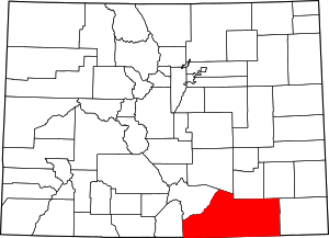 Map of Colorado highlighting Las Animas County | |
| Towns | ||
| CDPs | ||
| Unincorporated communities | ||
| Ghost towns | ||

| Authority control |
|
|---|