Valdez, Colorado
Valdez is an unincorporated community and census-designated place (CDP) in Las Animas County, Colorado, United States.[2][3] Its population was 47 at the 2010 census.[1]
Valdez, Colorado | |
|---|---|
 Entering Valdez from the east on State Highway 12 | |
 Valdez  Valdez | |
| Coordinates: 37°07′20″N 104°42′07″W | |
| Country | |
| State | |
| County | Las Animas |
| Area | |
| • Total | 1.61 sq mi (4.17 km2) |
| • Land | 1.61 sq mi (4.17 km2) |
| • Water | 0 sq mi (0 km2) |
| Elevation | 6,485 ft (1,977 m) |
| Population (2010)[1] | |
| • Total | 47 |
| • Density | 29/sq mi (11.3/km2) |
| Time zone | UTC-7 (MST) |
| • Summer (DST) | UTC-6 (MDT) |
| GNIS feature ID | 08-80095 |
The community is in western Las Animas County, in the valley of the Purgatoire River. It is bordered to the west by Segundo. Colorado State Highway 12 runs along the northern edge of the community, leading east (downriver) 13 miles (21 km) to Trinidad, the county seat, and west (upriver) 20 miles (32 km) to Stonewall Gap.
References
- "Geographic Identifiers: 2010 Census Summary File 1 (G001), Valdez CDP, Colorado". American FactFinder. U.S. Census Bureau. Archived from the original on February 13, 2020. Retrieved September 20, 2019.
- "Valdez Census Designated Place". Geographic Names Information System. United States Geological Survey.
- "Valdez". Geographic Names Information System. United States Geological Survey.
- "Census of Population and Housing". Census.gov. Retrieved June 4, 2016.
Municipalities and communities of Las Animas County, Colorado, United States | ||
|---|---|---|
| City | 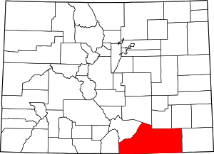 Map of Colorado highlighting Las Animas County | |
| Towns | ||
| CDPs | ||
| Unincorporated communities | ||
| Ghost towns | ||
This article is issued from Wikipedia. The text is licensed under Creative Commons - Attribution - Sharealike. Additional terms may apply for the media files.