2020 Pacific typhoon season
The 2020 Pacific typhoon season is a late-starting, ongoing event in the annual cycle of tropical cyclone formation, in which tropical cyclones form in the western Pacific Ocean. The season runs throughout the year, though most tropical cyclones typically develop between May and October. The season has been unusually quiet, with only nine systems forming as of August 13. Additionally, the JTWC recorded no tropical cyclone development in the month of July, the first such occurrence since reliable records began. The season's first tropical cyclone developed on May 10, making it the sixth-latest start in the basin on record, just slightly behind 1973, and the first to start this late since 2016.
| 2020 Pacific typhoon season | |
|---|---|
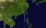
 Season summary map | |
| Seasonal boundaries | |
| First system formed | May 10, 2020 |
| Last system dissipated | Season ongoing |
| Strongest storm | |
| Name | Vongfong |
| • Maximum winds | 155 km/h (100 mph) (10-minute sustained) |
| • Lowest pressure | 965 hPa (mbar) |
| Seasonal statistics | |
| Total depressions | 9 |
| Total storms | 6 |
| Typhoons | 2 |
| Super typhoons | 0 |
| Total fatalities | 24 total |
| Total damage | $442.1 million (2020 USD) |
| Related articles | |
| |
The season's first named storm, Vongfong (Ambo), developed east of Mindanao and rapidly intensified to become a Category 3 typhoon at peak intensity, undergoing an eyewall replacement cycle and made landfall on Samar Island, causing US$31.1 million damage to the Philippines, while in the midst of the current COVID-19 pandemic.
The scope of this article is limited to the Pacific Ocean to the north of the equator between 100°E and 180th meridian. Within the northwestern Pacific Ocean, there are two separate agencies that assign names to tropical cyclones which can often result in a cyclone having two names. The Japan Meteorological Agency (JMA) will name a tropical cyclone should it be judged to have 10-minute sustained wind speeds of at least 65 km/h (40 mph) anywhere in the basin, whilst the Philippine Atmospheric, Geophysical and Astronomical Services Administration (PAGASA) assigns names to tropical cyclones which move into or form as a tropical depression in their area of responsibility located between 135°E and 115°E and between 5°N–25°N regardless of whether or not a tropical cyclone has already been given a name by the JMA. Tropical depressions that are monitored by the United States' Joint Typhoon Warning Center (JTWC) are given a number with a "W" suffix.
Seasonal forecasts
| TSR forecasts Date | Tropical storms | Total Typhoons | Intense TCs | ACE | Ref. |
|---|---|---|---|---|---|
| Average (1965–2019) | 26 | 16 | 9 | 294 | [1] |
| May 21, 2020 | 26 | 15 | 8 | 258 | [1] |
| July 9, 2020 | 26 | 14 | 7 | 216 | [2] |
| August 6, 2020 | 21 | 13 | 5 | 157 | [3] |
| Other forecasts Date | Forecast Center | Period | Systems | Ref. | |
| January 22, 2020 | PAGASA | January–March | 0–4 tropical cyclones | [4] | |
| January 22, 2020 | PAGASA | April–June | 2–5 tropical cyclones | [4] | |
| June 24, 2020 | PAGASA | July–September | 6–10 tropical cyclones | [5] | |
| June 24, 2020 | PAGASA | October–December | 4–7 tropical cyclones | [5] | |
| 2020 season | Forecast Center | Tropical cyclones | Tropical storms | Typhoons | Ref. |
| Actual activity: | JMA | 9 | 6 | 2 | |
| Actual activity: | JTWC | 7 | 7 | 3 | |
| Actual activity: | PAGASA | 7 | 4 | 1 | |
During the year several national meteorological services and scientific agencies forecast how many tropical cyclones, tropical storms, and typhoons will form during a season and/or how many tropical cyclones will affect a particular country. These agencies include the Tropical Storm Risk (TSR) Consortium of University College London, PAGASA and Taiwan's Central Weather Bureau. The first forecast for the year was released by PAGASA on January 22 predicting the first half of 2020, within its monthly seasonal climate outlook.[4] The PAGASA predicts that only 0-4 tropical cyclones are expected to form or enter the Philippine Area of Responsibility between January and March, while 5-8 tropical cyclones are expected to form between April and June. This was due to the fact that the El Niño–Southern Oscillation was seeing neutral conditions across the Pacific, and could persist until midyear.[4] On May 21, the TSR issued their extended-range forecast for 2020, forecasting tropical activity below the average normal, with 26 tropical storms, 15 typhoons and 8 intense typhoons.[1] These numbers were supported by the current values from the Indian Ocean Dipole, the Accumulated Cyclone Energy index and the sea-surface temperatures in the Niño 3.75 region, leading to a stronger than normal trade windspeed throughout much of the Western Pacific.[1]
On June 24, the PAGASA issued a climate forecast, predicting the number of tropical cyclones for the second half of the season. They predicted that 6–10 tropical cyclones are expected to form between the months of July and September, while 4–7 tropical cyclones are expected to form between the months of October and December.[5] On July 9, TSR issued their forecast for the season, predicting a well-below average season with 26 named storms, 14 typhoons and only 7 intense typhoons.[2] On August 6, TSR issued their third and final forecast for the season, lowering their numbers to 21 named storms, 13 typhoons and 5 intense typhoons.[3] They mentioned that the 2020 season is expected to be one of the "least active typhoon season on record", with a predicted ACE index barely half of the normal and a 96% probability being a below-average season.[3]
Season summary

The first few months of 2020 were extremely quiet, with no tropical systems developing from January to April. On May 10, the season saw its first tropical system with the development of Tropical Depression 01W (Ambo), making it the sixth-latest starting season on record, as well as the latest since 2016. Two days later, the system strengthened to the first officially named tropical storm of the season, Vongfong. Tropical Storm Vongfong then intensified immediately into a significant typhoon and struck the central part of the Philippines on May 14, first making its landfall in San Policarpo, Eastern Samar, crossing 4 more islands and hit mainland Luzon.
After Vongfong, a month of inactivity ensued, and on June 10, a new tropical depression formed off the coast of Samar, Philippines, and was named Butchoy by the PAGASA a day later. Butchoy made landfall in the Philippines as the JTWC issued a TCFA for it. Once it exited Philippine landmass, Butchoy was upgraded into a tropical depression by the JTWC and all warnings issued by PAGASA was lowered, and Butchoy further intensified into a tropical storm in the West Philippine Sea and was named Nuri by the Japan Meteorological Agency. After Nuri dissipated over mainland China, the basin became quiet again for more than a month with only Tropical Depression Carina forming east of Luzon; this led to the first time that no tropical storms developed within the month of July since reliable records began. The activity in the West Pacific increased somewhat with the fotmation of Tropical Storm Sinlaku, and the formation and intensification of Hagupit for a typhoon, ending a fast of more than 2 months without any significant typhoon. Hagupit affected China as a mid-Category 1 storm. The storm transitioned to a Subtropical Storm and affected North Korea and Russia as a Extratropical storm. A few days later, a new tropical depression formed, and then intensified into Tropical Storm Jangmi.
Systems
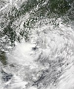
Typhoon Vongfong (Ambo)
| Typhoon (JMA) | |
| Category 3 typhoon (SSHWS) | |
  | |
| Duration | May 10 – May 18 |
|---|---|
| Peak intensity | 155 km/h (100 mph) (10-min) 962 hPa (mbar) |
After 4 consecutive months of inactivity in the Western Pacific basin, a low-pressure area was first noted on May 9 by the JTWC near Micronesia and was given a medium chance of developing into a tropical cyclone.[6] The following day, the JMA declared that it had developed into a tropical depression to the east of Mindanao, Philippines and was expected to slowly move west.[7] The JTWC then issued a Tropical Cyclone Formation Alert (TCFA) for the embryonic system just hours later while convection began to gradually obscure the center.[8] Later that day, the PAGASA followed suit and upgraded the system to a tropical depression, assigning it the name Ambo, as it became the first tropical cyclone to enter their area of responsibility for 2020.[9][10]
The system began to slowly drift westwards throughout the following days,[11] gradually intensifying with occasional convective bursts occurring near the slightly elongated circulation. On the next day, the JTWC upgraded Ambo into a tropical depression, designating it as 01W.[12] The storm gradually intensified throughout the day, as signified by a well-defined rain band developing on the northwestern side, and began to turn north. At this time, the JMA upgraded 01W to a tropical storm and assigned it the first name of the year, Vongfong.[13] Shortly after, the JTWC followed and upgraded the system to tropical storm intensity.[14] Utilizing favorable conditions with low wind shear, 29-30 °C waters, and excellent outflow, Vongfong began to rapidly intensify by early May 13.[15] Shortly after, the JMA upgraded the system to a severe tropical storm. Soon after, the JTWC upgraded the storm to a Category 1 typhoon with 1-minute sustained winds of 130 km/h (80 mph) as the structure quickly improved. The PAGASA and JMA would then upgrade the system to a typhoon later in the day,[15] with the JTWC quickly upgrading the system to a Category 2 typhoon as the eye became clearer. A few hours later, Vongfong intensified to a category 3-equivalent typhoon.[16] Then, the storm later went an eyewall replacement cycle, quickly finishing the cycle while fluctuating in intensity.[17] At 12:15 pm PST on May 14, Vongfong made its first landfall in San Policarpo, Eastern Samar.[18] Vongfong gradually weakened shortly after, crossing over the Ticao Pass as it moved further inland.[19] By the succeeding day, PAGASA recorded five more landfalls: hitting the islands of Dalupiri Island, Capul Island, Ticao Island, Burias Island, and San Andres, Quezon in Luzon Island's Bondoc Peninsula.[20] Ambo weakened into a Category 1 storm due to these multiple landfalls, although the storm was situated in favorable atmospheric conditions.[21] The system further weakened on May 15, and was downgraded by both the JMA and PAGASA to a severe tropical storm,[22][23] with the JTWC downgrading it to a tropical storm as well. Then, Vongfong made its 7th landfall in Real, Quezon, and began to head further inland into Luzon.[24][25] Vongfong then further weakened and was downgraded by the JMA and the PAGASA into a tropical storm.[26][27] The weakening trend continued, and by May 16, Vongfong emerged into the Luzon Strait as a low-end tropical storm, with the storm's center exposed as the result of the mountainous terrains of the Luzon landmass.[28][17] After emerging, 6 hours later, the JTWC downgraded Vongfong into a tropical depression, and issued their final warning.[29] Soon after, PAGASA followed suit,[30] and the JMA as well.[31] The remnants of the storm fully dissipated by May 17, with PAGASA downgrading the storm's remains into an low-pressure area.[32][17]
In preparation for the incoming typhoon, Tropical Cyclone Wind Signal (TCWS) #3 warnings were issued for Northern Samar and the northern portion of Eastern Samar.[33] According to the NDRRMC, Typhoon Vongfong (Ambo) left ₱1.57 billion (US$31.1 million) worth of damages in agriculture, and left 5 dead, as of May 27.[34][35]
Tropical Storm Nuri (Butchoy)
| Tropical storm (JMA) | |
| Tropical storm (SSHWS) | |
  | |
| Duration | June 10 – June 14 |
|---|---|
| Peak intensity | 75 km/h (45 mph) (10-min) 996 hPa (mbar) |
On June 10, the JMA began monitoring on a weak tropical depression that had developed to the east of the Philippine island of Samar in Visayas.[36] During the next day, the PAGASA began tracking the system, giving the local name Butchoy.[37][38] The storm then made its first landfall in Polillo Island in Quezon at 5:30pm PHT, and making its second landfall in Infanta, Quezon shortly thereafter.[39] Soon after, the JTWC issued an Tropical Cyclone Formation Alert for the storm.[40]
Afterwards, the JTWC officially upgraded Butchoy to a tropical depression, and designated it as 02W.[41] With an favorable environment with low vertical wind shear, moderate equatorial outflow and 30-31 °C sea surface temperatures,[41] Butchoy started to intensify in the West Philippine Sea, becoming a tropical storm and receiving the name Nuri from the JMA later on the same day.[42] Then, PAGASA issued their final warning on Nuri as it exited the Philippine Area of Responsibility.[43]
By the next day, Nuri intensified further and subsequently peaked in intensity, with the JMA analysing the storm's peak winds of 75 km/h (45 mph).[44] Six hours later, the JTWC upgraded Nuri to a tropical storm.[45] However, later in the same day, the JTWC downgraded Nuri into a tropical depression, citing that the storm has drifted into high vertical wind shear.[46] The JMA followed suit, downgrading Nuri into a depression.[47] The JTWC issued their final warning on Nuri as the storm subsequently made landfall in Yanjiang, China.[48][49] The JMA followed suit six hours later, issuing their final warning on the system.[50]
The PAGASA issued Tropical Cyclone Signal No. 1 for western Mindanao, southern Luzon, and Visayas on June 11 as Butchoy neared the Philippines.[51] The combination of the system and prevailing southwesterly winds brought showers and thunderstorms across the Philippines.[52] Heavy rainfall in Albay led to the activation of disaster risk management officials and other emergency assets.[51] The rains from the tropical depression prompted PAGASA to declare the start of the rainy season in the Philippines on June 12, 2020, which was also during the country's Independence Day.[53][54] In Hong Kong, Nuri brought heavy rain. One person also drowned due to rough waters.[55]
Tropical Depression Carina
| Tropical depression (JMA) | |
  | |
| Duration | July 11 – July 15 |
|---|---|
| Peak intensity | <55 km/h (35 mph) (10-min) 1004 hPa (mbar) |
After about one month of inactivity, on July 11, the JMA designated an low-pressure area near Luzon as a tropical depression.[56] The next day, the JTWC designated the depression as an invest and was given a low chance of developing, and later upgraded to a medium chance.[57] On the following day, the PAGASA upgraded the low-pressure system to a tropical depression and named it Carina.[58] Over an environment favorable for further development, with low vertical wind shear, established equatorial outflow and 28-29 °C sea surface temperatures,[57] Carina generally moved north-northwest until midday (12:00 UTC) on July 14, when Carina rapidly weakened into a low-pressure area, due to unfavorable environment of strong wind shear and diffluent easterly flow.[57][59] PAGASA then issued their final advisory to Carina, and the remnants dissipated on July 15.[60][61]
As the low-pressure system was named Carina, PAGASA immediately hoisted Signal #1, the lowest of their storm warning signals, to Batanes, Babuyan Islands and the northeastern portion of Cagayan.[62] Due to heavy rainfall caused by Carina, the storm caused damage on Ilocos Norte, Abra and Isabela.[63]
Tropical Storm Sinlaku
| Tropical storm (JMA) | |
| Tropical storm (SSHWS) | |
  | |
| Duration | July 31 – August 3 |
|---|---|
| Peak intensity | 65 km/h (40 mph) (10-min) 992 hPa (mbar) |
On July 29, a tropical disturbance was situated a couple hundred miles east of Manila, Philippines. Struggling to consolidate, the disturbance moved westward toward land and brought minimal rainfall to the Philippines as it crossed over the archipelago and began strengthening in the South China Sea. Environmental conditions became conducive for development as the annually occurring Meiyu front had weakened significantly, and the JMA declared that a tropical depression had formed in the early hours of July 31. The depression struggled to consolidate due to its proximity to land, and its low-level circulation center was exposed as of July 31. Then early on August 1, the depression intensified into Tropical Storm Sinlaku. A little later, Sinlaku slowly moves over the waters of the South China Sea, but without gaining strength. A few hours later, Sinlaku made landfall near Halong Bay, in northern Vietnam. Shortly thereafter, Sinlaku was gradually weakening over the high Vietnamese mountains.[64]
Sinlaku produced heavy rain across central and northern Vietnam, resulting in significant flooding. Two people died, one from a collapsed embankment and the other from flash flooding. Thousands of homes were inundated and crops suffered extensive damage.[65] Damage in the nation was about 2 billion đồng (US$86,000).[66] The remnants of Sinlaku emerged in the Indian Ocean and intensified into a well marked low pressure area between August 5–8 after causing devastating damage in Thailand at the end of day 3, recreating a lot of torrential rain in portions of India.[67][68] Flash floods across Thailand killed four people.[69]
Typhoon Hagupit (Dindo)
| Typhoon (JMA) | |
| Category 1 typhoon (SSHWS) | |
  | |
| Duration | July 31 – August 5 |
|---|---|
| Peak intensity | 130 km/h (80 mph) (10-min) 975 hPa (mbar) |
On August 1, JMA began monitoring a weak tropical depression (designated by PAGASA as a low-pressure area) that developed in the northern portion of the Philippine Sea. Joint Typhoon Warning Center then gave a Tropical Cyclone Formation Alert on the system, with PAGASA later assigning the name "Dindo" to the tropical depression.[70] Later, the Joint Typhoon Warning Center upgraded Dindo into a tropical depression and designated it 03W. Dindo intensified into a tropical storm on August 1 according to the Japan Meteorological Agency, and assigned it the international name Hagupit. Hagupit then began intensifying in the Philippine Sea, reaching winds of 75 kph (40 mph) late on August 1. By August 2, Hagupit continued to strengthen even further south of Okinawa in Japan. Hagupit was upgraded by the Japan Meteorological Agency (JMA) to a severe tropical storm in mid-August 2. Hagupit continued to intensify, reaching maximum sustained winds close to Category 1 at the beginning of August 3. As Hagupit (locally named "Dindo") exited the Philippine Area of Responsibility (PAR), the PAGASA issued its final bulletin on the system. North of the island of Taiwan, Hagupit intensified into a Category 1 typhoon. Typhoon Hagupit also formed a large eye in its center as it approached China. At around 17:00 UTC, Hagupit made landfall in Wenzhou, China, with winds of 85 mph and pressure of 975 mbar (hPa). After its landfall, Hagupit managed to maintain category 1 for another 6 hours, but soon after Hagupit quickly weakened over Chinese Territory. During mid-August 4, JTWC downgraded Hagupit into a tropical depression, but JMA still monitored Hagupit as a tropical storm. At 20:00 UTC, JTWC issued the final Warning on Hagupit at hundred miles about Seoul, South Korea.
In advance of Hagupit, Chinese officials ordered the evacuation of areas vulnerable to flooding. [71] Hagupit caused torrential rainfall over portions of China peaking at 13.11 inches (333 mm) in the Jingshan district of Wenzhou.[72] Hagupit killed 12 people.
Tropical Storm Jangmi (Enteng)
| Tropical storm (JMA) | |
| Tropical storm (SSHWS) | |
  | |
| Duration | August 7 – August 11 |
|---|---|
| Peak intensity | 85 km/h (50 mph) (10-min) 996 hPa (mbar) |
On August 7, the JMA began tracking a weak tropical depression in the Philippine Sea. On the next day, the PAGASA upgraded it to a depression and named it Enteng. Some time later, the JTWC issued a TCFA. Soon after, the disturbance intensified to a tropical depression, with unusually weak winds of 25 mph. But, near end on the same day, the Japan Meteorological Agency upgraded 05W to a tropical storm, receiving the name Jangmi. As such, Jangmi became the fifth named tropical storm of the 2020 typhoon season.[73]Jangmi was a fast-moving system, quickly exiting the Philippine Area of Responsibility and heading northwards, and affected South Korea. The final advisory was issued on Jangmi by 1:00 UTC on August 11.
Jangmi dropped drenching rainfall through the Ryukyu Islands of Japan, with a peak amount of 2.2 inches (55.8 mm) recorded on the island of Kumejima. In South Korea, Jangmi dropped up to 2.6 inches (66.04 mm) of precipitation, in an area already hard hit by flooding in the months previous to Jangmi. [74] [75]
Tropical Depression 06W (Gener)
| Tropical depression (JMA) | |
| Tropical storm (SSHWS) | |
  | |
| Duration | August 9 – August 13 |
|---|---|
| Peak intensity | 55 km/h (35 mph) (10-min) 1012 hPa (mbar) |
A hybrid system formed on August 7 south of Japan. It slowly moved westwards over the next couple of days, and on August 9, it transitioned into a tropical cyclone. Due to the fact that the hybrid disturbance already had tropical-storm-force winds, it was immediately declared a tropical storm by the JTWC. Then, 06W reached its peak intensity of 50 mph with an unusually high pressure of 1012 mbar, but this peak in intensity was short-lived and shortly after peak, 06W gradually weakened and at around 15:00 UTC on August 10, JTWC downgraded 06W to a tropical depression.
Tropical Depression 06W then ceased to be monitored by the JMA on August 12 due to collapses in the convective activity, dry upper-level air intake, and other factors and ending its official monitoring, yet the JTWC still continued to issue updates normally for 06W even though the system had little signs of activity. After moving generally westward, the system began to move to the southwest and, at 20:00 UTC (4:00 am, August 13th PST), it entered the Philippine's area of responsibility and was given the name Gener by PAGASA.[76][77] At 03:00 UTC on August 13, the JTWC issued its final warning on 06W, ending the monitoring of agency and global agencies.
Severe Tropical Storm Mekkhala (Ferdie)
| Severe tropical storm (JMA) | |
| Category 1 typhoon (SSHWS) | |
  | |
| Duration | August 9 – August 11 |
|---|---|
| Peak intensity | 95 km/h (60 mph) (10-min) 992 hPa (mbar) |
Another area of persistent convection formed within the proximity of the through that would also spawn Tropical Storm Jangmi On August 7, west of Luzon. As Jangmi became the dominant system in the area, this low-pressure area remained disorganized. However, on the next day, as Jangmi moved away from the area, the system began to organize, and on August 9, the JTWC upgraded the storm to a Tropical Depression.[78] Soon after, at 8:00 p.m. PST, the PAGASA followed and upgraded the storm and gave it the name Ferdie.[79] By the next day, the JTWC upgraded Ferdie into a tropical storm. The PAGASA then issued its last warning as Ferdie exited the Philippine Area of Responsibility. Then soon, the JMA followed suit and upgraded Ferdie to a tropical storm, giving it the international name Mekkhala. At 07:30 CST on August 11 (23:30 UTC on August 10), Mekkhala made landfall at Zhangpu County in Fujian, China shortly after peak intensity.[80]
Mekkhala forced a Signal No. 1 warning to be placed for the Ilocos region in the Philippines. Mekkhala brought monsoonal conditions to portions of Luzon, shortly after its formation.[81] Although remain well offshore Taiwan, the storm still brought heavy rainfall to the island. [82]
In China, local officials suspended ferry services and told ships to return to port, in preparation for Mekkhala. [83] The China Meteorological Administration issued a Level III emergency response, while flood control workers were sent to areas which were hit by Mekkhala. [84] Mekkhala dropped torrential rainfall over China with amounts of up to 7.874 inches (200 mm) reported in some areas. Train services were halted and flights were cancelled at local airports as Mekkhala moved onshore. [85]
Other systems
Late on July 27, the JMA began to track a weak tropical depression in the open Western Pacific.[86] Later on the following day, the system was unofficially classified as a subtropical depression by the JTWC, when it has been given a low-chance of transitioning to a tropical cyclone.[87] On a marginal environment with cyclonic easterly flow, moderate to strong wind shear and 28-30 °C sea surface temperatures, the system was expected to recurve poleward and was to be absorbed by an approaching frontal system.[87] The depression, however, dissipated on July 30.[88]
Storm names
Within the Northwest Pacific Ocean, both the Japan Meteorological Agency (JMA) and the Philippine Atmospheric, Geophysical and Astronomical Services Administration (PAGASA) assign names to tropical cyclones that develop in the Western Pacific, which can result in a tropical cyclone having two names.[89] The Japan Meteorological Agency's RSMC Tokyo — Typhoon Center assigns international names to tropical cyclones on behalf of the World Meteorological Organization's Typhoon Committee, should they be judged to have 10-minute sustained windspeeds of 65 km/h (40 mph).[90] PAGASA names to tropical cyclones which move into or form as a tropical depression in their area of responsibility located between 135°E and 115°E and between 5°N and 25°N even if the cyclone has had an international name assigned to it.[89] The names of significant tropical cyclones are retired, by both PAGASA and the Typhoon Committee.[90] Should the list of names for the Philippine region be exhausted then names will be taken from an auxiliary list of which the first ten are published each season. Unused names are marked in gray.
International names
A tropical cyclone is named when it is judged to have 10-minute sustained windspeeds of 65 km/h (40 mph).[91] The JMA selected the names from a list of 140 names, that had been developed by the 14 members nations and territories of the ESCAP/WMO Typhoon Committee.[92] Retired names, if any, will be announced by the WMO in 2021; replacement names will be announced in 2022. The next 28 names on the naming list are listed here along with their international numeric designation, if they are used.
|
|
|
Philippines
This season, PAGASA will use its own naming scheme for storms that will either develop within or move into their self-defined area of responsibility.[93] The names are taken from a list of names that were last used during 2016 and are scheduled to be used again during 2024.[93] All of the names are the same except Kristine, Leon, and Nika, which replaced the names Karen, Lawin, and Nina after they were retired.[93]
|
|
|
|
|
|
|
|
|
|
Season effects
This table summarizes all the systems that developed within or moved into the North Pacific Ocean, to the west of the International Date Line during 2020. The tables also provide an overview of a system's intensity, duration, land areas affected and any deaths or damages associated with the system.
| Name | Dates active | Peak classification | Sustained wind speeds |
Pressure | Areas affected | Damage (USD) |
Deaths | Refs |
|---|---|---|---|---|---|---|---|---|
| Vongfong (Ambo) | May 10 – 18 | Typhoon | 155 km/h (100 mph) | 965 hPa (28.50 inHg) | Palau, Philippines, Taiwan | $31.1 million | 5 | [34][35] |
| Nuri (Butchoy) | June 10 – 14 | Tropical storm | 75 km/h (45 mph) | 996 hPa (29.41 inHg) | Philippines, South China | Unknown | 1 | [55] |
| Carina | July 11 – 15 | Tropical depression | Not specified | 1004 hPa (29.65 inHg) | Philippines, Taiwan | Minimal | None | |
| TD | July 27 – 29 | Tropical depression | Not specified | 1010 hPa (29.83 inHg) | None | None | None | |
| Sinlaku | July 31 – August 3 | Tropical storm | 65 km/h (40 mph) | 992 hPa (29.29 inHg) | South China, Vietnam, Laos, Thailand, Myanmar | Unknown | 6 | [65][69] |
| Hagupit (Dindo) | July 31 – August 5 | Typhoon | 130 km/h (80 mph) | 975 hPa (28.79 inHg) | Ryukyu Islands, Taiwan, East China, Korean Peninsula | Unknown | 12 | |
| Jangmi (Enteng) | August 7 – 10 | Tropical storm | 85 km/h (50 mph) | 996 hPa (29.41 inHg) | Philippines, Ryukyu Islands, Korean Peninsula | None | None | |
| 06W (Gener) | August 9 – 13 | Tropical depression | 55 km/h (35 mph) | 1012 hPa (29.88 inHg) | Bonin Islands, Ryukyu Islands | None | None | |
| Mekkhala (Ferdie) | August 9 – 11 | Severe tropical storm | 95 km/h (60 mph) | 992 hPa (29.29 inHg) | Philippines, Taiwan, East China | Unknown | None | |
| Season aggregates | ||||||||
| 9 systems | May 10 – Season ongoing | 155 km/h (100 mph) | 965 hPa (28.50 inHg) | $31.1 million | 24 | |||
See also
- Tropical cyclones in 2020
- Pacific typhoon season
- 2020 Atlantic hurricane season
- 2020 Pacific hurricane season
- 2020 North Indian Ocean cyclone season
- South-West Indian Ocean cyclone seasons: 2019–20, 2020–21
- Australian region cyclone seasons: 2019–20, 2020–21
- South Pacific cyclone seasons: 2019–20, 2020–21
References
- Saunders, Mark; Lea, Adam (May 21, 2020). Extended Range Forecast for Northwest Pacific Typhoon Activity in 2020 (PDF) (Report). Tropical Storm Risk Consortium. Retrieved May 21, 2020.
- Saunders, Mark; Lea, Adam (July 9, 2020). July Forecast Forecast Update for Northwest Pacific Typhoon Activity in 2020 (PDF) (Report). Tropical Storm Risk Consortium. Retrieved July 9, 2020.
- Saunders, Mark; Lea, Adam (August 6, 2020). August Forecast Forecast Update for Northwest Pacific Typhoon Activity in 2020 (PDF) (Report). Tropical Storm Risk Consortium. Retrieved August 6, 2020.
- 121st Climate Forum March-August 2020 (PDF) (Seasonal Climate Outlook). Philippine Atmospheric Geophysical and Astronomical Services Administration. January 22, 2020. Archived from the original (PDF) on July 16, 2019. Retrieved March 13, 2020.
- 125th Climate Forum July-December 2020 (PDF) (Seasonal Climate Outlook). Philippine Atmospheric Geophysical and Astronomical Services Administration. June 24, 2020. Archived from the original on July 16, 2019. Retrieved June 25, 2020.
- Significant Tropical Weather Advisory for the Western and South Pacific Oceans Reissued 090030Z-090600Z May 2020 (Report). Pearl Harbor, Hawaii: Joint Typhoon Warning Center. May 9, 2020.
- Warning and Sumary 100000 (Report). Tokyo, Japan: Japan Meteorological Agency. May 10, 2020. Archived from the original on May 11, 2020.
- Tropical Cyclone Formation Alert (Invest 95W) (Report). Pearl Harbor, Hawaii: Joint Typhoon Warning Center. May 10, 2020. Archived from the original (TXT) on May 10, 2020. Retrieved May 10, 2020.
- "First storm this year to hit Mindanao, PAGASA says". CNN Philippines. May 10, 2020. Retrieved May 13, 2020.
- "Severe Weather Bulletin #1 for Tropical Depression "Ambo"" (PDF). Philippine Atmospheric, Geophysical and Astronomical Services Administration. May 10, 2020. Retrieved May 13, 2020.
- "Severe Weather Bulletin #3 for Tropical Depression "Ambo"" (PDF). Philippine Atmospheric, Geophysical and Astronomical Services Administration. Retrieved May 12, 2020.
- "Tropical Depression 01W Warning Nr 1". Joint Typhoon Warning Center. April 12, 2020. Archived from the original on May 11, 2020.
- Shu-fen, Wang; Hsin-Yin, Lee (May 12, 2020). "Tropical Storm Vongfong likely to approach Taiwan over weekend: CWB". Focus Taiwan.
- "Tropical Storm 01W (Vongfong) Warning Nr 004". Joint Typhoon Warning Center. May 12, 2020. Archived from the original on May 12, 2020.
- "Severe Weather Bulletin #10 - Typhoon "AMBO" (VONGFONG)" (PDF). Philippine Atmospheric, Geophysical and Astronomical Services Administration.
- "Typhoon 01W (Vongfong) Warning Nr 009". Joint Typhoon Warning Center. May 13, 2020. Archived from the original on May 13, 2020.
- Joint Typhoon Warning Center (May 17, 2020). "bwp012020.dat". National Oceanic and Atmospheric Administration. Retrieved August 2, 2020.
- "Severe Weather Bulletin #14 for Typhoon "Ambo" (Vongfong)" (PDF). Philippine Atmospheric, Geophysical and Astronomical Services Administration. May 14, 2020.
- "Severe Weather Bulletin #17 - Typhoon "AMBO" (VONGFONG)" (PDF). Philippine Atmospheric, Geophysical and Astronomical Services Administration. Retrieved May 14, 2020.
- "Severe Weather Bulletin #20 for Typhoon "Ambo" (Vongfong)" (PDF). Philippine Atmospheric, Geophysical and Astronomical Services Administration. May 15, 2020. Retrieved May 15, 2020.
- Prognostic Reasoning for Typhoon 01W (Vongfong) Warning NR 013 (Report). Pearl Harbor, Hawaii: Joint Typhoon Warning Center. May 14, 2020. Retrieved May 15, 2020 – via Iowa Environmental Mesonet.
- Warning 150600 (Report). Tokyo, Japan: Japan Meteorological Agency. May 15, 2020. Retrieved May 15, 2020 – via Iowa Environmental Mesonet.
- "Severe Weather Bulletin #22 for Severe Tropical Storm "Ambo" (Vongfong)" (PDF). Philippine Atmospheric, Geophysical and Astronomical Services Administration. May 15, 2020. Retrieved May 15, 2020.
- "Severe Weather Bulletin #25 - Severe Tropical Storm "AMBO" (VONGFONG)" (PDF). Philippine Atmospheric, Geophysical and Astronomical Services Administration. Retrieved May 15, 2020.
- "Severe Tropical Storm Vongfong Takes Aim at Philippine Heartland" (May 15, 2020). The New York Times. Retrieved May 15, 2020.
- Warning 151800 (Report). Tokyo, Japan: Japan Meteorological Agency. May 15, 2020. Retrieved May 15, 2020 – via Iowa Environmental Mesonet.
- Severe Weather Bulletin #26 for Tropical Storm "AMBO" (PDF) (Report). National Disaster Risk Reduction and Management Council. May 16, 2020. Retrieved August 2, 2020.
- Prognostic Reasoning for Tropical Storm 01W (Vongfong) Warning NR 018 (Report). Pearl Harbor, Hawaii: Joint Typhoon Warning Center. May 15, 2020. Retrieved May 17, 2020 – via Iowa Environmental Mesonet.
- Prognostic Reasoning for Tropical Depression 01W (Vongfong) Warning NR 019 (Report). Pearl Harbor, Hawaii: Joint Typhoon Warning Center. May 16, 2020. Archived from the original on May 12, 2020. Retrieved May 17, 2020.
- Severe Weather Bulletin No. 32 for Tropical Storm "AMBO" (I.N VONGFONG) (PDF) (Report). National Disaster Risk Reduction and Management Council. May 16, 2020. Retrieved August 2, 2020.
- TD Downgraded from TS 2001 Vongfong (2001) (RSMC Tropical Cyclone Advisory). Tokyo, Japan. May 16, 2020. Retrieved May 17, 2020 – via Iowa Environmental Mesonet.
- Severe Weather Bulletin #37 for Typhoon "Ambo" (Vongfong) (PDF) (Report). Philippine Atmospheric, Geophysical and Astronomical Services Administration. May 17, 2020. Retrieved May 17, 2020.
- "Severe Weather Bulletin #11 - Typhoon "AMBO" (VONGFONG)" (PDF). Philippine Atmospheric, Geophysical and Astronomical Services Administration. Retrieved May 14, 2020.
- "Sitrep No.15 re Preparedness Measures and Effects for Typhoon "AMBO" (I.N. "VONGFONG")" (PDF). NDRRMC. May 27, 2020.
- "5 dead, P80 million lost in Typhoon 'Ambo' wake". Manila Standard. May 18, 2020.
- "WWJP27 RJTD 10000". Japan Meteorological Agency. June 10, 2020. Archived from the original on June 12, 2020. Retrieved August 2, 2020.
- "PAGASA-DOST on Twitter". Twitter. Retrieved 2020-06-11.
At 2pm today (11June2020), the LPA east southeast of Infanta, Quezon has developed into a Tropical Depression and was named "Butchoy". We will issue an initial severe weather bulletin at 5pm today.
- Severe Weather Bulletin No. 1 for Tropical Depression "Butchoy" (PDF) (Report). National Disaster Risk Reduction and Management Council. June 11, 2020. Retrieved June 11, 2020.
- Severe Weather Bulletin No. 02 for Tropical Depression "BUTCHOY" (PDF) (Report). National Disaster Risk Reduction and Management Council. June 11, 2020. Retrieved June 11, 2020.
- "WTPN21 PGTW 111500". Joint Typhoon Warning Center. June 11, 2020. Archived from the original on June 12, 2020. Retrieved June 12, 2020.
- Prognostic Reasoning for Tropical Depression 02W (Two) Warning NR 001 (Report). Pearl Harbor, Hawaii: Joint Typhoon Warning Center. June 12, 2020. Retrieved June 12, 2020 – via Iowa Environmental Mesonet.
- TS NURI (2002) UPGRADED FROM TD (RSMC Tropical Cyclone Advisory). Tokyo, Japan. June 12, 2020. Retrieved June 12, 2020 – via Iowa Environmental Mesonet.
- Severe Weather Bulletin No. 08 (FINAL) for Tropical Storm "BUTCHOY" (PDF) (Report). National Disaster Risk Reduction and Management Council. June 12, 2020. Retrieved June 13, 2020.
- WTPQ20 RJTD 130000 (RSMC Tropical Cyclone Advisory). Tokyo, Japan. June 13, 2020. Retrieved June 13, 2020 – via Iowa Environmental Mesonet.
- Prognostic Reasoning for Tropical Storm 02W (Nuri) NR 006 (Report). Pearl Harbor, Hawaii: Joint Typhoon Warning Center. June 13, 2020. Archived from the original on June 13, 2020. Retrieved June 13, 2020.
- Prognostic Reasoning for Tropical Depression 02W (Nuri) NR 008 (Report). Pearl Harbor, Hawaii: Joint Typhoon Warning Center. June 13, 2020. Retrieved June 13, 2020 – via Iowa Environmental Mesonet.
- TD DOWNGRADED FROM TS NURI (2002) (RSMC Tropical Cyclone Advisory). Tokyo, Japan. June 14, 2020. Retrieved June 14, 2020 – via Iowa Environmental Mesonet.
- Tropical Depression 02W (Nuri) NR 009 (Report). Pearl Harbor, Hawaii: Joint Typhoon Warning Center. June 13, 2020. Retrieved June 13, 2020 – via Iowa Environmental Mesonet.
- "Nuri: China's first tropical cyclone of the year is a wet mess". Aljazeera.com. June 14, 2020.
- WTPQ20 BABJ 140900 CA (RSMC Tropical Cyclone Advisory). Tokyo, Japan. June 14, 2020. Retrieved June 14, 2020 – via Iowa Environmental Mesonet.
- "Tropical depression Butchoy makes landfall in Quezon". CNN Philippines. Manila, Philippines. Cable News Network. June 11, 2020. Retrieved June 11, 2020.
- Arayata, Cristina (June 11, 2020). "LPA may become tropical depression Thursday: PAGASA". Philippine News Agency. Manila, Philippines: Philippine News Agency. Retrieved June 11, 2020.
- Acor Arceo (June 12, 2020). "PAGASA declares start of rainy season in the Philippines". Rappler. Retrieved June 12, 2020.
- Jamaine Punzalan (June 12, 2020). "Rainy season is here, PAGASA says as 'Butchoy' dampens Independence Day". ABS-CBN News. Retrieved June 12, 2020.
- Maisy Mok (June 15, 2020). "One drowning as first storm goes by". The Standard.
- WWJP27 RJTD 111200 (RSMC High Seas Bulletin). Tokyo, Japan. July 11, 2020. Retrieved July 11, 2020 – via Iowa Environmental Mesonet.
- "WPAC: Depression 99W - Dissipated". Joint Typhoon Warning Center. July 14, 2020. Retrieved July 14, 2020 – via Storm2K.
- "Severe Weather Bulletin #1 Tropical Depression "Carina"" (PDF). July 13, 2020. Retrieved July 15, 2020.
- Joahna Lei Casilao (July 14, 2020). "Carina weakens into low pressure area -PAGASA". GMA News. Retrieved July 14, 2020.
- Severe Weather Bulletin No. 13 ("FINAL") for Low Pressure Area (Formerly "Carina") (PDF) (Report). National Disaster Risk Reduction and Management Council. July 14, 2020. Retrieved July 14, 2020.
- "bwp992020.dat". National Oceanic and Atmospheric Administration. July 15, 2020. Archived from the original on July 15, 2020. Retrieved July 15, 2020.
- "LPA develops into Tropical Depression Carina; Signal No. 1 up over Batanes, Babuyan, parts of Cagayan". GMA News. July 13, 2020. Retrieved July 13, 2020.
- "TD Carina causes damage in Ilocos Norte, Abra and Isabela". GMA News. July 14, 2020. Retrieved July 14, 2020.
- https://blogs.nasa.gov/hurricanes/tag/sinlaku-2020/
- Nguyen Quy and Minh Cuong (August 3, 2020). "Two killed as heavy rains ravage northern Vietnam". Vietnam Express. Retrieved August 6, 2020.
- https://baoanhdatmui.vn/tin-tuc/doi-song-5/thiet-hai-do-anh-huong-bao-so-2-da-len-tren-2-ty-dong-30289.html
- https://thethaiger.com/hot-news/weather/over-1000-homes-damaged-as-remnants-of-tropical-storm-sinlaku-wreaks-havoc-in-ranong
- https://weather.com/en-IN/india/news/news/2020-08-03-rainy-week-ahead-for-central-and-peninsular-india-coastal-maharashtra
- "Vietnam, Laos, Thailand - Tropical Cyclone SINLAKU update (GDACS, NOAA, Copernicus EMS, Reliefweb, Floodlist, media) (ECHO Daily Flash of 04 August 2020)". ReliefWeb. European Commission's Directorate-General for European Civil Protection and Humanitarian Aid Operations. August 4, 2020. Retrieved August 6, 2020.
- "PAGASA-DOST on Twitter: "At 8:00 PM today, the Low Pressure Area east of Cagayan develop into Tropical Depression #DindoPH. Severe Weather Bulletin will be issued starting at 11:00 PM tonight." / Twitter". Twitter. Retrieved 2020-07-31.
- https://www.foxnews.com/world/typhoon-hagupit-eastern-china-evacuation-severe-weather-storm-flooding. Missing or empty
|title=(help) - https://www.shine.cn/news/metro/2008053636/. Missing or empty
|title=(help) - "Japan Meteorological Agency|Tropical Cyclone Information". www.jma.go.jp. Retrieved 2020-08-08.
- https://www.accuweather.com/en/hurricane/tropical-storm-jangmi-continues-flood-threat-for-south-korea-japan/790394. Missing or empty
|title=(help) - https://www.aljazeera.com/news/2020/08/south-korea-floods-landslides-kill-dozens-displace-thousands-200809034627417.html. Missing or empty
|title=(help) - Arceo, Acor (August 13, 2020). "Tropical Depression Gener enters PAR, but not a threat". Rappler.
- "DOST-PAGASA Severe Weather Bulletin #1 for Tropical Depression "Gener"" (PDF). PAGASA.
- "Tropical Depression 07W warning NR 001". Joint Typhoon Warning Center. August 9, 2020. Retrieved August 9, 2020.
- ABS-CBN News (2020-08-09). "Low pressure area intensifies into tropical depression Ferdie". ABS-CBN News. Retrieved 2020-08-09.
- Xu Yinglong (10 August 2020). "中央气象台8月11日07时30分发布台风登陆消息" (in Chinese). National Meteorological Center of CMA. Archived from the original on 11 August 2020. Retrieved 11 August 2020.
- "Signal No. 1 up over Ilocos as 'Ferdie', monsoon brings rains, winds over Luzon".
- https://focustaiwan.tw/society/202008110009. Missing or empty
|title=(help) - http://www.xinhuanet.com/english/2020-08/10/c_139280063.htm. Missing or empty
|title=(help) - "Tropical Storm Mekkhala brings rain to Taiwan, strikes China".
- http://www.xinhuanet.com/english/2020-08/11/c_139282104.htm. Missing or empty
|title=(help) - "WWJP27 RJTD 271800". Japan Meteorological Agency. July 27, 2020. Archived from the original on August 1, 2020. Retrieved August 1, 2020.
- "WPAC: Tropical Depression 90W". Joint Typhoon Warning Center. July 30, 2020. Retrieved July 30, 2020 – via Storm2K.
- "bwp902020.dat". National Oceanic and Atmospheric Administration. July 29, 2020. Archived from the original on July 30, 2020. Retrieved July 30, 2020.
- Padgett, Gary. "Monthly Tropical Cyclone Summary December 1999". Australian Severe Weather. Archived from the original on August 28, 2012. Retrieved October 1, 2013.
- The Typhoon Committee (February 21, 2013). "Typhoon Committee Operational Manual 2013" (PDF). World Meteorological Organization. pp. 37–38. Archived from the original (PDF) on August 28, 2012. Retrieved October 1, 2013.
- "1REVIEW OF THE 2015TYPHOON SEASON" (PDF). typhooncommittee.org. 2016. Retrieved 2019-12-11. Cite journal requires
|journal=(help) - Zhou, Xiao; Lei, Xiaotu (2012). "Summary of retired typhoons within the Western North Pacific Ocean". Tropical Cyclone Research and Review. The Economic and Social Commission for Asia and the Pacific/World Meteorological Organization's Typhoon Committee. 1 (1): 23–32. doi:10.6057/2012TCRR01.03. ISSN 2225-6032. Archived from the original on August 12, 2017. Retrieved December 21, 2014.
- "Philippine Tropical Cyclone Names". Philippine Atmospheric, Geophysical and Astronomical Services Administration. Archived from the original on December 28, 2016. Retrieved April 18, 2015.
- "PAGASA to retire destructive 'Ambo' from list of tropical cyclone names". Ellavyn De Vera-Ruiz. Philstar. May 19, 2020.
External links
| Wikimedia Commons has media related to 2020 Pacific typhoon season. |
- China Meteorological Agency
- Digital Typhoon
- Hong Kong Observatory
- Japan Meteorological Agency
- Joint Typhoon Warning Center
- Korea Meteorological Administration
- Malaysian Meteorological Department
- National Weather Service Guam
- Philippine Atmospheric, Geophysical and Astronomical Services Administration
- Taiwan Central Weather Bureau
- TCWC Jakarta (in Indonesian)
- Thai Meteorological Department (in Thai)
- Typhoon2000
- Vietnam's National Hydro-Meteorological Service