Zibad
Zibad (Persian: زيبَد, also Romanized as Zībad)[1] is a village in Zibad Rural District, Kakhk District, Gonabad County, Razavi Khorasan Province, Iran. At the 2006 census, its population was 4243, in 1701 families.[2][3]
Zibad(Zeevad) زيبَد | |
|---|---|
village | |
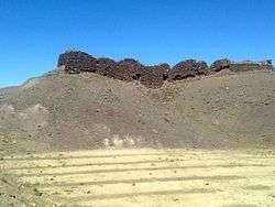
 Shelter of the last emperor of Persia, Yazdegerd III | |
 Zibad(Zeevad) | |
| Coordinates: 34°16′35″N 58°29′15″E | |
| Country | |
| Province | Razavi Khorasan |
| County | Gonabad |
| Bakhsh | Kakhk |
| Rural District | Zibad |
| Population (2006) | |
| • Total | 4,243 |
| Time zone | UTC+3:30 (IRST) |
| • Summer (DST) | UTC+4:30 (IRDT) |
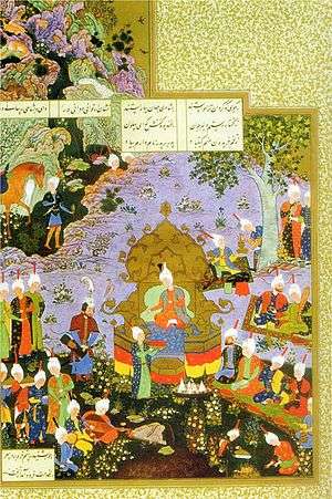
Zibad, meaning beautiful, was a famous ancient city in Shahnameh. According to Shahnameh Ferdowsi (around 1000 AD), it was the place of a famous war called Davazdah Rokh(12 hero) between Iran and Turan. Zibad also has an ancient qanat that may be more than 1600 years old.
Zibad is famous for :
- its saffron and opium production.
- its ancient castle which was shelter of the last emperor of Persia, Yazdegerd III, the place of three ancient wars, and its Mithraism monument.
- its Qanat and darb e soufe a famous mountain wall rock, similar to Taq-e Bostan
- its water clock which had been in use continuously from 400BCE until 1950.
- Its Watermill producing flour and crushed wheat. The ancient water mill was at work until 1984 and destroyed for construction of a dam.
According to Callisthenes, the Persians were using water clocks in 328BCE to ensure a just and exact distribution of water from qanats to their shareholders for agricultural irrigation. The use of water clocks in Iran, especially in Zibad, dates back to 500BCE. Later they were also used to determine the exact holy days of pre-Islamic religions, such as the Nowruz, Chelah, or Yaldā - the shortest, longest, and equal-length days and nights of the years. The water clocks used in Iran were one of the most practical ancient tools for timing the yearly calendar. .[4]
special festivals
Iranian festival such as Yaldā Night , Nowruz are celebrated in special way and traditional custom in zibad.

Kuh e tir mahi
mountain of TirMahi or Kūh-e Tīr Māhī is located in Zibad the second pic mountain in khorasan.
See also
- Davazdah Rokh
- Zibad Rheum
- Iran
- Gonabad
- Kūh-e Tīr Māhī
References
| Wikimedia Commons has media related to Zibad. |
- Zibad can be found at GEOnet Names Server, at this link, by opening the Advanced Search box, entering "-3089466" in the "Unique Feature Id" form, and clicking on "Search Database".
- "Census of the Islamic Republic of Iran, 1385 (2006)". Islamic Republic of Iran. Archived from the original (Excel) on 2011-11-11.
- http://www.amar.org.ir/Portals/0/sarshomari90/Files/ABADY-90/os09.xls
- conference of Qanat in Iran - water clock in persiaد1383 آفتاب


.png)