Xixiangtang District
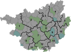
Xixiangtang District (simplified Chinese: 西乡塘区; traditional Chinese: 西鄉塘區; pinyin: Xīxiāngtáng Qū; Standard Zhuang: Sihsienghdangz Gih) is one of 7 districts of the prefecture-level city of Nanning, the capital of Guangxi Zhuang Autonomous Region, South China. The district was approved to establish by merging the former two districts of Yongxin (永新区, excluding 10 villages of Jaingxi Town) and Chengbei (城北区) by the Chinese State Council on September 15, 2004.[4]
Xixiangtang 西乡塘区 · Sihsienghdangz Gih | |
|---|---|
 Xixiangtang Location in Guangxi | |
| Coordinates: 22°50′25″N 108°18′29″E[1] | |
| Country | People's Republic of China |
| Autonomous region | Guangxi |
| Prefecture-level city | Nanning |
| Area | |
| • Total | 1,154 km2 (446 sq mi) |
| Population (2010)[3] | |
| • Total | 1,153,305 |
| • Density | 1,000/km2 (2,600/sq mi) |
| Time zone | UTC+8 (China Standard) |
See also
- Nanning Railway Station
References
- Google (2014-07-02). "Hengyang Subdistrict Office" (Map). Google Maps. Google. Retrieved 2014-07-02.
- Nanning City Land Use Plan (2006–20)/《南宁市土地利用总体规划(2006-2020年)》.(in Chinese) Accessed 8 July 2014.
- 《中国2010年人口普查分县资料》 (in Chinese). 中国统计出版社. December 2012. ISBN 978-7-5037-6659-6.
- 西乡塘区历史沿革 (in Chinese). xzqh.org. 2013-11-05. Retrieved 2019-07-19.
External links
This article is issued from Wikipedia. The text is licensed under Creative Commons - Attribution - Sharealike. Additional terms may apply for the media files.