Wyoming Highway 112
Wyoming Highway 112 (WYO 112) is a 29.50-mile-long (47.48 km) state highway in north-central Crook County, Wyoming that runs from Hulett to the Montana-Wyoming State Line.
| ||||
|---|---|---|---|---|
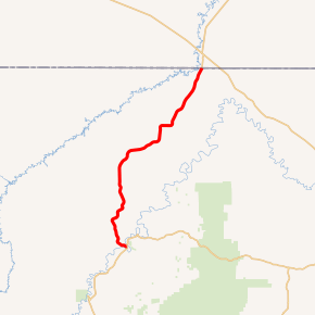
WYO 112 highlighted in red | ||||
| Route information | ||||
| Maintained by WYDOT | ||||
| Length | 29.50 mi[1] (47.48 km) | |||
| Major junctions | ||||
| South end | ||||
| North end | ||||
| Location | ||||
| Counties | Crook | |||
| Highway system | ||||
State highways in Wyoming
| ||||

Route description
Wyoming Highway 112 begins its south end at Wyoming Highway 24 in Hulett. From there WYO 112 travels north to Montana-Wyoming State Line. The highway continues north from there a short distance as Montana Secondary Highway 326 to meet US 212 in Alzada, Montana.[2][3]
Major intersections
The entire route is in Crook County. [4]
| Location[4] | mi | km | Destinations | Notes | |
|---|---|---|---|---|---|
| Hulett | 0.00 | 0.00 | |||
| | 29.50 | 47.48 | Continuation beyond Montana state line | ||
| 1.000 mi = 1.609 km; 1.000 km = 0.621 mi | |||||
gollark: I saw faXmu.
gollark: I wonder why forest is so busy right now compared to the other places.
gollark: At last, I can pointlessly cave-hunt again, with my free egg slot!
gollark: Nah.
gollark: If the near-hatching one doesn't get picked up soon, mind keeping it? I will have a slot in <1 hour.
References
- Wyoming Department of Transportation Reference Marker Book - November 2004 (PDF) (Map). WYDOT. Archived from the original (PDF) on July 17, 2011. Retrieved 2011-03-17.
- aaroads.com - Wyoming Routes 100-199
- Google (3 September 2016). "Wyoming Highway 112" (Map). Google Maps. Google. Retrieved 3 September 2016.
- Geography Division (2016). "Wyoming Governmental Unit Reference Map". United States Census Bureau. Retrieved January 23, 2017.
External links
This article is issued from Wikipedia. The text is licensed under Creative Commons - Attribution - Sharealike. Additional terms may apply for the media files.