Wyoming Highway 111
Wyoming Highway 111 (WYO 111) is an 8.63-mile-long (13.89 km) state highway in Wyoming located in eastern Crook County.
| ||||
|---|---|---|---|---|
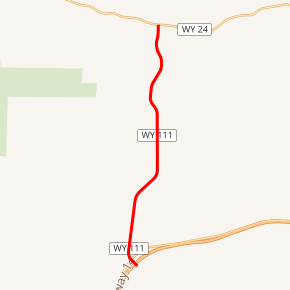
WYO 111 highlighted in red | ||||
| Route information | ||||
| Maintained by WYDOT | ||||
| Length | 8.63 mi[1] (13.89 km) | |||
| Major junctions | ||||
| South end | ||||
| North end | ||||
| Location | ||||
| Counties | Crook | |||
| Highway system | ||||
State highways in Wyoming
| ||||

Route description
Wyoming Highway 111 begins its south end at I-90/US 14 (Exit 199). From there the highway travels north to Wyoming Highway 24 in Aladdin.[2] Highway 111 is 8.63 miles (13.89 km) long and provides a connection between I-90 and WYO 24.[3]
Major intersections
The entire route is in Crook County.
| Location | mi | km | Destinations | Notes | |
|---|---|---|---|---|---|
| | 0.0 | 0.0 | Southern Terminus of WYO 111 Exit 199 (I-90/US 14) | ||
| Aladdin | 8.63 | 13.89 | Northern Terminus of WYO 111 | ||
| 1.000 mi = 1.609 km; 1.000 km = 0.621 mi | |||||
gollark: The one which takes you to the sand, or the one with the void you get dehydrated in?
gollark: Maybe "translate the cube" (push it, but translate sounds better).
gollark: Yes, that is possible.
gollark: Apologies, my internet connection briefly incursed.
gollark: - also the cubes, I guess
References
- Wyoming Department of Transportation Reference Marker Book - November 2004 (PDF) (Map). WYDOT. Archived from the original (PDF) on July 17, 2011. Retrieved 2011-03-17.
- Google (3 September 2016). "Wyoming Highway 111" (Map). Google Maps. Google. Retrieved 3 September 2016.
- aaroads.com - Wyoming Routes 100-199
This article is issued from Wikipedia. The text is licensed under Creative Commons - Attribution - Sharealike. Additional terms may apply for the media files.