Woodland Park, Washington
Woodland Park is an unincorporated community in Cowlitz County, Washington. The Woodland Park community is located 17 miles (27 km) northeast of Woodland along Washington State Route 503 and on the north shore of Lake Merwin, a reservoir on the Lewis River. The Woodland Park community is part of the Woodland School District, a K-12 school district of about 2,200 students.
Woodland Park, Washington | |
|---|---|
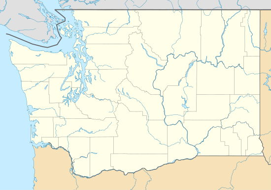 Woodland Park Location in the state of Washington  Woodland Park Woodland Park (the United States) | |
| Coordinates: 45°59′25″N 122°28′32″W | |
| Country | United States |
| State | Washington |
| County | Cowlitz |
| Elevation | 78 m (256 ft) |
| Time zone | UTC−8 (PST) |
| • Summer (DST) | UTC−7 (PDT) |
| ZIP code | 98603 |
| Area code(s) | 360 |
| FIPS code | 53-79710 |
| GNIS feature ID | 1528296 |
Woodland Park is located 19.3 miles (31.1 km) southwest of Mount St. Helens. The eruption of Mount St. Helens on May 18, 1980 was the deadliest and most economically destructive volcanic event in the history of the United States.
Geography
Woodland Park is located at 45°59′25″N 122°28′32″W (45.9903884, -122.4756559).[2]
gollark: I guess it wouldn't be a massive issue, given that the code needed for viewbombing is already there but just used slightly responsibly.
gollark: It would basically involve taking about ten lines of publicly available code and basic JS knowledge.
gollark: You don't actually need one.
gollark: I mean, I have code for ARish stuff *anyway*, but if I make one it'll be significantly easier to make an *eeeevil* one.
gollark: Basically, I can't stop the code from being used to make an *un*-time-limited ARer.
References
- "USGS—Woodland Park, Washington". Retrieved 13 June 2014.
- "2013 U.S. Gazetteer Files". census.gov. Retrieved 13 June 2014.
External links
Municipalities and communities of Cowlitz County, Washington, United States | ||
|---|---|---|
| Cities | 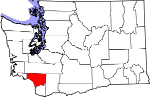 Map of Washington highlighting Cowlitz County | |
| CDPs | ||
| Unincorporated communities |
| |
| Footnotes | ‡This populated place also has portions in an adjacent county or counties | |
This article is issued from Wikipedia. The text is licensed under Creative Commons - Attribution - Sharealike. Additional terms may apply for the media files.