Caples, Washington
Caples is an unincorporated community in Cowlitz County, Washington. The Caples community is located 2.44 miles (3.93 km) west of Woodland along Caples Road, on the east shore of Columbia River and across the river from Columbia City, Oregon. The Caples community is part of the Woodland School District, a K-12 school district of about 2,200 students.
Caples, Washington | |
|---|---|
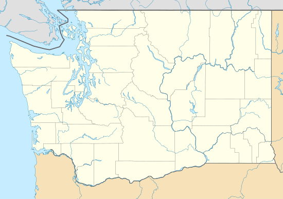 Caples Location in the state of Washington  Caples Caples (the United States) | |
| Coordinates: 45°54′20″N 122°48′03″W | |
| Country | United States |
| State | Washington |
| County | Cowlitz |
| Elevation | 6 m (20 ft) |
| Time zone | UTC−8 (PST) |
| • Summer (DST) | UTC−7 (PDT) |
| ZIP code | 98674 |
| Area code(s) | 360 |
| GNIS feature ID | 1513509 |
Geography
Caples is located at 45°54′20″N 122°48′03″W (45.9056699, -122.8009371).[2]
gollark: Huh, I thought you were going to complain about me "explaining closure terribly" or something.
gollark: It's called closure. Stuff defined in something gets access to locals from that thing.
gollark: Just do```luafunction fs.open(file, mode) local f = {} -- Store fs files in here local handle = io.open(file, mode) function f.readAll() return handle:read("*a") end function f.close() handle:close() end function f.write(data) handle:write(data) end return fend```unless there's some other thing you need it for.
gollark: Wait, why do you need a global `openFiles` thing for that?
gollark: Cool, should be useful.
References
- "USGS—Caples, Washington". Retrieved 15 June 2014.
- "2013 U.S. Gazetteer Files". census.gov. Retrieved 15 June 2014.
External links
Municipalities and communities of Cowlitz County, Washington, United States | ||
|---|---|---|
| Cities | 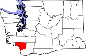 Map of Washington highlighting Cowlitz County | |
| CDPs | ||
| Unincorporated communities |
| |
| Footnotes | ‡This populated place also has portions in an adjacent county or counties | |
This article is issued from Wikipedia. The text is licensed under Creative Commons - Attribution - Sharealike. Additional terms may apply for the media files.