Willow Park, Texas
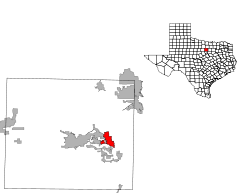
Willow Park is a city in Parker County, Texas, United States. The population was 3,982 at the 2010 census.
Willow Park, Texas | |
|---|---|
Location of Willow Park, Texas | |
 | |
| Coordinates: 32°45′14″N 97°39′0″W | |
| Country | United States |
| State | Texas |
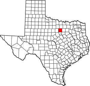
| County | Parker |
| Area | |
| • Total | 6.53 sq mi (16.91 km2) |
| • Land | 6.43 sq mi (16.66 km2) |
| • Water | 0.10 sq mi (0.25 km2) |
| Elevation | 932 ft (284 m) |
| Population (2010) | |
| • Total | 3,982 |
| • Estimate (2019)[2] | 5,842 |
| • Density | 908.13/sq mi (350.64/km2) |
| Time zone | UTC-6 (Central (CST)) |
| • Summer (DST) | UTC-5 (CDT) |
| ZIP code | 76087 |
| Area code(s) | 817 |
| FIPS code | 48-79492[3] |
| GNIS feature ID | 1388568[4] |
| Website | City of Willow Park |
Willow Park was the location of Trinity Meadows Race Track, one of the first horse racing tracks opened once Texas legalized parimutuel betting. However, it was never seriously considered for upgrade to first-class status, and once Lone Star Park opened, Trinity Meadows Race Track closed. It is home to Squaw Creek golf course, located just off Ranch House Road.
KTVT, Channel 11 in Fort Worth operates a 1 million watt doppler radar in Willow Park.
Geography
Willow Park is located at 32°45′14″N 97°39′0″W (32.753808, -97.650081).[5]
According to the United States Census Bureau, the city has a total area of 6.3 square miles (16 km2), of which, 6.2 square miles (16 km2) of it is land and 0.1 square miles (0.26 km2) of it (1.60%) is water. The population of Willow Park's corporate limits is 5,100.
Demographics
| Historical population | |||
|---|---|---|---|
| Census | Pop. | %± | |
| 1970 | 230 | — | |
| 1980 | 1,152 | 400.9% | |
| 1990 | 2,328 | 102.1% | |
| 2000 | 2,849 | 22.4% | |
| 2010 | 3,982 | 39.8% | |
| Est. 2019 | 5,842 | [2] | 46.7% |
| U.S. Decennial Census[6] | |||
As of the census[3] of 2000, there were 2,849 people, 991 households, and 885 families residing in the city. The population density was 462.9 people per square mile (178.9/km2). There were 1,010 housing units at an average density of 164.1 per square mile (63.4/km2). The racial makeup of the city was 96.31% White, 0.32% African American, 0.74% Native American, 0.46% Asian, 1.26% from other races, and 0.91% from two or more races. Hispanic or Latino of any race were 3.55% of the population.
There were 991 households out of which 41.8% had children under the age of 18 living with them, 82.5% were married couples living together, 4.8% had a female householder with no husband present, and 10.6% were non-families. 9.4% of all households were made up of individuals and 3.1% had someone living alone who was 65 years of age or older. The average household size was 2.87 and the average family size was 3.06.
In the city, the population was spread out with 27.8% under the age of 18, 5.1% from 18 to 24, 26.2% from 25 to 44, 31.1% from 45 to 64, and 9.8% who were 65 years of age or older. The median age was 40 years. For every 100 females, there were 103.4 males. For every 100 females age 18 and over, there were 95.3 males.
The median income for a household in the city was $74,155, and the median income for a family was $78,926. Males had a median income of $61,375 versus $35,610 for females. The per capita income for the city was $30,266. About 1.5% of families and 1.9% of the population were below the poverty line, including 2.3% of those under age 18 and 2.6% of those age 65 or over.
Education
Willow Park is served by the Aledo and Weatherford Independent School Districts. Trinity Christian Academy has been located in Willow Park since 1993 and serves students pre K through 12th Grade.
References
- "2019 U.S. Gazetteer Files". United States Census Bureau. Retrieved August 7, 2020.
- "Population and Housing Unit Estimates". United States Census Bureau. May 24, 2020. Retrieved May 27, 2020.
- "U.S. Census website". United States Census Bureau. Retrieved 2008-01-31.
- "US Board on Geographic Names". United States Geological Survey. 2007-10-25. Retrieved 2008-01-31.
- "US Gazetteer files: 2010, 2000, and 1990". United States Census Bureau. 2011-02-12. Retrieved 2011-04-23.
- "Census of Population and Housing". Census.gov. Retrieved June 4, 2015.

