Watson Township, Effingham County, Illinois
Watson Township is one of fifteen townships in Effingham County, Illinois, USA. As of the 2010 census, its population was 3,193 and it contained 1,263 housing units.[2]
Watson Township | |
|---|---|
 Location in Effingham County | |
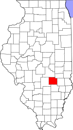
 Effingham County's location in Illinois | |
| Coordinates: 39°03′N 88°31′W | |
| Country | United States |
| State | Illinois |
| County | Effingham |
| Established | November 6, 1860 |
| Area | |
| • Total | 35.83 sq mi (92.8 km2) |
| • Land | 35.83 sq mi (92.8 km2) |
| • Water | 0 sq mi (0 km2) 0% |
| Elevation | 554 ft (169 m) |
| Population (2010) | |
| • Estimate (2016)[1] | 3,163 |
| • Density | 89.1/sq mi (34.4/km2) |
| Time zone | UTC-6 (CST) |
| • Summer (DST) | UTC-5 (CDT) |
| ZIP codes | 62401, 62424, 62467, 62473 |
| FIPS code | 17-049-79254 |
Geography
According to the 2010 census, the township (T7N R6E) has a total area of 35.83 square miles (92.8 km2), all land.[2]
Unincorporated towns
Cemeteries
The township contains these five cemeteries: Immanuel Lutheran, Loy Chapel, Old Loy, Rinehart and Watson.
Major highways

Airports and landing strips
- Effingham County Memorial Airport
- Percival Airport
School districts
- Dieterich Community Unit School District 30
- Effingham Community Unit School District 40
- Teutopolis Community Unit School District 50
Political districts
- Illinois' 19th congressional district
- State House District 102
- State House District 108
- State Senate District 51
- State Senate District 54
gollark: ubq, I have prepared a "mostly working binary".
gollark: You configure it by manually updating a SQLite database!
gollark: I may eventually have to have some optional JS for a latency graph, but it shouldn't be necessary for basic features.
gollark: Nope.
gollark: *And*, unlike statping, it serves clients with something like 3KB of static HTML/CSS.
References
- "Watson Township, Effingham County, Illinois". Geographic Names Information System. United States Geological Survey. Retrieved 2010-01-16.
- United States Census Bureau 2007 TIGER/Line Shapefiles
- United States National Atlas
- "Population and Housing Unit Estimates". Retrieved June 9, 2017.
- "Population, Housing Units, Area, and Density: 2010 - County -- County Subdivision and Place -- 2010 Census Summary File 1". United States Census. Archived from the original on 2020-02-12. Retrieved 2013-05-28.
- "Census of Population and Housing". Census.gov. Retrieved June 4, 2016.
External links
This article is issued from Wikipedia. The text is licensed under Creative Commons - Attribution - Sharealike. Additional terms may apply for the media files.