Waterford, New York
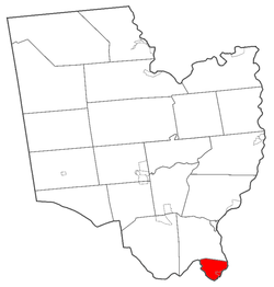
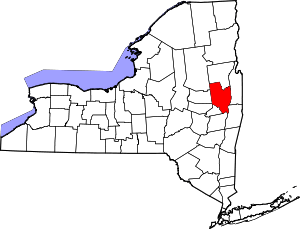
Waterford is a town in Saratoga County, New York, United States. The population was 8,423 at the 2010 census. The name of the town is derived from its principal village, also called Waterford. The town and village are in the southeast corner of Saratoga County, and north-northwest of Troy It is located at the junction of the Erie Canal and the Hudson River.
History
The town is part of the Van Schaick land patent of 1687. The first settlement took place at the site of the current Waterford village, then called "Half Moon Point".
The town was formed in 1816 by splitting the area of southeastern Saratoga County known as Halfmoon (anglicized from the Dutch name Halve Maan) into the town of Halfmoon and the town of Waterford.
The village of Waterford is the oldest incorporated village in the US, having been incorporated in 1794, before the town was formed. Waterford has been host to "Canal Fest" and "Tugboat Roundup" celebrations for many years.
The Northside Historic District, Ormsby-Laughlin Textile Companies Mill, Peebles (Peobles) Island, and Waterford Village Historic District are listed on the National Register of Historic Places.[1] In addition, the canal tugboats Catawissa and Urger have received listings; although the first mentioned boat was scrapped in 2008, the second mentioned boat is permanently stationed in Waterford as an educational resource.
Waterfront community
Waterford is home to the largest annual tugboat festival in the Northeast US. Every September, a three-day festival is held in Waterford along the waterfront in the village. Recently, 30,000 visitors attended over the 3-day weekend. Arts, crafts, farmer's market items, games, music, story-telling and of course tugboats are on display. Many historic boats travel through the locks in Waterford, as it is the entrance to the modern New York State Barge Canal system.
The village plans to complete installation of historic-replica streetlamps. In the future, the village may bury electrical power lines to take down the utility poles and improve aesthetics.
Waterford is the home of Michael Brown, founder of Death Wish Coffee Company, and the Coffee Cowboy Scott Swedish, manager of Saratoga Coffee Traders (official home of Death Wish Coffee Co.). Death Wish Coffee Company was featured during Super Bowl 50 in 2016.
Geography

The Village of Waterford is located at 42°47′28″N 73°40′47″W,[2] in the southeastern corner of the Town.
According to the United States Census Bureau, the town has a total area of 7.4 square miles (19.2 km²), of which, 6.6 square miles (17.0 km²) of it is land and 0.9 square miles (2.2 km²) of it (11.59%) is water.
The eastern town line, defined by the Hudson River, is the border with Rensselaer County, and the southern town line, defined by the Mohawk River, is the border with Albany County. The easternmost section and locks of the Erie Canal pass through the town and connect with the Hudson River. The Waterford Flight series of locks is one of the steepest in the world.[3][4] The east-west Erie Canal is linked to the north-south Champlain Canal at Waterford.
US Route 4, partly conjoined with New York State Route 32, is a north-south highway through eastern Waterford.
Demographics
| Historical population | |||
|---|---|---|---|
| Census | Pop. | %± | |
| 1820 | 1,184 | — | |
| 1830 | 1,473 | 24.4% | |
| 1840 | 1,824 | 23.8% | |
| 1850 | 2,683 | 47.1% | |
| 1860 | 3,260 | 21.5% | |
| 1870 | 3,631 | 11.4% | |
| 1880 | 4,328 | 19.2% | |
| 1890 | 5,286 | 22.1% | |
| 1900 | 6,157 | 16.5% | |
| 1910 | 6,128 | −0.5% | |
| 1920 | 4,552 | −25.7% | |
| 1930 | 5,667 | 24.5% | |
| 1940 | 5,709 | 0.7% | |
| 1950 | 6,052 | 6.0% | |
| 1960 | 7,231 | 19.5% | |
| 1970 | 7,644 | 5.7% | |
| 1980 | 7,194 | −5.9% | |
| 1990 | 8,695 | 20.9% | |
| 2000 | 8,515 | −2.1% | |
| 2010 | 8,423 | −1.1% | |
| Est. 2016 | 8,496 | [5] | 0.9% |
| U.S. Decennial Census[6] | |||
As of the census[7] of 2000, there were 8,515 people, 3,497 households, and 2,287 families residing in the town. The population density was 1,299.2 people per square mile (501.9/km²). There were 3,725 housing units at an average density of 568.3 per square mile (219.6/km²). The racial makeup of the town was 96.86% White, 0.74% Black or African American, 0.20% Native American, 1.09% Asian, 0.09% from other races, and 1.01% from two or more races. Hispanic or Latino of any race were 0.94% of the population.
There were 3,497 households out of which 30.9% had children under the age of 18 living with them, 50.0% were married couples living together, 11.6% had a female householder with no husband present, and 34.6% were non-families. 27.5% of all households were made up of individuals and 10.7% had someone living alone who was 65 years of age or older. The average household size was 2.42 and the average family size was 2.98.
In the town, the population was spread out with 23.6% under the age of 18, 8.0% from 18 to 24, 32.6% from 25 to 44, 21.6% from 45 to 64, and 14.2% who were 65 years of age or older. The median age was 37 years. For every 100 females, there were 92.6 males. For every 100 females age 18 and over, there were 89.3 males.
The median income for a household in the town was $46,362, and the median income for a family was $56,345. Males had a median income of $39,913 versus $27,879 for females. The per capita income for the town was $22,538. About 3.5% of families and 5.7% of the population were below the poverty line, including 7.7% of those under age 18 and 6.3% of those age 65 or over.
As of the 2010 census there were 8,423 people. The racial makeup of the town was 94.8% White, 1.3% African-American, 0.1% Native American, 1.5% Asian. 1.8% were Hispanic or Latino.[8]
Communities and locations in the town of Waterford
- Cohoes Falls – A waterfall on the Mohawk River, and a source of water power to early industry
- Peebles Island – An island at the south part of the town
- Momentive Performance Materials Inc. (formerly General Electric Silicone Products) – Manufacturer of silicone products and specialty chemicals, may be largest employer in the town
- Northside – Actually the south side of the town of Waterford. The name may be derived from its location on the north side of the Mohawk River. Northside may also derive its name from at one time being served by the "northside" part of the Cohoes Post Office (e.g. 123 Any Street, Northside, Cohoes, NY). After around 1960, all of Waterford was served by the Waterford Post Office.
- Peebles Island State Park – A state park in the south part of the town
- Prospect Hill – A hamlet north of Waterford village, on County Road 96
- State Canal Park – A state park in the western part of Waterford
- Sugarloaf Pond – A pond in the south part of the town
- Waterford Village – The village of Waterford, located within the Town, and right at the confluence of the Hudson and Mohawk Rivers
- St. Mary's of the Assumption Catholic Church
- St. Mary's of the Assumption Catholic School
See also
References
- "National Register Information System". National Register of Historic Places. National Park Service. March 13, 2009.
- "US Gazetteer files: 2010, 2000, and 1990". United States Census Bureau. 2011-02-12. Retrieved 2011-04-23.
- Finch, Roy G. (1988) [1925]. The Story of the New York State Canals: Historical and Commercial Information (PDF). New York State Canal Corporation. p. 19. Retrieved 9 March 2013.
- "Dedication of the Flight of Five Locks as a Civil Engineering Landmark (9/9/2012)". ASCE Rennselaer. American Society of Civil Engineers (ASCE), RPI Chapter. Archived from the original on 16 December 2013. Retrieved 2 March 2013.
- "Population and Housing Unit Estimates". Retrieved June 9, 2017.
- "Census of Population and Housing". Census.gov. Retrieved June 4, 2015.
- "U.S. Census website". United States Census Bureau. Retrieved 2008-01-31.
- U.S. Census FactFinder, 2010 Summary, Race and Hispanic or Latino Origin https://factfinder.census.gov/faces/tableservices/jsf/pages/productview.xhtml?src=CF
External links
| Wikimedia Commons has media related to Waterford, New York. |
- Town of Waterford
- Waterford Historical Museum
- The Saratogian, "Early History of Waterford", Our county and its people: A descriptive and biographical record of Saratoga County, New York. Boston: The Boston History Company, 1899, reproduced on Rays Place website
- Waterford Public Library

