Wang Sai Phun District
Wang Sai Phun (Thai: วังทรายพูน, pronounced [wāŋ sāːj pʰūːn]) is a district (amphoe) in the eastern part of Phichit Province, central Thailand.
Wang Sai Phun วังทรายพูน | |
|---|---|
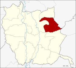 Amphoe location in Phichit Province | |
| Coordinates: 16°23′18″N 100°32′18″E | |
| Country | Thailand |
| Province | Phichit |
| Seat | Nong Phra |
| Area | |
| • Total | 259.501 km2 (100.194 sq mi) |
| Population (2005) | |
| • Total | 25,541 |
| • Density | 98.4/km2 (255/sq mi) |
| Time zone | UTC+7 (ICT) |
| Postal code | 66180 |
| Geocode | 6602 |
History
Tambon Wang Sai Phun, Nong Phra and Nong Pla Lai were separated from Mueang Phichit District and made up the new minor district (king amphoe) Wang Sai Phun on 1 August 1975.[1] It was upgraded to a full district on July 13, 1981.[2] The government assigned Tambon Nong Plong of Mueang Phichit to be part of Wang Sai Phun on 23 September 1993.[3]
Geography
Neighboring districts are (from the south clockwise) Thap Khlo, Taphan Hin, Mueang Phichit, Sak Lek of Phichit Province and Noen Maprang of Phitsanulok Province.
Administration
The district is divided into four sub-districts (tambon), which are further subdivided into 57 villages (muban). Wang Sai Phun is a township (thesaban tambon) which covers parts of tambon Wang Sai Phun and Nong Phra. There are a further four tambon administrative organizations (TAO).
| No. | Name | Thai name | Villages | Pop. | |
|---|---|---|---|---|---|
| 1. | Wang Sai Phun | วังทรายพูน | 14 | 8,899 | |
| 2. | Nong Pla Lai | หนองปลาไหล | 16 | 5,163 | |
| 3. | Nong Phra | หนองพระ | 17 | 8,006 | |
| 4. | Nong Plong | หนองปล้อง | 10 | 3,473 |
References
- ประกาศกระทรวงมหาดไทย เรื่อง แบ่งท้องที่อำเภอเมืองพิจิตร จังหวัดพิจิตร ตั้งเป็นกิ่งอำเภอวังทรายพูน (PDF). Royal Gazette (in Thai). 92 (144 ง): 1876. July 29, 1975.
- พระราชกฤษฎีกาตั้งอำเภอหนองใหญ่ อำเภอบ่อไร่ อำเภอพรหมคีรี อำเภอนาบอน อำเภอบางสะพานน้อย อำเภอนาดี อำเภอกงหรา อำเภอวังทรายพูน อำเภอธารโต อำเภอคำตากล้า อำเภอศรีนคร อำเภอด่านช้าง อำเภอพรเจริญ อำเภอวังสามหมอ และอำเภอลานสัก พ.ศ. ๒๕๒๔ (PDF). Royal Gazette (in Thai). 98 (115 ก Special): 7–10. July 13, 1981.
- พระราชกฤษฎีกาเปลี่ยนแปลงเขตอำเภอเมืองพิจิตร กับอำเภอวังทรายพูน จังหวัดพิจิตร พ.ศ. ๒๕๒๖ (PDF). Royal Gazette (in Thai). 100 (152 ก Special): 13–14. September 23, 1993.