Mueang Phichit District
Mueang Phichit (Thai: เมืองพิจิตร, pronounced [mɯ̄a̯ŋ pʰí(ʔ).t͡ɕìt]) is the capital district (amphoe mueang) of Phichit Province, central Thailand.
Mueang Phichit เมืองพิจิตร | |
|---|---|
 Nan River, Mueang Phichit at Wat Tha Luang | |
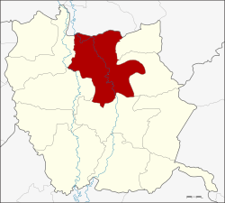 District location in Phichit Province | |
| Coordinates: 16°26′18″N 100°21′0″E | |
| Country | Thailand |
| Province | Phichit |
| Seat | Nai Mueang |
| Area | |
| • Total | 738.9 km2 (285.3 sq mi) |
| Population (2008) | |
| • Total | 112,779 |
| • Density | 153.0/km2 (396/sq mi) |
| Time zone | UTC+7 (ICT) |
| Postal code | 66000 |
| Geocode | 6601 |
Geography
Neighboring districts are (from the east clockwise) Sak Lek, Wang Sai Phun, Taphan Hin, Pho Prathap Chang, Sam Ngam of Phichit Province and Bang Krathum of Phitsanulok Province.
History
In 1917 the district's name was changed from Mueang to Tha Luang (ท่าหลวง).[1] In 1938 it was renamed Mueang Phichit.[2]
Administration
The district is divided into 16 sub-districts (tambons), which are further subdivided into 134 villages (mubans). The town (thesaban mueang) Phichit covers tambon Nai Mueang. There are three more sub-district municipalities (thesaban tambons). Tha Lo and Hua Dong each cover parts of their tambons, and Wang Krot parts of tambon Ban Bung. There are a further 15 tambon administrative organizations (TAO).
| No. | Name | Thai | Villages | Pop.[3] |
|---|---|---|---|---|
| 1. | Nai Mueang | ในเมือง | - | 23,521 |
| 2. | Phai Khwang | ไผ่ขวาง | 8 | 3,727 |
| 3. | Yan Yao | ย่านยาว | 10 | 6,048 |
| 4. | Tha Lo | ท่าฬ่อ | 7 | 5,582 |
| 5. | Pak Thang | ปากทาง | 9 | 5,945 |
| 6. | Khlong Khachen | คลองคะเชนทร์ | 10 | 8,480 |
| 7. | Rong Chang | โรงช้าง | 7 | 5,800 |
| 8. | Mueang Kao | เมืองเก่า | 9 | 5,876 |
| 9. | Tha Luang | ท่าหลวง | 10 | 6,355 |
| 10. | Ban Bung | บ้านบุ่ง | 7 | 7,462 |
| 11. | Kha Mang | ฆะมัง | 12 | 6,368 |
| 12. | Dong Pa Kham | ดงป่าคำ | 9 | 4,930 |
| 13. | Hua Dong | หัวดง | 9 | 7,044 |
| 15. | Pa Makhap | ป่ามะคาบ | 14 | 8,518 |
| 19. | Sai Kham Ho | สายคำโห้ | 5 | 2,579 |
| 20. | Dong Klang | ดงกลาง | 9 | 4,544 |
Missing numbers are tambon which now form Sak Lek District.
References
- ประกาศกระทรวงมหาดไทย เรื่อง เปลี่ยนชื่ออำเภอ (PDF). Royal Gazette (in Thai). 34 (0 ก): 40–68. 1917-04-29.
- พระราชกฤษฎีกาเปลี่ยนนามจังหวัด และอำเภอบางแห่ง พุทธศักราช ๒๔๘๑ (PDF). Royal Gazette (in Thai). 55 (0 ก): 658–666. 1938-11-14.
- "Population statistics 2008". Department of Provincial Administration. Archived from the original on 2009-08-20. Retrieved 2009-11-06.
External links
- amphoe.com (Thai)