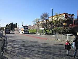
Wallsend Metro station
Wallsend is a station on the Tyne and Wear Metro, serving Wallsend in North Tyneside. The station joined the network in November 1982, following the opening of the line between Tynemouth and St. James.
| Wallsend | |
|---|---|
| Tyne and Wear Metro | |
 | |
| Location | |
| Place | Wallsend |
| Local authority | North Tyneside |
| Coordinates | 54.9897°N 1.5323°W |
| Fare zone information | |
| Metro zone | B |
| Network One | 2 |
| Original zone | 27 |
| Station code | WSD |
| Operations | |
| Platforms | 2 |
| Usage | |
| Metro Usage | 0.50[1] million |
| History | |
| Original company | Newcastle and North Shields Railway |
| Opened | 19 June 1839 |
| Closed for conversion | 11 August 1980 |
| Metro since | 14 November 1982 |
| List of stations | |
The station is situated on the site of the former Wallsend station, which opened in 1839, under the Newcastle and North Shields Railway. This later became part of the North Tyneside Loop, served by the North Eastern Railway. Following closure for conversion in the early 1980s, the station was demolished and re-built.
Michael Pinsky's Pontis art project was commissioned for the station in 2003, and featured photographs of the local area, which were digitally altered so that words appeared in Latin.[2] This installation has since been replaced by a new artwork, which consists of images of Hadrian's Wall, by photographer Graeme Peacock.[3][4]
Wallsend is the only station in the United Kingdom which has signage in Latin.[5][6] This is a nod to the station's location, near to the Segedunum Roman Fort at the end of Hadrian's Wall. It is also one of the few stations in England to have bilingual signage, with others being London St. Pancras International, Ebbsfleet International and Ashford International (French), Southall (Punjabi) and Hereford (Welsh).
The station was used by 499,680 passengers in 2017–18, making it the fifth-most-used station in North Tyneside.
Facilities
Step-free access is available at all stations across the Tyne and Wear Metro network, with ramps providing step-free access to both platforms at Wallsend. The station is equipped with ticket machines, sheltered waiting area, seating, next train information displays, timetable posters, and an emergency help point on both platforms. Ticket machines are able to accept payment with credit and debit card (including contactless payment), notes and coins.[7][8] The station is also fitted with smartcard validators, which feature at all stations across the network.[9][10]
There is a small free car park available at the station, with 24 spaces. There is also the provision for cycle parking, with 8 cycle pods available for use.[11]
Service and frequency
Wallsend is served by the Yellow Line , which operates between South Shields and St. James with an end-to-end journey time of 83 minutes.
Services from platform 1 operate towards South Shields via Whitley Bay, with the first train departing at 05:59 (06:11 on Saturday and 06:18 on Sunday). Services from platform 2 operate towards St. James, with the first train departing at 05:41 (05:59 on Saturday and 06:44 on Sunday). Trains run frequently across the network, at intervals of up to every 12 minutes (Monday to Saturday daytime), and every 15 minutes (evening and Sunday), with the last trains departing at around midnight.[11]
Journey times from Wallsend are:
- 11 minutes to St. James
- 17 minutes to Whitley Bay
- 35 minutes to South Gosforth via Whitley Bay
Wallsend Bus Station
Wallsend Bus Station | |
|---|---|
 | |
| Location | Station Road Wallsend North Tyneside |
| Coordinates | 54.9893°N 1.5338°W |
| Owned by | Tyne and Wear PTE (Nexus) |
| Operated by | Tyne and Wear PTE (Nexus) |
| Bus stands | 3 |
| Connections | Wallsend |
| Construction | |
| Parking | 24 spaces |
| Bicycle facilities | 8 cycle pods |
| Other information | |
| Fare zone |
|
| History | |
| Opened | 14 November 1982 |
| Location | |
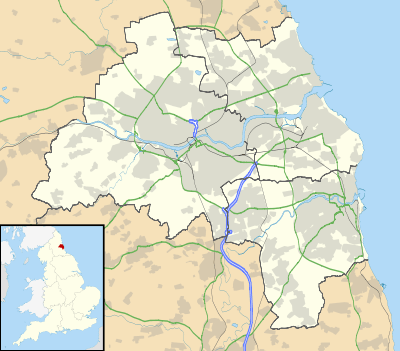
 Wallsend Bus Station Location within Tyne and Wear | |
Wallsend Bus Station opened in November 1982, along with the adjacent Tyne and Wear Metro station. It is served by Go North East and Stagecoach North East's local bus services, with frequent routes serving Newcastle upon Tyne and North Tyneside. The bus station has three departure stands (lettered A–C), each of which is fitted with a waiting shelter, seating, next bus information displays, and timetable posters. The bus station was refurbished in 2009 – at a cost of £130,000.[12]
As of June 2020, the stand allocation is:
| Stand | Route | Destination |
|---|---|---|
| A | No services operate from this stand | |
| B | 41 | Hadrian Park |
| 42 | Cramlington via Killingworth | |
| 42A | Kingston Park | |
| C | 12 | Fenham |
| 40 | Chapel House | |
| 553 | Regent Centre | |
| Q3 | Newcastle Great Park via Haymarket | |
See also
References
- "Tyne and Wear Metro usage figures 2017–2018". Retrieved 21 August 2019.
- "'Pontis' by Michael Pinsky". Nexus. Retrieved 25 May 2020.
- "Metro's 'Roman' station has a modern new feel". Nexus. 12 April 2013. Retrieved 25 May 2020.
- Henderson, Tony (13 April 2013). "Roman heritage artwork unveiled at Wallsend Metro station". The Journal. Newcastle upon Tyne. Retrieved 22 May 2016.
- "Latin lessons for Tyneside travellers". BBC News. 13 March 2003. Retrieved 25 May 2020.
- Stokes, Paul (14 March 2003). "Metro passengers find their way to the vomitorium". The Telegraph. Retrieved 25 May 2020.
- "Metro passengers feel the benefit of contactless payment". Nexus. 13 January 2014. Retrieved 25 May 2020.
- "Revamp for Metro ticket machines". BBC News. 11 December 2011. Retrieved 25 May 2020.
- "City Metro stations get new smart ticket machines and gates". Nexus. 22 October 2012. Retrieved 25 May 2020.
- "Pop card validators at Metro stations are put through their paces". Nexus. 21 March 2013. Retrieved 25 May 2020.
- "Timetables and stations: Wallsend". Nexus. Retrieved 25 May 2020.
- "Nexus gives Wallsend Bus Station a facelift". Nexus. 1 September 2009. Retrieved 25 May 2020.
External links
- Local area map and onward connections for Wallsend
- Timetable and station information for Wallsend

| Preceding station | Following station | |||
|---|---|---|---|---|
towards St James | Yellow line | towards South Shields |