Ukrah
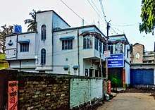
Ukrah (pronounced [ʌkrə]) or Nagarukhra (pronounced [nəgɑ:rʌkrə]) is a town [1] with Police Station in Kalyani subdivision of Nadia district in the Indian state of West Bengal. It is located around 50 kilometres (31 mi) from Kolkata , the capital of West Bengal.
Ukrah Nagarukhra | |
|---|---|
Town | |
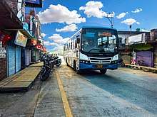
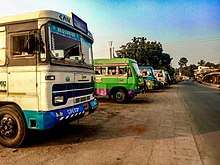
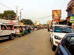 Traffic congestion on Intercity Road | |
 Ukrah Location in West Bengal, India  Ukrah Ukrah (India) | |
| Coordinates: 22.941°N 88.635°E | |
| Country | |
| State | West Bengal |
| District | Nadia |
| Government | |
| • Type | Urban body (Nagarukhra - I & II) |
| • Body | Semi-Urban |
| • MLA | Nilima Nag (Mallick) |
| • Public Work Dept.& Transportation Leader of Nadia Dist | Chanchal Debnath |
| Elevation | 12 m (39 ft) |
| Population (2011) | |
| • Total | 13,548 |
| • Density | 2,834/km2 (7,340/sq mi) |
| Languages | |
| • Official | Bengali, English, Hindi |
| Time zone | UTC+5:30 (IST) |
| PIN | 741257 |
| Telephone code | +91 3473 |
| ISO 3166 code | IN-WB |
| Vehicle registration | WB |
| Sex ratio | 943 ♂/♀ |
| Lok Sabha constituency | Bangaon |
| Vidhan Sabha constituency | Haringhata |
| Website | nadia |
| Census Village | |
Geography
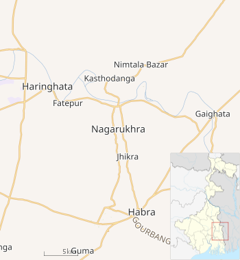 |
| Nagarukhra - OSMap in West Bengal |
Ukrah is located at 22.944°N 88.660°E. [2].It has an average elevation of 12 metres (39 ft).
Nagarukhra is bounded by the Jamuna River on the North. This suburban is approximately 65 km far from district headquarter, Krishnagar and approximately 50 km. far from the state capital, Kolkata.
Climate
The weather is quite pleasant, the summer is quite hot and winter is moderate [3]. The level of moisture increases during summers.
| Climate data for Nagarukhra, IN | |||||||||||||
|---|---|---|---|---|---|---|---|---|---|---|---|---|---|
| Month | Jan | Feb | Mar | Apr | May | Jun | Jul | Aug | Sep | Oct | Nov | Dec | Year |
| Average high °C (°F) | 26.4 (79.5) |
29.1 (84.4) |
33.5 (92.3) |
35.3 (95.5) |
35.4 (95.7) |
34 (93) |
32.3 (90.1) |
32.1 (89.8) |
32.4 (90.3) |
32.3 (90.1) |
30.3 (86.5) |
27 (81) |
31.7 (89.0) |
| Average low °C (°F) | 13.8 (56.8) |
16.9 (62.4) |
21.7 (71.1) |
25.1 (77.2) |
26 (79) |
26.5 (79.7) |
26.1 (79.0) |
26.1 (79.0) |
25.8 (78.4) |
23.9 (75.0) |
19.6 (67.3) |
14.5 (58.1) |
22.2 (71.9) |
| Average precipitation mm (inches) | 1 (0.0) |
2 (0.1) |
3 (0.1) |
4 (0.2) |
89 (3.5) |
231 (9.1) |
451 (17.8) |
342 (13.5) |
324 (12.8) |
167 (6.6) |
8 (0.3) |
0 (0) |
1,622 (64) |
| Average rainy days | 4 | 3 | 4 | 6 | 12 | 18 | 23 | 22 | 18 | 11 | 3 | 1 | 125 |
| Source: www.yr.no | |||||||||||||
Demographics
As of 2011 India census, Ukrah had a population of 13,548, comprising 6,974 males and 6,574 females. Ukrah has an average literacy rate of 83.91%, with 1,309 (9.66%) of the town's population between 0–6 years of age.
As of 2001 India census, Ukrah had a population of 11,900, comprising 6,142 males and 5,758 females.[4]
Administration
Police station
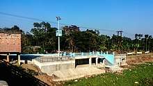
Nagarukhra Police Station[6] is a newly established Juridical administrative Police Department in Nagarukhra. This Police Station has jurisdiction over Nagarukhra and its neighbouring areas (except Haringhata Municipal areas). The New Police Station located on the bank of Jamuna River.
Electricity Board
The WBSEDCL (West Bengal State Electricity Distribution Company Limited) is responsible as a leading Power Utility services organization of the town. This Government based electricity company serves electric service to the entire town and households. It also serves electric connection to its neighbour localities. Nagarukhra wbsedcl CCC [7]is the Regional control office for WBSEDCL Customer Care.
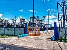
Nagarukhra 33/11 KV Substation is a power station, from where the entire town and its neighbours get electric supply.
Groundwater contamination
Ukrah is one of the areas where the groundwater is affected by arsenic contamination.[8]
Education
High schools
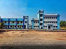
Ukrah has three Higher Secondary Schools.
_-_Wide_Angle_View.jpg)
- Nagarukhra High School is the oldest Higher Secondary school of this area.
.jpg)
- Nagarukhra Kshetra-Mohan Girls' High School is the Girls' Higher secondary school as well.
.jpg)
- Dighalgram Netaji Vidyapith is also a higher secondary school at Dighalgram, Nagarukhra-II.
These schools are undertaken by West Bengal Council of Higher Secondary Education[9]. except that there are many kindergarten schools are available in this region.
English medium school
Ukrah has an Elementary English Medium School, named as Michael Madhusudan English Medium Primary and Elementary School. This School is a Second State Govornment Affiliated English Medium Elementary School in Nadia District.[10]
Transport
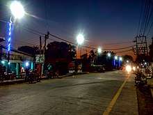
Kanchrapara - Nagarukhra - Bongaon Intercity Roadway [11] passing through Ukrah or Nagarukhra.This road is connected with National Highway 112 to the east, with National Highway 12 and Kalyani Expressway to the west directly.This road is also a shortest roadway to access the Petrapole-Bangladesh Border for Border Security Force and Indian Army. This road also connects many different villages and towns. This road is intersect with other three major roads in Nagarukhra, Ashoknagar-Kalyangarh Road intersection at near Town Kali Bari; Nimtala Road intersection at new market chowmatha crossing and Habra Road intersection at near Anandamoyee Kali Mandir Tinmatha More.
Bus services
Nagarukhra has various bus route services to connect with different places.
Private bus lines
- 22. Nagarukhra - Kanchrapara via Duttapara, Fatehpur, Haringhata, Barajaguli, BCKV, Mohanpur, Kampa Army Camp, KPA Station.
- 22. Nagarukhra - Kalyani via Duttapara, Fatehpur, Haringhata, Barajaguli, BSF Camp,7 No., AIIMS-Kalyani, Anandapur.
- 19B. Gaighata - Ranaghat via Jaleswar, Hanspur, Nagarukhra, Haringhata, Birohi, Chakdaha, Simurali, Ranaghat.
- 95. Bongaon - Ashoknagar via Gopalnagar, Palla, Nahata, Chowberia, Nimtala, Kasthadanga, Nagarukhra, Jhikra, Habra.
MN series
Bus transit without number
- Nagarukhra - Kolkata.
- Thakurnagar - Nabadwip Ghat.
- Thakurnagar - Kalna Ghat.
WBTC route line
Bus Terminals
- Public Bus Terminus:
Nagarukhra Public Bus Terminus (NPBT) is situated on North bank of Jamuna River(West Bengal), beside the Nagarukhra Police Station's Gate no.1. The bus depot was built up in 2016.
Air
Netaji Subhas Chandra Bose International Airport (IATA: CCU, ICAO: VECC) is the nearest airport. It is an international airport located in Kolkata, West Bengal, India, serving the Kolkata metropolitan area. The airport is located approximately 45 kilometres (28 mi) from Nagarukhra.
References
- "Nagarukhra town detail". Latlong.net.
- "Ukhra Weather Forecast". Accuweather.
- "Nagarukhra weather forecast". Yr - my location.
- "Census digital library". Census-2001. Retrieved 12 April 2004.
- "C1 Population by Religious Community". West Bengal. Register General and Census Commissioner, India. Retrieved 2 May 2017.
- "Nadia District is getting 23th Police Station in Nagarukhra, West Bengal". The Tribune Journal.
- "Tender for Nagarukhra WBSEDCL Construction". tenderdetail.com.
- "Groundwater arsenic contamination in West Bengal-India (20 years study)". SOES. Retrieved 25 March 2011.
- "WBCHSE Schools in Nadia Dist".
- "Nagarukhra is going to get an Elementary English medium school soon". The Tribune Journal.
- "Kanchrapara - Nagarukhra - Bongaon Highway - OpenstreetMap". OpenstreetMap.org.
External links
| Wikimedia Commons has media related to Category:Nagarukhra. |
![]()
Cities, towns and locations in Nadia District | |||||||||
|---|---|---|---|---|---|---|---|---|---|
| Cities, municipal and census towns |
| ||||||||
| Locations other than cities and towns |
| ||||||||
| Related topics |
| ||||||||