Uckerfelde
Uckerfelde is a municipality in the Uckermark district of Brandenburg, Germany.
Uckerfelde | |
|---|---|
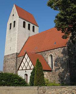 Church in Bietikow | |
Location of Uckerfelde within Uckermark district 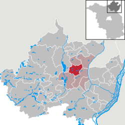 | |
 Uckerfelde  Uckerfelde | |
| Coordinates: 53°15′54″N 13°57′00″E | |
| Country | Germany |
| State | Brandenburg |
| District | Uckermark |
| Municipal assoc. | Gramzow |
| Government | |
| • Mayor | Manfred Endrunat |
| Area | |
| • Total | 45.93 km2 (17.73 sq mi) |
| Elevation | 78 m (256 ft) |
| Population (2018-12-31)[1] | |
| • Total | 952 |
| • Density | 21/km2 (54/sq mi) |
| Time zone | CET/CEST (UTC+1/+2) |
| Postal codes | 17291 |
| Dialling codes | 039858, 039861 |
| Vehicle registration | UM |
| Website | www.amtgramzow.de |
Demography
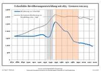
Development of population since 1875 within the current boundaries (Blue line: Population; Dotted line: Comparison to population development of Brandenburg state; Grey background: Time of Nazi rule; Red background: Time of communist rule)
|
|
|
gollark: Of course, xenowyrms are still better.
gollark: I have two other CB zyus, which would probably be enough to get one, but nobody seems to have a CB yellow and want to trade it.
gollark: Aaargh, why are there no trades available for yellow zyuus.
gollark: 1/110412.5.
gollark: They're probably worth more as hatchlinngs.
References
- "Bevölkerung im Land Brandenburg nach amtsfreien Gemeinden, Ämtern und Gemeinden 31. Dezember 2018". Amt für Statistik Berlin-Brandenburg (in German). July 2019.
- Detailed data sources are to be found in the Wikimedia Commons.Population Projection Brandenburg at Wikimedia Commons
Towns and municipalities in Uckermark | ||
|---|---|---|
| Coat of Arms of Uckermark district | |
This article is issued from Wikipedia. The text is licensed under Creative Commons - Attribution - Sharealike. Additional terms may apply for the media files.