U.S. Route 77 in Kansas
U.S. Route 77 (US-77) is a part of the U.S. Highway System that runs from the Veteran's International Bridge in Brownsville, Texas north to Interstate 29 (I-29) in Sioux City, Iowa. In the U.S. state of Kansas, US-77 is a main north–south highway that runs from the Oklahoma border north to the Nebraska border.
| ||||
|---|---|---|---|---|
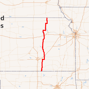
US-77 highlighted in red | ||||
| Route information | ||||
| Maintained by KDOT | ||||
| Existed | 1927[1]–present | |||
| Major junctions | ||||
| South end | ||||
| ||||
| North end | ||||
| Location | ||||
| Counties | Cowley, Butler, Marion, Dickinson, Morris, Geary, Riley, Marshall | |||
| Highway system | ||||
| ||||

Route description
US 77 runs for 234 miles (377 km) in Kansas. Between the US 40 junction and the Cowley County line is designated as a Blue Star Memorial Highway. In Cowley County, it is the Robert B. Docking Memorial Highway. Near Arkansas City it is the Walnut Valley Greenway.[2]
From Nebraska to US 24 and from K-15 to Arkansas City, it is part of the National Highway System.
History
US-77 was established in Kansas by 1927.[1]
Major intersections
| County | Location | mi[3] | km | Destinations | Notes |
|---|---|---|---|---|---|
| Cowley | | 0.000 | 0.000 | Continuation into Oklahoma | |
| Arkansas City | Southern end of US-166 overlap | ||||
| | Northern end of US-166 overlap | ||||
| | Western terminus of K-360 | ||||
| Winfield | Southern end of K-15 overlap | ||||
| | Northern end of K-15 overlap | ||||
| Butler | Augusta | Southern end of US-54 and US-400 overlap | |||
| | Northern end of US-400 overlap | ||||
| | Northern end of US-54 overlap; eastern terminus of K-254 | ||||
| | Northern end of US-50 and US-56 overlap | ||||
| | I-35 and Kansas Turnpike exit 76 | ||||
| Marion | Florence | ||||
| | Eastern terminus of K-256 | ||||
| | Southern end of US-56 overlap; western terminus of K-150; roundabout | ||||
| Dickinson | | Western terminus of US-56 Business | |||
| | Northern end of US-56 overlap; eastern terminus of US-56 Business | ||||
| Dickinson–Morris county line | | ||||
| Morris | | Eastern terminus of K-209 | |||
| Geary | | Eastern terminus of K-157 | |||
| Junction City | I-70 exit 295; southern end of K-18 overlap | ||||
| | Northern end of K-18 overlap | ||||
| | |||||
| | Northern terminus of K-57 | ||||
| | Southern end of K-82 overlap | ||||
| Riley | | Northern end of K-82 overlap | |||
| Riley | Southern end of US-24 overlap | ||||
| | Northern end of US-24 overlap | ||||
| | Western terminus of K-16 | ||||
| Marshall | Waterville | Southern end of K-9 overlap | |||
| | Southern end of K-9 overlap | ||||
| Marysville | Southern end of US-36 overlap | ||||
| | Northern end of US-36 overlap | ||||
| | Northern terminus of K-57 | ||||
| | Continuation into Nebraska | ||||
1.000 mi = 1.609 km; 1.000 km = 0.621 mi
| |||||
gollark: Cosplay as an omnipotent being, obviously.
gollark: (this is technically considered a card game)
gollark: Muahahahaha, I will now steal your identity.
gollark: https://xkcd.com/1439/
gollark: According to XKCD, they're already compatible with bees.
See also


References
- Rand McNally and Company (1927). "Kansas" (Map). Rand McNally Auto Road Atlas of the United States and Ontario, Quebec, and the Maritime Provinces of Canada, with a Brief Description of the National Parks and Monuments. 1:1,600,000. Chicago: Rand McNally and Company. pp. 54–55. OCLC 2078375. Retrieved July 27, 2020 – via Rumsey Collection.
- Kennedy, Richie. Kansas Highways Routelog. Route56. URL accessed March 6, 2007.
- Staff (2016). "Pavement Management Information System". Kansas Department of Transportation. Retrieved April 21, 2017.
This article is issued from Wikipedia. The text is licensed under Creative Commons - Attribution - Sharealike. Additional terms may apply for the media files.