K-150 (Kansas highway)
K-150 is a 16.645-mile-long (26.788 km) east–west state highway in the U.S. state of Kansas. The route links U.S. Route 56 (US-56) and US-77 northeast of Marion with US-50 west of Elmdale. It runs through the Flint Hills region of Kansas, and is a two-lane road its entire length. There are no cities or towns along the road, but it provides a direct link for traffic from Marion, Hillsboro, McPherson and points west to Emporia and the Kansas Turnpike.[3][4]
| ||||
|---|---|---|---|---|
%26groups%3D_b58582bf848a8eb7a052af2f6df3b623e697f01a.svg)
K-150 highlighted in red | ||||
| Route information | ||||
| Maintained by KDOT | ||||
| Length | 16.645 mi[1] (26.788 km) | |||
| Existed | July 1, 1937[2]–present | |||
| Major junctions | ||||
| West end | ||||
| East end | ||||
| Location | ||||
| Counties | Marion, Chase | |||
| Highway system | ||||
| ||||

K-150 was first designated a state highway in a July 1, 1937 meeting, and its alignment has not been changed since. In 2015, the western terminus was upgraded to a roundabout.
Route description
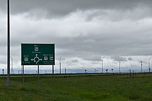
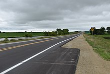
The route begins at a roundabout intersection with US-56 and US-77, at the southern end of their concurrency. From there, the route heads straight east through farmland, and after about 2.8 miles (4.5 km) crosses Martin Creek. Just past the creek the route intersects Yarrow Road, as it passes by a couple farmhouses. It then intersects Zebulon Road and then Alfalfa Road, passing by Grant Cemetery in between. The highway continues two miles (3.2 km) past here then intersects Clover Road. After an intersection with Clover Road, the fields around the highway turn into grassland as K-150 continues east, and enters into Chase County one mile (1.6 km) later. As K-150 enters the county, it soon intersects C Road, then crosses Silver Creek 1.4 miles (2.3 km) later. It continues 3.5 miles (5.6 km) through grasslands then crosses Gould Creek. The road then ends 2.7 miles (4.3 km) later at US-50, which runs diagonally, south of Elmdale.[5][6]
The Kansas Department of Transportation (KDOT) tracks the traffic levels on its highways, and in 2018, they determined that on average the traffic varied from 1490 vehicles near each terminus.[7] K-150 is not included in the National Highway System.[8] The National Highway System is a system of highways important to the nation's defense, economy, and mobility. K-150 does connect to the National Highway System at its eastern and western terminus.[9]
History
Early roads
Before state highways were numbered in Kansas there were Auto trails, which were an informal network of marked routes that existed in the United States and Canada in the early part of the 20th century. The western terminus of K-150 connected to the Old Santa Fe Trail, South West Trail, National Old Trails Road and Kansas-Oklahoma-Texas Highway. The eastern terminus connected to the New Santa Fe Trail.[10]
Establishment and realignments
.jpg)
K-150 was first designated a state highway in a July 1, 1937 resolution and at that time ran from US-50N and US-77 eastward to US-50S.[2] It was first noted on the 1937 Kansas state roadmap. On June 27, 1956, the AASHO Route Numbering Committee approved US 56, between Springer, New Mexico, and Kansas City, Missouri. At this time US-50N was renumbered to US-56 and US-50S was renumbered to US-50.[11]
The route has changed little, but in August 2001, work began on a $17.5 million (equivalent to $25.3 million in 2020) project to reconstruct the entire length of K-150. New bridges were built, asphalt shoulders were added and the sight distances were improved. Work was completed by August 2003 by Wittwer, Inc., Affiliates.[12] Construction on the $5.416 million (equivalent to $5.84 million in 2020) enhanced roundabout at the western terminus began in June 2015. The roundabout was enhanced by leaving in place the shooflies that were installed to take traffic around the site during construction. This allows oversized trucks that wouldn't fit on the roundabout to pass.[13][14] K-150 was closed from early September 2015, to late December 2015, and traffic was detoured south along US-77 to make room for construction on that section of the roundabout.[15]
Until recently, there was another K-150 which ran from K-7 in Olathe eastward to the Missouri border, where it became Route 150. But when Olathe and Overland Park annexed the land around K-150, the highway was decommissioned, since it would have run entirely through city limits, which is against Kansas law.
Major intersections
| County | Location | mi[1] | km | Destinations | Notes |
|---|---|---|---|---|---|
| Marion | Centre Township | 0.000 | 0.000 | Western terminus; roundabout | |
| Chase | Diamond Creek Township | 16.645 | 26.788 | Eastern terminus | |
| 1.000 mi = 1.609 km; 1.000 km = 0.621 mi | |||||
References
- Staff (2016). "Pavement Management Information System". Kansas Department of Transportation. Retrieved April 23, 2017.
- State Highway Commission of Kansas (July 1, 1937). "Resolution establishing a road in Marion and Chase Counties". Topeka: State Highway Commission of Kansas. Retrieved September 11, 2019.
- KDOT (2010). 2010 Marion County Map (PDF) (Map). Scale not given. Topeka: KDOT. Retrieved September 11, 2019.
- KDOT (2009). 2009 Chase County Map (PDF) (Map). Scale not given. Topeka: KDOT. Retrieved September 11, 2019.
- Google (April 4, 2011). "K-150" (Map). Google Maps. Google. Retrieved April 4, 2011.
- Official State Transportation Map (Map) (2007-2008 ed.). Kansas Department of Transportation. § F9.
- Bureau of Transportation Planning (2018). Traffic Flow Map Kansas State Highway System (PDF) (Map). [c. 1:1,584,000]. Topeka: Kansas Department of Transportation. Retrieved September 11, 2019.
- Federal Highway Administration (May 8, 2019). National Highway System: Kansas (PDF) (Map). [c. 1:3,900,000]. Federal Highway Administration. Retrieved September 11, 2019.
- Natzke, Stefan; Neathery, Mike; Adderly, Kevin (September 26, 2012). "What is the National Highway System?". National Highway System. Federal Highway Administration. Retrieved September 11, 2019.
- Rand McNally and Company (1924). "Kansas" (Map). AutoTrails Map, Southern Nebraska, Eastern Colorado, Kansas, Northeastern New Mexico, Northern Oklahoma. 1:1,600,000. Chicago: Rand McNally and Company. OCLC 2078375. Retrieved August 7, 2020 – via Rumsey Collection.
- Oklahoma Department of Transportation, Chronological History Documentation: US 56 (correspondence between ODOT, AASHO, and other DOTs)
- Kansas Department of Transportation (March 2002). "Highway projects are in full swing across Kansas" (PDF). Topeka: www.ksdot.org. Retrieved August 8, 2020.
- John Green (May 8, 2015). "Unique U.S. 56 roundabout set". Topeka: hutchnews.com. Retrieved September 11, 2019.
- John Green (March 12, 2018). "KDOT awards $5 mil contract for St. John roundabout". Topeka: hutchnews.com. Retrieved September 11, 2019.
- salina.com (September 3, 2015). "Work on Marion County roundabout to enter second phase". Topeka: salina.com. Retrieved September 11, 2019.
External links
- Kansas Highway Maps: Current, Historic, KDOT
- Kansas Highways Routelog