Tzucacab Municipality
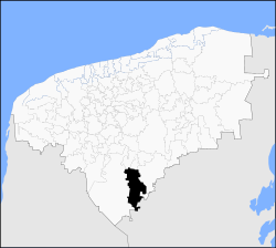
Tzucacab Municipality is one of the 106 subdivisions of the State of Yucatán in Mexico. Its municipal seat is located in the City of Tzucacab.
Tzucacab | |
|---|---|
Municipality | |
 Location of the Municipality | |
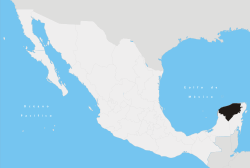
 Tzucacab Location of the Municipality in Mexico | |
| Coordinates: 20°04′N 89°02′W | |
| Country | |
| State | |
| Mexico Ind. | 1821 |
| Yucatan Est. | 1824 |
| Municipality Est. | 1918 [1] |
| Government | |
| • Municipal President | Efren Estrada Mario Camara[1] |
| Area | |
| • Total | 1,289 km2 (498 sq mi) |
| [1] | |
| Elevation | 36 m (118 ft) |
| Population | |
| • Total | 13,564 |
| Time zone | UTC-6 (Central Standard Time) |
| • Summer (DST) | UTC-5 (Central Daylight Time) |
| INEGI Code | 098 |
| Major Airport | Merida (Manuel Crescencio Rejón) International Airport |
| IATA Code | MID |
| ICAO Code | MMMD |
Location
Tzucacab Municipality is located in the southern region of the state and falls between latitudes 19° 38' and 20° 09' north and longitudes 88° 59' and 89° 14' west.[1]
Climate
| Climate data for Tzucacab | |||||||||||||
|---|---|---|---|---|---|---|---|---|---|---|---|---|---|
| Month | Jan | Feb | Mar | Apr | May | Jun | Jul | Aug | Sep | Oct | Nov | Dec | Year |
| Average high °C (°F) | 29.6 (85.3) |
31.7 (89.1) |
33.1 (91.6) |
35 (95) |
35.9 (96.6) |
34.5 (94.1) |
33.8 (92.8) |
34.0 (93.2) |
33.3 (91.9) |
32.0 (89.6) |
30.5 (86.9) |
30 (86) |
33 (91) |
| Average low °C (°F) | 15.2 (59.4) |
15.9 (60.6) |
17.0 (62.6) |
18.2 (64.8) |
20.3 (68.5) |
20.5 (68.9) |
19.7 (67.5) |
19.7 (67.5) |
19.9 (67.8) |
19.2 (66.6) |
17.3 (63.1) |
16 (61) |
18.3 (64.9) |
| Average precipitation mm (inches) | 36 (1.4) |
36 (1.4) |
28 (1.1) |
58 (2.3) |
97 (3.8) |
180 (7.2) |
180 (7) |
180 (7.2) |
190 (7.6) |
140 (5.4) |
61 (2.4) |
56 (2.2) |
1,200 (49) |
| Source: Weatherbase [4] | |||||||||||||
Communities
The municipality is made up of 40 different communities, of which the most important are:[1]
- Tzucacab (Municipal Seat)
- Catmis
- Ekbalam
- Corral
- Noh-Bec
Architectural landmarks
The Church of St. Francis Xavier, located in the municipal seat Tzucacab, dates back to the colonial era.[1]
gollark: Oh, exciting!
gollark: Please DM me the text.
gollark: I can use my alt.
gollark: Link?
gollark: I can write it for you?
References
- "Nuestros municipios - Tzucacab". Retrieved 2009-11-11.
- "Encyclopedia of the Municipalities of Mexico: Yucatan". Archived from the original on 2008-11-20. Retrieved 2009-11-01.
- Census Results by Locality, 2005 Archived 2011-07-22 at the Wayback Machine INEGI.
- "Weatherbase: Historical Weather for Tzucacab, Yucatán". Weatherbase. 2011. Retrieved on November 24, 2011.
This article is issued from Wikipedia. The text is licensed under Creative Commons - Attribution - Sharealike. Additional terms may apply for the media files.
