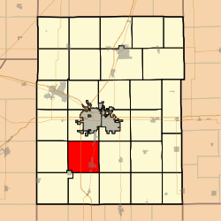
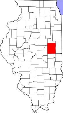
Tolono Township, Champaign County, Illinois
Tolono Township is a township in Champaign County, Illinois, USA. As of the 2010 census, its population was 5,270 and it contained 2,300 housing units.[2]
Tolono Township | |
|---|---|
 Location in Champaign County | |
 Champaign County's location in Illinois | |
| Coordinates: 40°01′04″N 88°17′55″W | |
| Country | United States |
| State | Illinois |
| County | Champaign |
| Established | November 8, 1859 |
| Area | |
| • Total | 35.63 sq mi (92.3 km2) |
| • Land | 35.61 sq mi (92.2 km2) |
| • Water | 0.02 sq mi (0.05 km2) 0.06% |
| Elevation | 715 ft (218 m) |
| Population (2010) | |
| • Estimate (2016)[1] | 5,412 |
| • Density | 148/sq mi (57/km2) |
| Time zone | UTC-6 (CST) |
| • Summer (DST) | UTC-5 (CDT) |
| FIPS code | 17-019-75627 |
Geography
Tolono is Township 18 North, Range 8 East of the Third Principal Meridian.
According to the 2010 census, the township has a total area of 35.63 square miles (92.3 km2), of which 35.61 square miles (92.2 km2) (or 99.94%) is land and 0.02 square miles (0.052 km2) (or 0.06%) is water.[2] The stream of Page Run runs through this township.
Cemeteries
The township contains eight cemeteries: Bailey Memorial, Barnett, Bartley, Battershell, Beckman, Prairieview, Saint Marys and Saint Patrick.
Churches
Prairieview Church (Section 3) adjacent to Prairieview Cemetery is no longer standing.
Grain elevators
Tolono elevator (Section 26) was built along the Wabash—Norfolk Southern railroad. Operated by Tolono Mill and Elevator in 1913; V.L. Horton in 1929; Grand Prairie Coop Inc. in 2000.
Major highways
Airports and landing strips
Demographics
| Historical population | |||
|---|---|---|---|
| Census | Pop. | %± | |
| Est. 2016 | 5,412 | [1] | |
| U.S. Decennial Census[3] | |||
References
- "Tolono Township, Champaign County, Illinois". Geographic Names Information System. United States Geological Survey. Retrieved 2010-01-04.
- United States Census Bureau cartographic boundary files
- "Population and Housing Unit Estimates". Retrieved June 9, 2017.
- "Population, Housing Units, Area, and Density: 2010 - County -- County Subdivision and Place -- 2010 Census Summary File 1". United States Census. Archived from the original on 2020-02-12. Retrieved 2013-05-28.
- "Census of Population and Housing". Census.gov. Retrieved June 4, 2016.