Philo Township, Champaign County, Illinois
Philo Township is a township in Champaign County, Illinois, USA. As of the 2010 census, its population was 1,954 and it contained 756 housing units.[2]
Philo Township | |
|---|---|
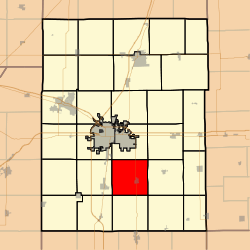 Location in Champaign County | |
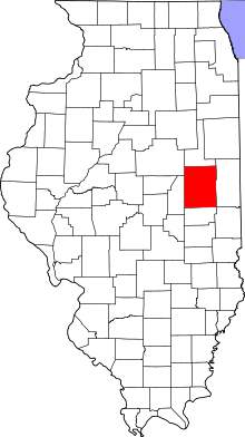 Champaign County's location in Illinois | |
| Coordinates: 40°00′38″N 88°10′55″W | |
| Country | United States |
| State | Illinois |
| County | Champaign |
| Established | November 8, 1859 |
| Area | |
| • Total | 36.66 sq mi (94.9 km2) |
| • Land | 36.66 sq mi (94.9 km2) |
| • Water | 0 sq mi (0 km2) 0% |
| Elevation | 682 ft (208 m) |
| Population (2010) | |
| • Estimate (2016)[1] | 1,927 |
| • Density | 53.3/sq mi (20.6/km2) |
| Time zone | UTC-6 (CST) |
| • Summer (DST) | UTC-5 (CDT) |
| FIPS code | 17-019-59546 |
History
Philo Township changed its name from Hale Township on April 30, 1860.
Geography
Philo is Township 18 North, Range 9 East of the Third Principal Meridian.
According to the 2010 census, the township has a total area of 36.66 square miles (94.9 km2), all land.[2]
Cities and towns
Cemeteries
The township contains five cemeteries: Calvary, Captain Davidson, Champain County Poor Farm, Locust Grove and Loeffler.
Grain elevators
Philo elevator (Section 22) was built along the Wabash—Norfolk Southern railroad.
Major highways

Demographics
| Historical population | |||
|---|---|---|---|
| Census | Pop. | %± | |
| Est. 2016 | 1,927 | [1] | |
| U.S. Decennial Census[3] | |||
gollark: It's on the "Evidence Based Medicine Consultancy" website, which is linked from that article.
gollark: Your article says that it's just someone petitioning to do that, and their website has this delightful content.
gollark: If UK health authorities had actually called for stopping COVID-19 vaccine use, then yes, this would be worrying.
gollark: Because it became a political issue currently.
gollark: That still doesn't fix the data apparently being bad and open-submission.
References
- "Philo Township, Champaign County, Illinois". Geographic Names Information System. United States Geological Survey. Retrieved 2010-01-04.
- United States Census Bureau cartographic boundary files
- "Population and Housing Unit Estimates". Retrieved June 9, 2017.
- "Population, Housing Units, Area, and Density: 2010 - County -- County Subdivision and Place -- 2010 Census Summary File 1". United States Census. Archived from the original on 2020-02-12. Retrieved 2013-05-28.
- "Census of Population and Housing". Census.gov. Retrieved June 4, 2016.
External links
Places adjacent to Philo Township, Champaign County, Illinois | |
|---|---|
Municipalities and communities of Champaign County, Illinois, United States | ||
|---|---|---|
| Cities | Map of Illinois highlighting Champaign County | |
| Villages | ||
| Townships | ||
| CDPs | ||
| Other unincorporated communities | ||
| Ghost town | ||
| Footnotes | ‡This populated place also has portions in an adjacent county or counties | |
This article is issued from Wikipedia. The text is licensed under Creative Commons - Attribution - Sharealike. Additional terms may apply for the media files.