Compromise Township, Champaign County, Illinois
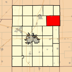
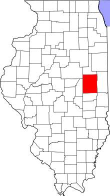
Compromise Township is a township in Champaign County, Illinois, USA. As of the 2010 census, its population was 1,463 and it contained 634 housing units.[2]
Compromise Township | |
|---|---|
 Location in Champaign County | |
 Champaign County's location in Illinois | |
| Coordinates: 40°15′57″N 88°00′46″W | |
| Country | United States |
| State | Illinois |
| County | Champaign |
| Area | |
| • Total | 47.75 sq mi (123.7 km2) |
| • Land | 47.75 sq mi (123.7 km2) |
| • Water | 0 sq mi (0 km2) 0% |
| Elevation | 709 ft (216 m) |
| Population (2010) | |
| • Estimate (2016)[1] | 1,550 |
| • Density | 30.6/sq mi (11.8/km2) |
| Time zone | UTC-6 (CST) |
| • Summer (DST) | UTC-5 (CDT) |
| FIPS code | 17-019-15976 |
History
Compromise Township formed from parts of Kerr Township and Rantoul Township on an unknown date.
Geography
Compromise is Township 21 North, parts of Ranges 10 and 11 East of the Third Principal Meridian and part of Range 14 West of the Second Principal Meridian.
According to the 2010 census, the township has a total area of 47.75 square miles (123.7 km2), all land.[2]
Cities and towns
- Gifford (south three-quarters)
Unincorporated towns
(This list is based on USGS data and may include former settlements.)
Cemeteries
The township contains five cemeteries: Huls, Kopman, Leal Park, Saint Lawrence and Welles.
Major highways
Airports and landing strips
- Busboom Airport
Demographics
| Historical population | |||
|---|---|---|---|
| Census | Pop. | %± | |
| Est. 2016 | 1,550 | [1] | |
| U.S. Decennial Census[3] | |||
gollark: He doesn't seem to have done anything very recruitery or bad yet.
gollark: > start learning some coding styro, i want some what normal people hereSoon: laser drone swarms flying around Illinois.
gollark: You could just *pretend* to delete it but really lock it to everyone.
gollark: You could probably cover most of the simpler questions with stuff like where you can buy good lasers and safety goggles, some basic information on colors/wavelengths, and safety stuff.
gollark: Maybe it would also be useful to have a "laser basics FAQ".
References
- "Compromise Township, Champaign County, Illinois". Geographic Names Information System. United States Geological Survey. Retrieved 2010-01-04.
- United States Census Bureau cartographic boundary files
- Illinois State Archives
- "Population and Housing Unit Estimates". Retrieved June 9, 2017.
- "Population, Housing Units, Area, and Density: 2010 - County -- County Subdivision and Place -- 2010 Census Summary File 1". United States Census. Archived from the original on 2020-02-12. Retrieved 2013-05-28.
- "Census of Population and Housing". Census.gov. Retrieved June 4, 2016.
External links
This article is issued from Wikipedia. The text is licensed under Creative Commons - Attribution - Sharealike. Additional terms may apply for the media files.