Tilney All Saints
Tilney All Saints is a civil parish in the English county of Norfolk. It covers an area of 11.56 km2 (4.46 sq mi) and had a population of 563 in 230 households at the 2001 census,[1] increasing to 573 at the 2011 Census.[2] For the purposes of local government, it falls within the district of King's Lynn and West Norfolk.
| Tilney All Saints | |
|---|---|
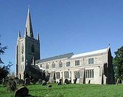 All Saints, Tilney All Saints | |
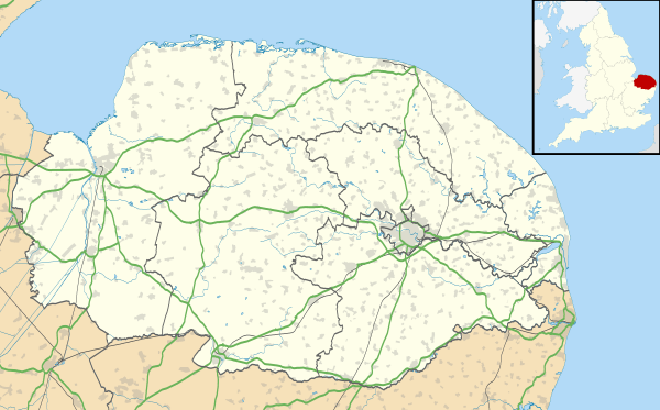 Tilney All Saints Location within Norfolk | |
| Area | 11.56 km2 (4.46 sq mi) |
| Population | 573 (2011) |
| • Density | 50/km2 (130/sq mi) |
| OS grid reference | TF567181 |
| Civil parish |
|
| District | |
| Shire county | |
| Region | |
| Country | England |
| Sovereign state | United Kingdom |
| Post town | KING'S LYNN |
| Postcode district | PE34 |
| Police | Norfolk |
| Fire | Norfolk |
| Ambulance | East of England |
Notes
- Census population and household counts for unparished urban areas and all parishes Archived 2017-02-11 at the Wayback Machine. Office for National Statistics & Norfolk County Council (2001). Retrieved 20 June 2009.
- "Civil Parish population 2011". Retrieved 29 August 2015.
gollark: I think the basic idea is that while rolling a single die results in each result having the same probability, with multiple dice more than one different individual roll combinations can add up to some results. So the distribution is spikier.
gollark: I don't. I just made a convenient thing to graph the probability of rolling each number a while ago.
gollark: How much of it, anyway?
gollark: Not sure that needs a ping...
gollark: I mean, they are newish features, but I'm not sure they're interesting enough to be worth an entirely new purchase vs KSP 1, with its mods.
External links
![]()
| Authority control |
|
|---|
This article is issued from Wikipedia. The text is licensed under Creative Commons - Attribution - Sharealike. Additional terms may apply for the media files.