Thropton
Thropton is a small village in Northumberland, England, situated about 2 miles (3.2 km) west of Rothbury near the junction of the Wreigh Burn and the River Coquet. In the village is a fine bridge over the Wreigh Burn which was built in 1811. There is a haugh to the south of the village, and imposing views of Simonside, a long low crag south of the Coquet that runs between Rothbury and Thropton.
| Thropton | |
|---|---|
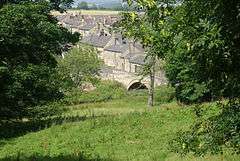 Thropton Bridge | |
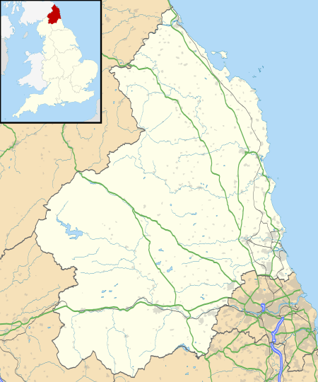 Thropton Location within Northumberland | |
| Population | 458 (2011 census)[1] |
| OS grid reference | NU027023 |
| Unitary authority | |
| Ceremonial county | |
| Region | |
| Country | England |
| Sovereign state | United Kingdom |
| Post town | MORPETH |
| Postcode district | NE65 |
| Dialling code | 01669 |
| Police | Northumbria |
| Fire | Northumberland |
| Ambulance | North East |
| UK Parliament | |
Amenities
There is a sub post office with a small village shop selling general provisions including fresh fruit and vegetables. A wider range of shops and facilities is available at Rothbury or further afield.
Thropton has two pubs: the Cross Keys and the Three Wheat Heads. The Three Wheat Heads is a 300-year-old coaching inn.
Landmarks
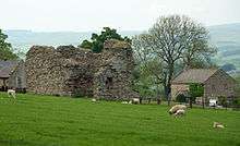
A little over a mile to the south of the village are the ruins of Great Tosson Tower, a pele tower probably built in the late fifteenth century and later used as part of a system of watch towers designed to curb the activities of the Border Reivers.[2][3]
Transport links
Thropton is the terminus for the X14 Thropton - Rothbury - Morpeth bus which is a lifeline to the rural community, with many services continuing towards Newcastle upon Tyne. It is currently operated by Arriva Northumbria and was formerly operated by Go North East.
References
- "Parish population 2011". Retrieved 1 July 2015.
- Tosson Tower at Pastscape
- Tosson Tower at Northumberland National Park Website Archived 2011-07-14 at the Wayback Machine