Tauriac-de-Camarès
Tauriac-de-Camarès is a commune in the Aveyron department in the Occitanie region in southern France.
Tauriac-de-Camarès | |
|---|---|
Location of Tauriac-de-Camarès 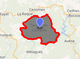
| |
 Tauriac-de-Camarès  Tauriac-de-Camarès | |
| Coordinates: 43°46′51″N 3°01′51″E | |
| Country | France |
| Region | Occitanie |
| Department | Aveyron |
| Arrondissement | Millau |
| Canton | Causses-Rougiers |
| Intercommunality | Rougier de Camarès |
| Government | |
| • Mayor (2008–2014) | Jean-Marc Nègre |
| Area 1 | 24.75 km2 (9.56 sq mi) |
| Population (2017-01-01)[1] | 41 |
| • Density | 1.7/km2 (4.3/sq mi) |
| Time zone | UTC+01:00 (CET) |
| • Summer (DST) | UTC+02:00 (CEST) |
| INSEE/Postal code | 12275 /12360 |
| Elevation | 467–905 m (1,532–2,969 ft) (avg. 510 m or 1,670 ft) |
| 1 French Land Register data, which excludes lakes, ponds, glaciers > 1 km2 (0.386 sq mi or 247 acres) and river estuaries. | |
Population
| Year | Pop. | ±% |
|---|---|---|
| 1962 | 112 | — |
| 1968 | 99 | −11.6% |
| 1975 | 82 | −17.2% |
| 1982 | 73 | −11.0% |
| 1990 | 56 | −23.3% |
| 1999 | 64 | +14.3% |
| 2008 | 58 | −9.4% |
gollark: ... is that an <:illum:531316942443642880> on there?
gollark: How do you derive the rules and what do you mean by "branches on the picture"?
gollark: I don't know how to actually implement the thing it says about identifying things uniquely by "a sequence of numbers which says where to turn at each intersection", since it seems like you'd need a way to convert them into a unique/canonical form for that to actually work.
gollark: I looked at that, yes.
gollark: I just picked it several years ago because it looked cool.
See also
References
- "Populations légales 2017". INSEE. Retrieved 6 January 2020.
| Wikimedia Commons has media related to Tauriac-de-Camarès. |
| Authority control |
|
|---|
This article is issued from Wikipedia. The text is licensed under Creative Commons - Attribution - Sharealike. Additional terms may apply for the media files.