Sainte-Juliette-sur-Viaur
Sainte-Juliette-sur-Viaur is a commune in the Aveyron department in southern France.
Sainte-Juliette-sur-Viaur | |
|---|---|
Location of Sainte-Juliette-sur-Viaur 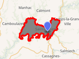
| |
 Sainte-Juliette-sur-Viaur  Sainte-Juliette-sur-Viaur | |
| Coordinates: 44°12′55″N 2°31′20″E | |
| Country | France |
| Region | Occitanie |
| Department | Aveyron |
| Arrondissement | Villefranche-de-Rouergue |
| Canton | Monts du Réquistanais |
| Intercommunality | Cassagnes-Bégonhès |
| Government | |
| • Mayor (2008–2014) | Véronique Lacueva |
| Area 1 | 16.71 km2 (6.45 sq mi) |
| Population (2017-01-01)[1] | 598 |
| • Density | 36/km2 (93/sq mi) |
| Time zone | UTC+01:00 (CET) |
| • Summer (DST) | UTC+02:00 (CEST) |
| INSEE/Postal code | 12234 /12120 |
| Elevation | 394–650 m (1,293–2,133 ft) (avg. 602 m or 1,975 ft) |
| 1 French Land Register data, which excludes lakes, ponds, glaciers > 1 km2 (0.386 sq mi or 247 acres) and river estuaries. | |
Population
| Year | Pop. | ±% |
|---|---|---|
| 1962 | 404 | — |
| 1968 | 468 | +15.8% |
| 1975 | 455 | −2.8% |
| 1982 | 456 | +0.2% |
| 1990 | 409 | −10.3% |
| 1999 | 441 | +7.8% |
| 2008 | 514 | +16.6% |
gollark: ++magic sql INSERT INTO marriages (e1, e2, information, married_at) VALUES ('<@!330678593904443393>', 'foxes (the species)', 'platonic unidirectional marriage', strftime('%s', 'now'));
gollark: Okay!
gollark: You are NOT getting that access because I do not know how to secure arbitrary SQL commands.
gollark: Or marriages to inanimate objects.
gollark: We can do unidirectional marriages.
See also
References
- "Populations légales 2017". INSEE. Retrieved 6 January 2020.
| Wikimedia Commons has media related to Sainte-Juliette-sur-Viaur. |
| Authority control |
|
|---|
This article is issued from Wikipedia. The text is licensed under Creative Commons - Attribution - Sharealike. Additional terms may apply for the media files.