Castanet, Aveyron
Castanet is a commune in the Aveyron department in southern France.
Castanet | |
|---|---|
Location of Castanet 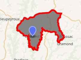
| |
 Castanet  Castanet | |
| Coordinates: 44°16′44″N 2°17′27″E | |
| Country | France |
| Region | Occitanie |
| Department | Aveyron |
| Arrondissement | Villefranche-de-Rouergue |
| Canton | Ceor-Ségala |
| Intercommunality | Pays Baraquevillois |
| Government | |
| • Mayor (2008–2014) | Claude Bou |
| Area 1 | 30.42 km2 (11.75 sq mi) |
| Population (2017-01-01)[1] | 513 |
| • Density | 17/km2 (44/sq mi) |
| Time zone | UTC+01:00 (CET) |
| • Summer (DST) | UTC+02:00 (CEST) |
| INSEE/Postal code | 12059 /12240 |
| Elevation | 436–744 m (1,430–2,441 ft) (avg. 680 m or 2,230 ft) |
| 1 French Land Register data, which excludes lakes, ponds, glaciers > 1 km2 (0.386 sq mi or 247 acres) and river estuaries. | |
Population
| Year | Pop. | ±% |
|---|---|---|
| 1962 | 682 | — |
| 1968 | 802 | +17.6% |
| 1975 | 734 | −8.5% |
| 1982 | 656 | −10.6% |
| 1990 | 591 | −9.9% |
| 1999 | 524 | −11.3% |
| 2007 | 573 | +9.4% |
gollark: I've just set up the osmarks.tk april fools' joke.
gollark: ++delete uniceland
gollark: ++list_deleted
gollark: ++delete that deletion
gollark: ++delete deletion
See also
References
- "Populations légales 2017". INSEE. Retrieved 6 January 2020.
| Wikimedia Commons has media related to Castanet (Aveyron). |
| Authority control |
|
|---|
This article is issued from Wikipedia. The text is licensed under Creative Commons - Attribution - Sharealike. Additional terms may apply for the media files.