Tanza–Trece Martires Road
The Tanza–Trece Martires Road (or Tanza–Trece Martires Highway) is a 12.559-kilometre (7.804 mi), two-to-four lane, primary highway in Cavite, Philippines.[1] It connects the municipality of Tanza to the city of Trece Martires.
| |
|---|---|
| Tanza–Trece Martires Highway | |
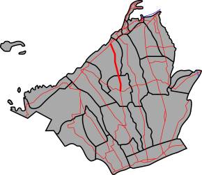 Route alignment of Tanza–Trece Martires Road | |
 The highway in Trece Martires | |
| Route information | |
| Maintained by Department of Public Works and Highways (DPWH) - Cavite 1st District Engineering Office | |
| Length | 12.559 km (7.804 mi) |
| Component highways | |
| Major junctions | |
| North end | |
| South end | |
| Location | |
| Provinces | Cavite |
| Major cities | Trece Martires |
| Towns | Tanza |
| Highway system | |
| |
.svg.png)

The entire road is designated as a component of National Route 64 (N64) of the Philippine highway network.
Intersections
The entire route is located in Cavite. Intersections are numbered by kilometer posts, with Rizal Park in Manila designated as kilometer zero.
| City/Municipality | km | mi | Destinations | Notes | |
|---|---|---|---|---|---|
| Tanza | 33.698 | 20.939 | Northern terminus. Continues north as | ||
| 42.000 | 26.098 | Route 64 reassurance sign | |||
| 39.691 | 24.663 | Punta Bridge | |||
| Trece Martires | 47.000 | 29.204 | Trece Martires kilometer zero | ||
| 47.148 | 29.296 | Southern terminus; Continues south as | |||
| 1.000 mi = 1.609 km; 1.000 km = 0.621 mi | |||||
gollark: Well, it boots off an EEPROM now, which loads a micro-SD card.
gollark: It just boots off a micro-SD card.
gollark: Strictly speaking, no.
gollark: It's the right order of magnitude, I think.
gollark: I have nginx on a 3B with 1GB of RAM, it's fine.
References
- "Cavite". www.dpwh.gov.ph. Retrieved 2018-01-09.
External links
| Expressways |
| ||||||||
|---|---|---|---|---|---|---|---|---|---|
| National roads |
| ||||||||
| Arterial Routes |
| ||||||||
This article is issued from Wikipedia. The text is licensed under Creative Commons - Attribution - Sharealike. Additional terms may apply for the media files.