Tanners Falls, Pennsylvania
Tanners Falls is a village in Dyberry Township, Wayne County, Pennsylvania, in the Lake Region of the Poconos.
Tanners Falls, Pennsylvania | |
|---|---|
| Village of Tanners Falls | |
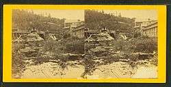
 The Tanners' Falls near the confluence of the East and West Branches of the Dyberry Creek, in Tanners Falls. | |
| Nickname(s): | |
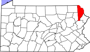
 Tanners Falls, Pennsylvania Tanners Falls' Location within Pennsylvania. | |
| Coordinates: 41°39′39″N 75°17′18″W | |
| Country | United States |
| State | Pennsylvania |
| U.S. Congressional District | PA-10 |
| School District | Wayne Highlands Region II |
| County | Wayne |
| Magisterial District | 22-3-04[3] |
| Township | Dyberry |
| Settled | c. 1830[1] |
| Founded by | Jason Torrey[1] |
| Named for | Tanners' Falls (water feature) |
| Elevation | 1,043[4] ft (318 m) |
| Time zone | UTC-5 (Eastern (EST)) |
| • Summer (DST) | UTC-4 (Eastern Daylight (EDT)) |
| ZIP codes | |
| Area code(s) | 570 |
| GNIS feature ID | 1204801[4] |
| FIPS code | 42-127-20576[6]-76058[4] |
| Major Roads | |
| Waterways | Camp Cayuga Lake,[7] Dyberry Creek (East[8] and West[9] Branches and union), Lake Cayuga,[10] Long Pond[11] |
Roads and intersections
Tanners Falls is centered on the intersection of Upper Woods Road (Pennsylvania Route 4007, or PA-4007) and Tanners Falls Road (part of PA-4017). Six more state routes also run through the village: Hancock Highway (part of PA-191); Bethany Turnpike (part of PA-670); Beech Grove Road (PA-4005); Niles Pond Road (PA-4019), which connects to Hancock; Egypt Drive; and Egypt Road. The last two are part of the aforementioned PA-4017; the latter connects to Tanners Falls and the former connects to the former. All of these roads are paved.
There also eight township roads in Tanners Falls. Six of them are entirely within the village: Lupyak Road (Township Road 451, or T451); Bryant Road (T461), which connects to Upper Woods; Pleasant Valley Road (T463); Alden Road (T544), which connects to both Beech Grove and Lupyak; Haines School Road (T546), which connects to Bethany and Beech Grove; and Kilroe Road (T554), which connects to just Bethany. The other two have sections in other villages: Town Hill Road (T437), which connects to Beech Grove, and Rosehill Road (T467), which connects to Niles Pond. Like many township roads in the state, Lupyak, Bryant, Pleasant Valley, Alden, Haines School, Kilroe, Town Hill, and Rosehill are all unpaved.
Finally, there are fourteen officially-named (i.e., their names may be used in addresses) private roads in the community, thirteen of which fall entirely within its boundaries: Breidenstein Park, which connects to Beech Grove; Cabin Corner, which connects to Haines School; Dyberry Drive, which connects to Bethany; Fairview Drive, which connects to Dyberry; Hidden Lane; Lakeview Drive, which connects to Alden and Hidden; Laurel Drive; Meadow Drive, which connects to Dyberry; Ponderosa Drive, which connects to Alden and Laurel; Skidmore Road, which connects to Bethany; Tighe Lane, which connects to Haines School; Vasko Drive, which connects to Laurel and Ponderosa; and Yellow Brick Road, which connects to Lakeview. The last one, Alden Lake Road, contains sections in other villages, and connects to just Alden. All of these are unpaved.
References
- Goodrich, Phineas G. (1992) [1880]. History of Wayne County. Baltimore: Gateway Press, Inc. p. 301.
- "Salute to Dyberry Township". Wayne County Historical Society. Wayne County Historical Society. 2014. Retrieved 28 November 2015.
- "District Magistrate". Wayne County, PA. Wayne County Courthouse. 2014. Archived from the original on 27 November 2014. Retrieved 28 November 2015.
- "Tanners Falls". Geographic Names Information System. United States Geological Survey. 2 August 1979. Retrieved 28 November 2015.
- "US Postal Code Boundaries". Google. Google Maps. 3 February 2014. Retrieved 28 November 2015.
- U.S. Census Bureau. Census 2000. "Census Demographic Profiles, Dyberry Township" (PDF). CenStats Databases. Retrieved 28 November 2015.
- "Camp Cayuga Lake". Geographic Names Information System. United States Geological Survey. 1 June 1990. Retrieved 28 November 2015.
- "East Branch Dyberry Creek". Geographic Names Information System. United States Geological Survey. 2 August 1979. Retrieved 28 November 2015.
- "West Branch Dyberry Creek". Geographic Names Information System. United States Geological Survey. 2 August 1979. Retrieved 28 November 2015.
- "Lake Cayuga". Geographic Names Information System. United States Geological Survey. 30 August 1990. Retrieved 28 November 2015.
- "Long Pond". Geographic Names Information System. United States Geological Survey. 2 August 1979. Retrieved 28 November 2015.
