Wallenpaupack Lake Estates, Pennsylvania
Wallenpaupack Lake Estates is a private community and census-designated place in Paupack Township, Wayne County in the U.S. State of Pennsylvania. The community's population was 1,279 as of the 2010 United States Census.
Wallenpaupack Lake Estates, Pennsylvania | |
|---|---|
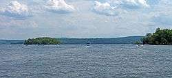
| Wallenpaupack Lake Estates. President - Jerry Beskovoyne, Jr. | |
 Wallenpaupack Lake Estates is situated on the banks of Lake Wallenpaupack, the third largest lake in Pennsylvania. | |
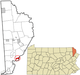
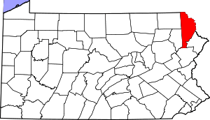
 Location in Wayne County and the state of Pennsylvania. | |
| Country | United States |
| State | Pennsylvania |
| US Congressional District | PA-10 |
| School District | Wallenpaupack Area |
| County | Wayne |
| Magisterial District | 22-3-01[1] |
| Township | Paupack |
| Named for | Lake Wallenpaupack |
| Area | |
| • Total | 2.02 sq mi (5.2 km2) |
| • Land | 1.73 sq mi (4 km2) |
| • Water | 0.39 sq mi (1 km2) |
| Elevation | 1,371[2] ft (418 m) |
| Population (2010) | |
| • Total | 1,279 |
| • Density | 285.4/sq mi (739.3/km2) |
| Time zone | UTC-5 (Eastern (EST)) |
| • Summer (DST) | UTC-4 (Eastern Daylight (EDT)) |
| ZIP code | |
| Area code(s) | 570 |
| GNIS feature IDs | 2633445,[2] 2633418[4] |
| FIPS code | 42-127-58480[5]-80652[2] |
| Waterways | Beaver Lake,[6] Deer Lake,[7] Lake Wallenpaupack |
| Website | Wallenpaupack Lake Estates |
Geography
According to the United States Census Bureau, the community has a total area of 2.02 square miles (5.2 km2), 1.73 square miles (4.5 km2) of which is land and 0.39 square miles (1.0 km2) (19.31%) of which is water.
Demographics
As of the census of 2010, there were 1,279 people and 405 families residing in the community. The population density was 739.3 inhabitants per square mile (285.4/km2). There were 1,415 housing units at an average density of 700.5 per square mile (270.5/km2). The racial makeup of the community was 96.0% White, 2.3% Black or African American, 0.2% American Indian or Alaska Native, 0.3% Asian. 0.4% of the community's inhabitants classified themselves as being from other races, and 0.8% identified as two or more races. Hispanics and Latinos of any race made up 3.6% of the population.
There were 537 households, 58.2% of which were heterosexual married couples living together (Pennsylvania did not start performing same-sex marriages until May 20, 2014), and 23.8% of which had children under the age of 18 living with them. 3.4% had a male householder with no wife present, while 11.5% had a female householder with no husband present, and 24.6% of households were non-families. 20.3% of all households were made up of individuals, 9.8% of which consisted of an individual 65 years of age or older. The average household size was 2.38 and the average family size was 2.70.
The community's population was relatively age-diverse, with 18.5% of residents under the age of 18, 54.8% aged 18 to 64, and 26.7% aged 65 years of age or older. The median age was 51.1 years.
The median income for a household in the community was $53,046, and the median income for a family was $64,719. The median income for male full-time, year-round workers was $49,087, while similar females had a median income of $38,635. The per capita income for the community was $28,155. About 11.3% of families and 15.4% of the population were below the poverty threshold, including 21.6% of those under age 18 and 9.4% of those ages 65 or over.
References
- "District Magistrate". Wayne County, PA. Wayne County Courthouse. 2014. Archived from the original on 27 November 2014. Retrieved 14 November 2014.
- "Wallenpaupack Lake Estates". Geographic Names Information System. United States Geological Survey. 19 July 2010. Retrieved 13 December 2014.
- "Look up a ZIP CodeTM". USPS.COM. USPS. 2014. Retrieved 23 November 2014.
- "Wallenpaupack Lake Estates Census Designated Place". Geographic Names Information System. United States Geological Survey. 19 July 2010. Retrieved 13 December 2014.
- U.S. Census Bureau. Census 2000. "Census Demographic Profiles, Paupack Township" (PDF). CenStats Databases. Retrieved 13 December 2014.
- "Beaver Lake". Geographic Names Information System. United States Geological Survey. 30 August 1990. Retrieved 13 December 2014.
- "Deer Lake". Geographic Names Information System. United States Geological Survey. 30 August 1990. Retrieved 13 December 2014.
