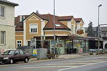
Strasshof an der Nordbahn
Strasshof an der Nordbahn (meaning Strasshof at the Northern railway) is a suburban town 25 km east of Vienna, Austria. A historical locomotive built by LOFAG is displayed in the town.
Strasshof an der Nordbahn | |
|---|---|
 Coat of arms | |
 Strasshof an der Nordbahn Location within Austria | |
| Coordinates: 48°19′10″N 16°38′51″E | |
| Country | Austria |
| State | Lower Austria |
| District | Gänserndorf |
| Government | |
| • Mayor | Ludwig Deltl (SPÖ) |
| Area | |
| • Total | 11.64 km2 (4.49 sq mi) |
| Elevation | 165 m (541 ft) |
| Population (2018-01-01)[2] | |
| • Total | 10,009 |
| • Density | 860/km2 (2,200/sq mi) |
| Time zone | UTC+1 (CET) |
| • Summer (DST) | UTC+2 (CEST) |
| Postal code | 2231 |
| Area code | 02287 |
| Vehicle registration | GF |
| Website | Willkomen in STRASSHOF an der Nordbahn (in German) |

Geography
Strasshof an der Nordbahn lies in Marchfeld in Lower Austria. About 21.08 percent of the municipality is forested.
History
Strasshof had about 50 inhabitants in 1900, and a railroad yard functioned from 1908 to 1959.. In 1944, about 75 percent of 21,000 Hungarian Jews deported from a concentration camp at Strasshof survived due to an agreement between the Aid and Rescue Committee of Budapest and Adolf Eichmann.. On 2 December 1944 the marshalling yard in "Straszhof" was the target of an Allied bombing.[3]
On 23 August 2006, kidnapped teenager Natascha Kampusch escaped after nearly 8½ years imprisonment in a cellar of a Strasshof house. The presumed kidnapper Wolfgang Priklopil committed suicide on the evening of the same day.
Population
| Year | Pop. | ±% |
|---|---|---|
| 1971 | 4,377 | — |
| 1981 | 4,973 | +13.6% |
| 1991 | 5,673 | +14.1% |
| 2001 | 6,993 | +23.3% |
| 2011 | 8,543 | +22.2% |
References
- "Dauersiedlungsraum der Gemeinden Politischen Bezirke und Bundesländer - Gebietsstand 1.1.2018". Statistics Austria. Retrieved 10 March 2019.
- "Einwohnerzahl 1.1.2018 nach Gemeinden mit Status, Gebietsstand 1.1.2018". Statistics Austria. Retrieved 9 March 2019.
- Turner, Dave (1997). 450th Bomb Group (H): the "Cottontails" of WWII. Turner Publishing. ISBN 1-56311-243-4. Retrieved 2009-10-18.